Sleuthing the Backwaters of the Great Fish River

The Great Fish River Valley near Committees Drift.

It is already early afternoon when I pull over on the top of the Nico Malan Pass, which drops a massive 673 vertical metres over 13,8 kilometres, into 1820 Settler Country. Taking a sip of the now lukewarm coffee in my Thermos, I look at the raw landscape around me. To my right, capped by a bluff of rock, are the Katberg which, in turn, become the Winterberg. To my left, the rest of the mountain chain stretches away toward the Hogsback and the Amatola.

The Katberg

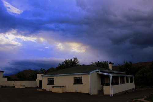
Above me, I can see the pale puff of rain clouds receding over the mountain tops. The very air looks grey and dampness seems to rise up off the tarred road like mist. The road ahead tapers away through miles of dry East Cape thicket, sprinkled with aloes, euphorbia, succulents, sweet thorn, and spekboom..

Although I was not born here, I am, in a sense, back where it began, my home patch. It was here that many of my ancestors settled when they came to South Africa, way back in the early 1800s.

The first was Benjamin Moodie, the Seventh and last Laird of Melsetter in the Orkney Islands whose family fell upon hard times and who sailed from London on the brig Brilliant in March 1817, arriving at the Cape in June. From there he trekked up to Grootvadersbosch in the Overberg where he hoped to recreate his bit of feudal Scotland in the shadows of the Langeberg. It was his grandson, Thomas (Groot Tom) Moodie who led the Moodie Trek into the then Southern Rhodesia which explains how I came to be born and raised up there, among the beautiful Nyanga mountains.

And why I am driving down this road today.

Then there were the Nesbitts (my father’s mother’s side of the family), from Ireland, whose history I have only recently discovered, but whose story I am now trying to follow. Other ancestors too – the Colemans, the Arnotts, the Stirks as well as my immediate kin, the Stidolphs. All spent time in the Eastern Cape area.

As I descend the winding road that leads, through Seymour and Fort Beaufort, into the vast Great Fish River Valley, I feel my senses heightening, flaring. I look and listen, feel the air, try to see the country as they did, all those years ago. Coming from the lush, green pastures of Scotland and Ireland, it certainly must have seemed very different from anything they were used to.

There is an old military blockhouse at Fort Brown, where the modern bridge crosses over the Great Fish River, a reminder of the days when this was all disputed territory. It formed part of a chain of similar forts, strung along the banks of the river, which the British soldiers, garrisoned in them, used to pass messages to one other.

Fort Brown – still a police station.

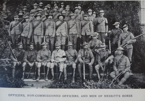
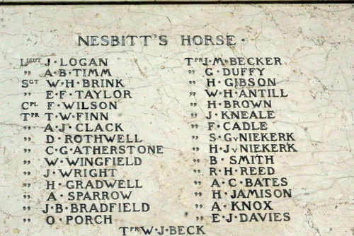
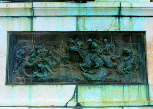
It is here I establish my first connection. An ancestor of mine, on my father’s mother’s side, Lt Col Richard Athol Nesbitt CB, was posted to Fort Brown, as an inspector, in 1875. Later he would go on to form Nesbitt’s Horse which fought with distinction in both the Frontier and Anglo-Boer War. There is a memorial honouring their contribution, among others, to the war effort standing in Church Square, Grahamstown.

Monument honouring, amongst others, members of Nesbitt’s Horse.

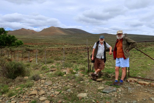
Having stopped to snap an obligatory photo of the place, for record purposes, I continue on my way, still taking in the country as I go. Hill leads to hill leads to hill and in between is nothing but space and distance. The oceans my ancestors crossed to get here could hardly have been more solitary than this empty country still is.

It gets me thinking about the 1820 Settlers who settled in this region. Innocent of the reality of Africa, they must have been shocked to discover the arid country, with its harsh climate, they were about to settle on was nothing like the rich farm and pasture land that they had been promised by the propagandists back home. Although the land was theirs to do what they would with, there was another aspect the pamphlet writers had chosen to gloss over in their colourful descriptions– the fact that the settlers were to form part of a Government-approved military buffer zone, aimed at keeping the Xhosa on the other side of the Great Fish River. Inevitably they found themselves caught up in an escalating conflict for which they were mostly ill-prepared.

Perhaps not too surprisingly then, many found it too lonely and too harsh a life and, their faith shaken, put the country behind them to return to the comforts of town life. Others persevered; in some cases, their descendants are still on the same farms. For yet others, Africa proved to be a temporary aberration. Anxious to escape the heat, sweat, and weariness of it all, they packed up and sailed back to England.

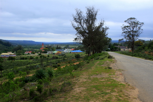
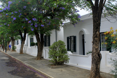
For my part, I am bound for Grahamstown where my one sister, Sally, lives. It was here that the settlers decided to build their capital and – because the town never grew at the rate envisaged – you can still see many fine examples of colonial architecture and of their early houses (see Picture Library below). It is also now home to Rhodes University, as well as one of the most dysfunctional and corrupt municipalities in modern South Africa.

The military life seems to have run deep in the Nesbitt blood. Richard’s father, Alexander Nesbitt, had enlisted, at the age 19, in the 67th Regiment (South Hampshire) and was stationed for many years in Mauritius before being sent with the Reserve Battalion, in August 1851, to the Eastern Cape on HMS Hermes to participate in the 8th Xhosa War.

Not much is known about him but his wife occupies her own special spot in history, for she was a passenger on the HMS Birkenhead, which was conveying troops of ten different regiments from Ireland to participate in the Border War when it struck a rock near Danger Point on the Cape Coast and sank with a loss of 450 lives.

The sinking of the HMS Birkenhead is, of course, famous in the annals of maritime history because it was here the order “Women and children first…” originated. Safe in a lifeboat, Elizabeth Anne “Annie” Nesbitt and her third child, the self-same Richard Athol, were two of the only 193 survivors.

Many of the places the various Nesbitts (and there were many of them) had lived in while in the East Cape I have visited myself so I feel I have both set and principal actors. What I now need to do is write a few scenes. For a moment I think of going to the military cemetery in King William’s Town where Alexander Nesbitt lies buried but my time is short and I am not even sure where it is, so, instead I elect to explore the Great Fish River basin from where it crosses the N3 and then take the dirt road that backtracks all the way to Fort Brown – a part of the world that had changed little over time.

Frontier Country. The dirt road back to Fort Brown with Great Fish River in the mid-distance.

With its turbulent, blood-stained, history, the Great Fish has always loomed large in my imagination. Like the Zambezi and Limpopo, it is one of those rivers which has acquired almost mythical status.

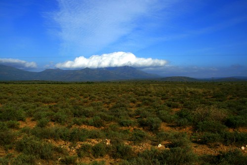
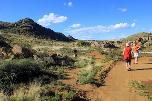
The first section of the journey takes you along the crest of a ridge with extensive views on both sides. Although you probably won’t see it mentioned in any tourist brochure, I think it is one of the best drives in all of South Africa because of its wildness, its freedom, it’s feeling of immensity, the land sweeping back in great folds all the way to the distant range of mountains on the one side and the deep blue of Indian Ocean on the other.

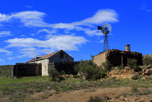
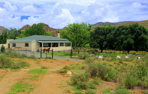
Not far from Fraser’s Camp, we turn left off the tar onto a gravel road that runs roughly parallel with the looping river. Many of the place names around here carry echoes of their frontier past. Dropping down into the valley, the first settlement to come into view is Trumpeter’s Drift, one of the many strategically sited forts the British built along the Great Fish in an effort to secure the land south of the river. Unlike most of the others, which stand crumbling and neglected, this solid, block-like structure still forms part of a working farm and is in relatively good nick.

Trumpeter’s Drift – old fort on left of buildings.

We drive on. Alongside us, the river continues to follow the most circuitous of routes as it twists and turns its way through the landscape. Countless thorn trees swarm together along its banks creating a dense, impenetrable mass. Swollen by the recent unexpectedly good rains, its soup brown water gushes copiously along. Broken branches, old logs, chunks of floating vegetation, and mud sweep past. In places, driftwood is piled high along the banks.

Great Fish River – flowing fast. Note thorns.

Our next stop is Committees Drift, another military outpost established by the British during the Frontier war of 1819 (the name “committees” is pronounced by locals as “kommetjies” indicating that the origins may be Khoisan or Dutch).

A steel girder bridge, erected in 1887, spans the river at this point. On the other side of it lies former Ciskei, one of the Apartheid government’s grandiose, if ill-conceived, “homeland republics” where the National Party tried to entrench the principle of racial separation. Granted “independence” (but never internationally recognised as such) in 1980 after a rigged election, the idea that it could function as a separate state was, of course, a fantasy that could never work as the South African economy remained dependent on the black workers who lived in remote corners like this. Among the poorest and most neglected areas in South Africa, it was also too small and lacked the resources to ever manage its own affairs and govern itself. It would always be obliged to live in the pocket of its giant neighbour.

Bridge at Committees Drift.

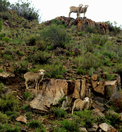
We drive on again, passing a group of smartly attired church-goers as we do. I am not particularly religious myself but I rather approve of the fact that there are people who are still prepared to dress up to please their God. A solitary donkey walks along the side of the road with an air of utmost purposefulness as if it has a fixed destination in mind. A herd of goats scurries off as we approach them and force their way through a farm fence. Because of its large size, the ram is unable to get through and is obliged to reverse out. Mustering all the regal dignity he can he strides off, acting like this was all part of the plan.

Ahead, more hills, more flatness while the sun spreads a dry ruddiness everywhere. Occasionally we pass the empty shells of deserted farmhouses, rotting from the top downwards. Eventually, there will be little left to remind you that somebody lived there. Once they stood for Hope in the Future. Now they stand neglected and forlorn, a lonely reminder of the essential sadness and transience of life.

Our plan is to lunch at Double Drift, in the Great Fish River Nature Reserve, another old fort that once housed British troops sent out to Africa to defend the Empire. Completed in 1837, it protected the important route to Fort Willshire and the interior. Although in a rather dilapidated state of repair it, once again, serves as a memorial to a particular moment in South African history.

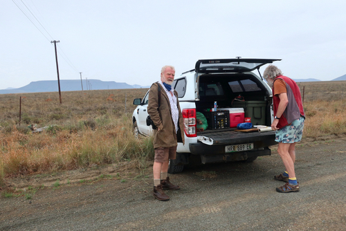
At the entrance gate to the reserve, we change our mind when we hear how much it will cost us for such a short visit (a substantial increase from when I visited last) so we decide to strike it off our list of Historic Places to Visit and have a tailgate lunch on the side of the road that leads to Kwandwe Private Game Reserve instead.

A tailgate lunch…

I don’t need to remind myself what the fort looks like anyway because Sally has done a beautiful painting of it (for more examples of her work see Sally Scott)

Double Drift fort. Chalk pastel. Painting by Sally Scott.

Entering Kwandwe, a little later on, I get a glimpse of another challenge the English settlers had to face – elephant. Although long shot out in most parts of the East Cape, they have been reintroduced into some of the larger local reserves, such as Kwandwe. We haven’t gone too far when we see one browsing in the dense thicket, his back stained a dusty yellow ochre from the local soil. A few kilometres on we see another, similarly camouflaged.

Elephants are awesome creatures. There is a mystery, a sense of enchantment, behind their wrinkled grey visage and massive bulk. I can watch them for hours. As intriguing as they are, they do, however, make difficult neighbours to live with, showing scant regard for fences or planted crops or humans for that matter. It is not wise to antagonize them.

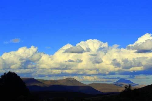
On the crest of another ridge, we stop for a final look over the Great Fish River Basin. Below us roll plains, speckled with bush, patterned with cloud shadows, receding into the blue haze of the far mountains, indifferent to man. Once again, I feel overawed by the age and might of this old continent. In such a primaeval wilderness, is very easy to believe here is where all life originated.

A final look back.

By sleuthing around in these backwaters, I also feel I am beginning to get somewhere in establishing a link with my past. My discoveries may not be earth-shattering but they are a start. They provide the building blocks upon which my own life had been constructed.

PHOTO LIBRARY

More pics of forts:

More Fish River Valley scenes:

Grahamstown scenes:

Escape to the High Country: Travels in the Karoo

Two High Plains Drifters: the author and Prof Goonie Marsh. Pic courtesy of Sally Scott.

There is no risk of overstating it: 2020 was a horrible year. With levels of worry, anxiety and depression reaching a new high level mark, I finally realised emergency solutions were called for. After puzzling it over, I decided the best thing to do would be to try and end the year on a high note by escaping – if only briefly – from all the mania and talk surrounding Covid-19.

And so we took to the hills, heading up into one of the more remote and isolated areas of the country – the Great Karoo, which forms part of South Africa’s vast, high-lyng central plateau. Here, I hoped, I would be able to rid my mind of the ever-looming spectre of the pandemic and reboot my soul.

Officially, there were three of us on the expedition – myself, my artist sister, Sally Scott, and Professor Goonie Marsh, the former-head of the Department of Geology Department at Rhodes University and a very useful man to have around because of his extensive knowledge of all things Karoo. Also, he is very good company.

The route Goonie had plotted for us, took us through the tiny hamlet of Riebeek East where the famous Voortrekker leader Piet Retief once owned the farm, Mooimeisefontein. Retief would later go on to negotiate land deals for his people in what is now my home turf, KwaZulu Natal, before his unexpected assassination at the hands of King Dingaan of the Zulu.

There was another reason I wanted to check out Riebeek-East. An ancestor of mine, on my father’s mother’s side, Lt Colonel Richard Athol Nesbitt, had served here as a sub-inspector with the Frontier Armed and Mounted Police (FAMP) back in 1866. Besides a few drowsing cows lying on the side of the road, there was not much sign of life. Cruising down the town’s empty streets, I tried to visualise what it must have been like when the sub-inspector came riding into town, correct and erect in his policeman uniform, on top of his handsome horse. It must, I concluded, have felt like some sort of banishment because, even today, Riebeek-East feels cut off from the outside world.

This point notwithstanding, I found I was developing a bit of a kinship with Richard Athol. It was almost like he was along with us for the ride. On my way down to Grahamstown, where Sally lives, I had stopped for a breather at Fort Brown, on the Great Fish River, another nondescript outpost of Empire where he had served. This was not the only place where we were to dog each others shadows. In 1872 Nesbitt was promoted to Acting Inspector and despatched to the next town on our journey, the more substantial Somerset East, nestling under the massive bulwark of the Bosberg.

In 1878 the FAMP were militarised, as a unit of the Colonial Forces, and renamed Cape Mounted Riflemen (CMR). The unit would go on to play a prominent role in the numerous conflicts that broke out within the Cape Colony and around its borders, as a result of the Cape government’s expansionist policies. Later, Richard Athol would come out of retirement and – at the request of the Colonial Government – raise and command Nesbitt’s Horse which, in his own clipped words, “served in most of the principal events of the [Anglo-Boer) war, with Lord Robert’s march – Paardeburg, capture of Bloemfontein, Johannesburg, Pretoria and in clearing the colony of rebels.”

The Lt Col was obviously not one for uneccessary sentiment or wasting words…

1902 found him resident in Grahamstown. His military exploits are commemorated in the impressive monument which stands in front of the town’s old Methodist Church. An entire side-panel is devoted to those members of his unit who lost their lives in this bitter conflict.

We finally parted company with our ghost passenger somewhere up on the Bruintjeshooghte, just south of Somerset East. We were now travelling in less familiar territory. Ahead lay the vast Plains of Cambdeboo, immortalised by the author Eve Palmer in her classic book of the same name. You actually pass by the farm – Cranemere – where she grew up and lived and you can still see the same dam that provided them with their lifeblood – water.

The small town of Pearston, where the great palaeontologist Dr Robert Broom once lived, is also on the road although, like many of these Karoo dorps, it now looks a little fly blown and past its best. Of Broom himself, more later.

Beyond that the world lay wide and empty around us until we finally got to Graaff Reinet – or the “gem of the Karoo” as it is sometimes called because of its neat, shaded streets and beautiful period houses – set in a mass of wild-looking hills with the Valley of Desolation to the west and, overlooking the town, the prominent landmark of Spandau Kop. Established in 1786, it is South Africa’s fourth oldest town and has its origins as a far flung frontier settlement on the very edges of the old Cape Colony.

Street scene, Graaff Reinet.

Just outside of town, on the road to Murraysburg, there is a stark, simple monument to Gideon Scheepers, the Boer military leader who was court-martial-led and shot here on the 18th June 1902, by the British authorities. It was – according to Goonie (who also has a solid grasp of the region’s history) – a severe punishment which turned him into an instant martyr for the Afrikaner cause. As opponents in the Anglo-Boer War, I wondered if Gideon and Richard Athol had ever crossed paths?

Beyond that, the road climbed steeply up the Oudeberg Pass. Before I knew it the Plains of Camdeboo were below us, then out of sight. At the turn-off, to Nieu-Bethesda we stopped for lunch on the side of the road, under one of those abrupt, flat-topped, mountains that rise out of the plains, like talismanic guardians, throughout the Karoo…

Lunchbreak in the Karoo.

The Karoo is a land of sun, heat, and stillness although, as if to defy my expectations, a light drizzle began to fall as we unpacked our picnic basket on the tail-gate of the bakkie. The summers can be scorchingly hot, in winter the night temperatures regularly drop well below freezing point. Rainfall is erratic, drought common.

It was not always so. There was a time when ceaseless rains poured down upon this ancient land, leaving it covered with inland seas, lakes, and swamps. Millions of strange-looking reptiles and amphibians roamed around and then died here; in our era, their fossilised remains have made the Karoo world-famous for palaeontologists. This brings us back to that pioneer of the profession, Dr Robert Broom, who did so much to uncover their secrets.

As we drove deeper into the interior the hills became barer, even more silent. There was little sign of habitation although, every now and again there was the occasional windmill or wind pomp just to remind you that people lived here. The road wound on and on, empty and devoid of traffic, so much so that driving along it eventually became like a form of meditation.

Originally this vast area was occupied by the San, aboriginal hunters, small in size and few in number, who drifted with the seasons and the herds of game. Of these animals the springbok is, undoubtedly, the most emblematic of the Karoo, their bodies evolving, over time, to deal with the hardships of life in this arid country. Despite the devastation wreaked by the early white hunters, which saw this beautiful animal being exterminated over much of its range, the springbok population has begun to rise again, now that their commercial value has become appreciated.

Later, the San themselves were hunted down or driven into the swamps and deserts. In their place came trekkers, traders, missionaries, and explorers, who braved the fierce heat, moving with their wagons and animals into the harsh dry interior. With them, they bought their religion. Nearby Murraysburg, named to honour the Reverend Andrew Murray, was originally a church town resorting under the full control of the Dutch Reformed Church up until June 1949 when it was placed under the control of the local municipality.

Just beyond the spot where a large sign announced that we were leaving the East and entering the West Cape, we came to an imposing white-pillared gate with a sign “Oudeland” next to it. Here we swung right, driving down a dirt road dotted with caramel-brown rain puddles. In every distance, the plain was sparse and bare although we did pass the crumbling ruins of an old barn and kraal with the inevitable wind pomp standing like a sentinel behind it. Moving fast, the clouds cast a storm light across the buildings. I wanted to look for the species of lark that had these scrub-strewn grasslands all to themselves but with more rain threatening now wasn’t the time for it so we plugged on.

Old barn and windmill. Pic taken after storm clouds had blown away.

Cresting a rise, the farmhouse and outbuildings came in to view in a valley below where – Goonie explained – a sill of hard, erosion-resistant, dolerite had cut through the softer sedimentary rocks. A small, seasonal, stream ran through the middle of it. The main farm complex was situated on the one side amongst a mass of poplar, gum, and willow trees and fields of grazing merino sheep; the lush green colour of the lucerne pastures, in which they were feeding, contrasting sharply with the stark, elemental beauty of the semi-desert that surrounded them.

Our house lay on the opposite bank, just above a belt of prickly pears. As we drove into the fenced yard we were greeted by a brown horse and a small herd of multi-coloured springbok. Such colour morphs are extremely rare in the wild (in fact, they are so unusual they were venerated by the San) but these white, or leucistic, forms are mostly the result of selective breeding to meet the needs of hunters seeking exotic trophies. It is a practice that has caused some controversy because the genes which cause these colour variants are actually recessive and so could weaken the species.

I am not a hunter and I get no joy in taking life, so I was delighted to share the animals’ company just for its own sake, especially when – every now and again and for seemingly no particular reason – its various members started leaping in stiff-legged bounces known as “pronking”, in which all four hooves hit the ground at the same time. The small herd was, the owner’s wife explained, all orphans who had been hand-reared and loved to the point where they had become family pets. Each one had its own name. I was especially taken with the one very friendly individual who had one blue eye and one green.

The house itself was built in the usual airy Karoo style with white-washed walls and a wide verandah on which you could sit and gaze out over the distant lonely blue mountains. Inside the appliances were all modern although the stuffed head of a large buffalo bull, as well as that of a puzzled-looking Zebra, added a slightly incongruous touch.

I was up at daybreak. We were lucky that morning. Overnight, the rain clouds had all blown away. The sky above us was a strange intense blue, wind-cleaned, limitless, and crisscrossed with lazy scrawls of thin cloud. There was a lovely lyrical quality to the landscape, to my eyes, it all seemed intoxicatingly clean and remote. Although I am not from these parts, I felt totally at home in this indivisible, self-contained world.

In this sort of country, there is almost no shade or protection from the elements although our morning walk did take us up to a stony ridge in which there was an overhang with bushes growing at its mouth. On its walls, we were excited to discover several faded examples of San rock art. I had no way of knowing how old they were – possibly thousands of years?

From the cave entrance we looked down over a large dam which reflected the changing weather in the sky above. Water lines of geese and duck and dabchick cracked its surface. Such open stretches of water always come as a surprise in this thirst-land. For the birds it must indeed seem like manna from heaven..

Back on the path, Goonie came to an abrupt stop, pointed his walking stick in the direction of an exposed sheet of unsuspecting, layered, grey rock and declared: “That looks like just the spot for a fossil!”. Sure enough, when we went down to investigate, we found several tiny fragments of fractured fossilised bone. With my untrained eye I would never have suspected they were there and would have passed the site by without a sideways glance.

Leaving them undisturbed we continued down to the dam wall. From its top we stood, awed by the view, as the escarpment retreated away; each ridge exposing new gullies and rough broken ground and more valleys until finally reaching the horizon, where the pale ramparts of the distant range of mountains raised themselves. Then we walked on, feeling buoyant and light and energised. Sally, with her artists eye (as opposed to Goonie’s more scientific one) was struck by all the strange patterns and details in the landscape and regularly stopped to record them.

Later, when it got too hot for walking, Goonie and I climbed in to the circular reservoir around the back of the house and had a swim. It felt good, splashing around like I was a young boy again…

A refreshing dip

That evening we sat with our drinks out on the verandah. The earth was still in twilight shadow. In the distance massed, bulging, cumulonimbus clouds gathered above the mountain tops. As the sun sank so they changed shape, form and colour.

All felt well with the world. Far from the madding crowds, I finally began to get some sort of harmony between body and mind. Looking back over the journey, I also felt I had established another link with my past, learnt a little bit more about how I got to be who and where I am…

Harmony in nature...

My sense of contentment did not last. Back in Grahamstown all the talk still centred on the pandemic and the overcrowded hospitals and the beach and liquor ban. I couldn’t help but feel a little deflated. The happy little bubble I had created for myself in the wilds of the Karoo suddenly seemed far away. That is the problem with fantasies – sooner or later they get punctured and you are back with harsh reality.

GALLERY:

.