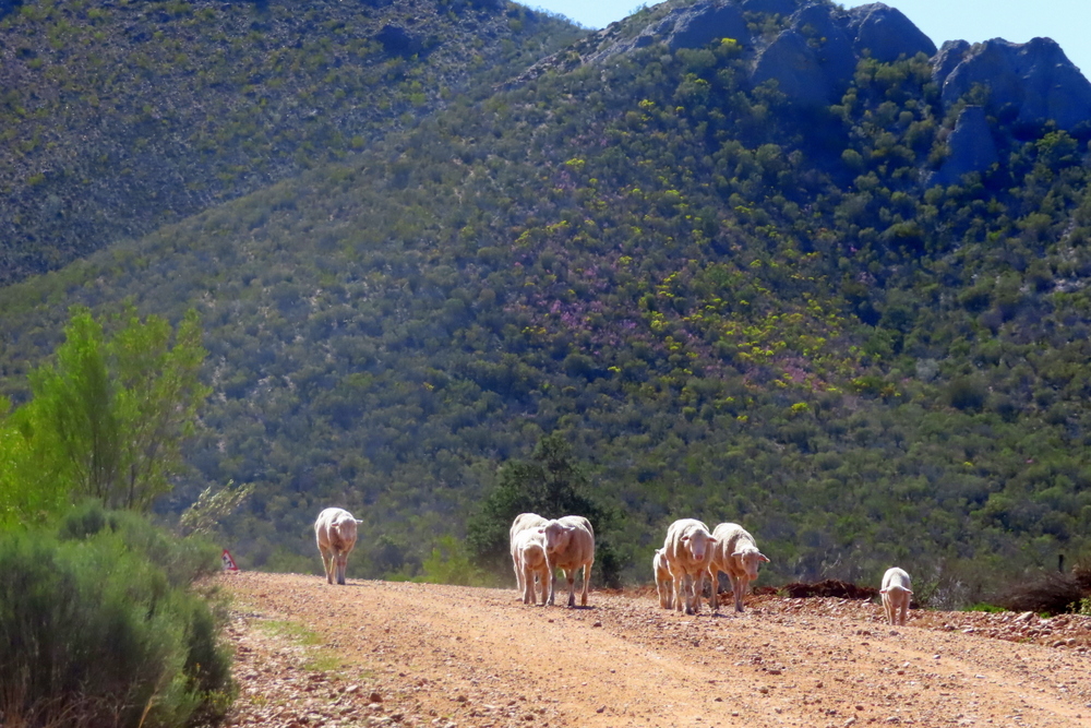
I am heading south, from my home at Curry’s Post, in the cool, misty KwaZulu-Natal Midlands, towards the eastern Karoo. I am a man on a mission, in search of stimulating scenes and artistic inspiration. I am confident I’ll find what I seek down there.
It is a journey I have made many times but the suddenness of the change in the countryside always surprises me. You cross over the border and the pine plantations and green pastures of KZN disappear out of sight in the rearview mirror. The rivers are fewer, the trees become small, stunted and windswept, and the veld is dry, earthy and dotted with grey scrub, cactus-like plants, aloes and succulents. It is an enormous, dramatic landscape that completely dwarfs you and makes you feel very small. Vast sun-baked, plains stretch out on either side, blue mountains shimmer in the midday heat; krantzes, kloofs and flat-topped kopjes dance by. The dorps and settlements get smaller, the traffic lighter, and there is less and less sign of human occupation.
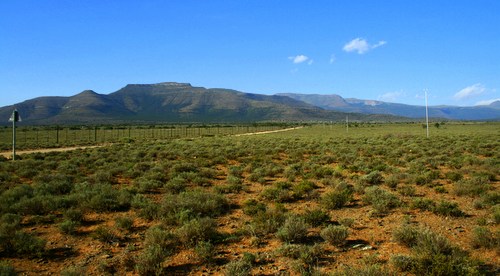
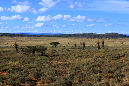
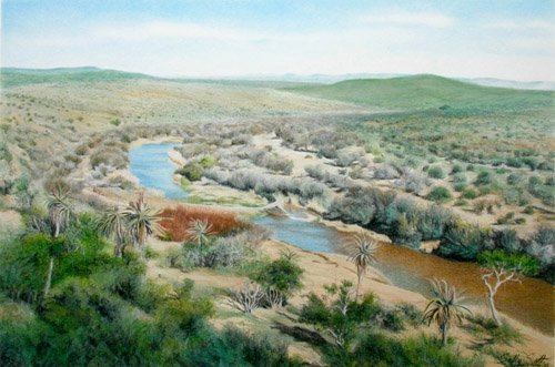
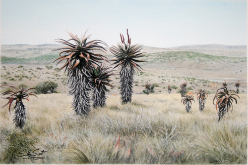
The Plains of Camdeboo.
As you drive, you are constantly aware of the vast horizons and the space between them and you.`It is strange to think this area was once a vast lake inhabited by giant reptiles, who left their bones behind for palaeontologists to puzzle over millions of years later.
The deeper I penetrate, the more the Karoo begins to work its magic. There is something about this empty, quiet, timeless landscape that eats into my soul. Although it is very different to the country I grew up in, I still feel an instinctive connection with the dry Karoo. Maybe it is because it feels so ancient and exudes such an air of mystery. Like the sedimentary rocks that dominate much of its geology, layers and layers of history lie embedded here, dating back to the beginning of time. If you choose the right spot, you can find yourself looking at more or less the same scene someone thousands of years ago would have seen. Perhaps this gives the Karoo its unique atmosphere, the sense that you are moving amongst ancient spirits. Plus, that huge blue-domed sky which dominates everything and the slightly ethereal quality of the light.
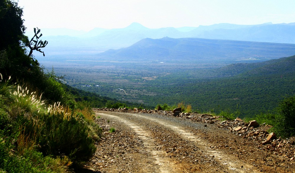
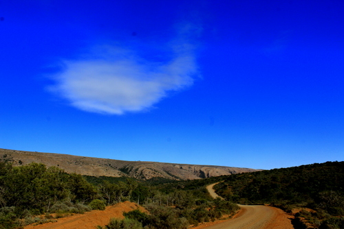
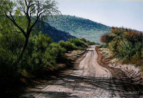
I drive on through a dry, rocky, mountainous country. Hills lead to more hills, the road rises and drops and rises again. The sun is shining straight on the windscreen. The occasional farm roads, grey and rutted, branch off the main road I’m on. I call it a main road but there is so little traffic it is almost a ghost road. Travelling down these side roads the clouds of dust you are kicking up behind you mix with the medicinal-like smell of the plants that grow on the stony slopes.
It is like travelling back in time, you still get a glimpse of what life must have been like centuries ago, back in the days of the trekboers and the travellers, farmers and townsfolk. And before that Khoekoi and San whose demise is one of the great tragedies of Africa.
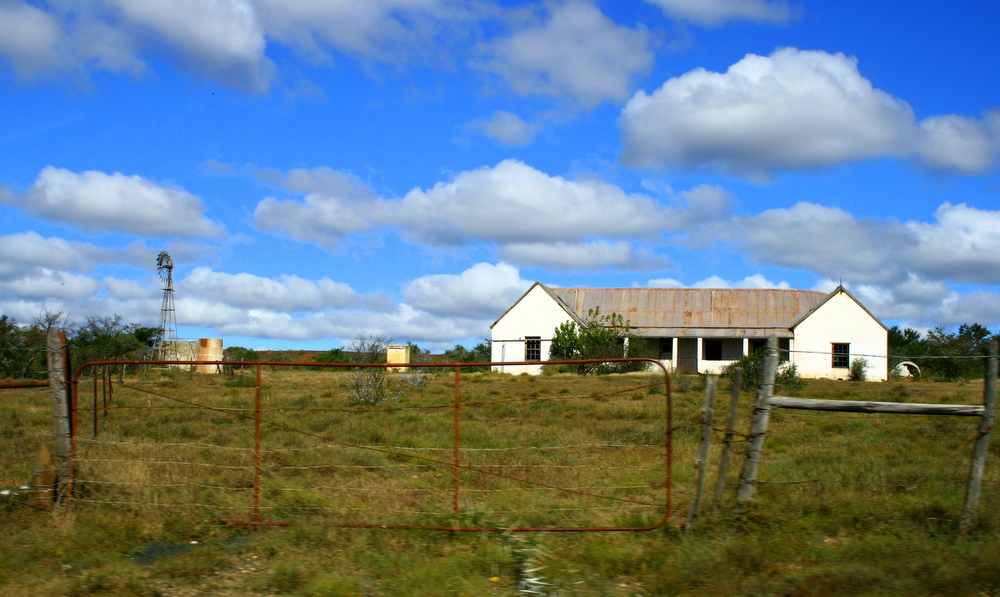
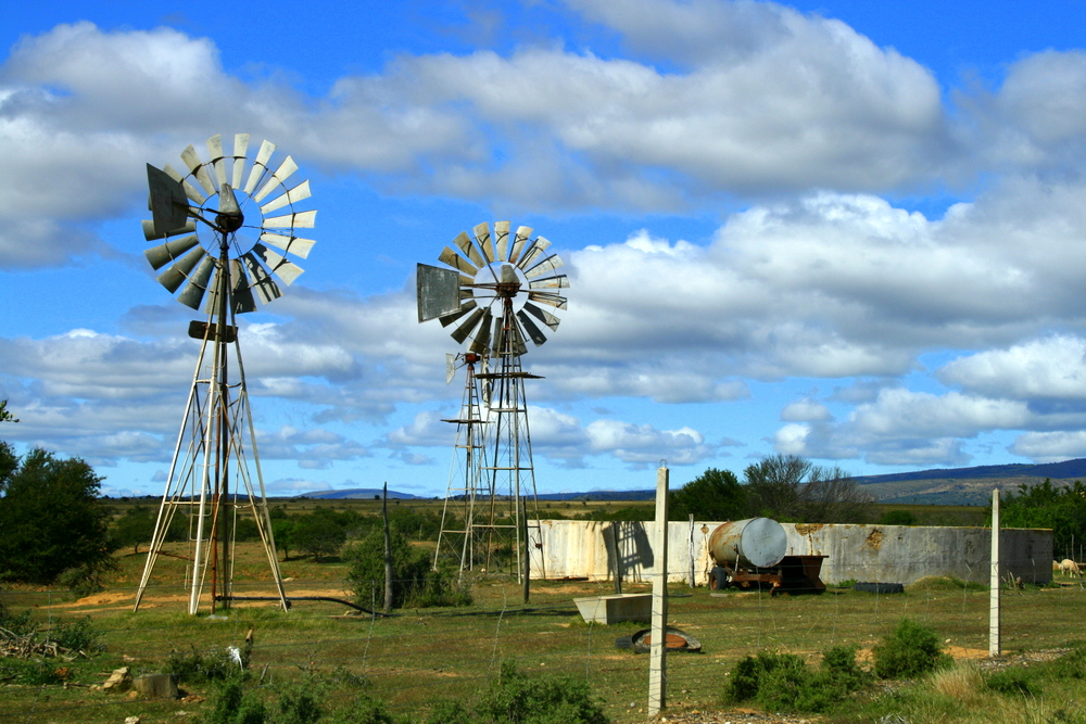
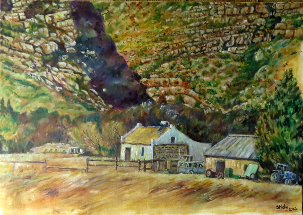
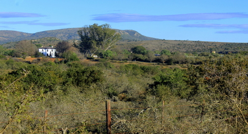
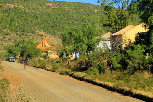
Every now and again a lonely farmhouse swims into view. Most of these old homesteads follow a fairly simple structure with a few outbuildings scattered around the back. Usually, there is a clanking windmill, a cement reservoir in which life-preserving water is stored, a few fruit trees, some drystone enclosures, a sheep kraal, possibly a chicken coop and a collection of labourers cottages situated some distance away. Often there is a graveyard where generations of the same family lie buried.
The farmhouse has always occupied an iconic place in white South African mythology (especially Afrikaner). Wanting land they could call their own, many of the early Dutch settlers, believing it was God’s will that they should do so, packed up their possessions and pushed on deeper and deeper into the interior. If conquest was their questionable motive, they were still, undoubtedly, courageous. Trekking across the dry wasteland, under a burning sun, in their creaking wagons and spans of puffing oxen, they would come to be seen by their descendants, as heroic figures, tough and resourceful, pioneering individualists who helped forge a new nation, giving it an identity rooted in the soil. As each farm was pegged out, it became a further outreach of civilisation, another step in the taming of the land, a further extension of the frontier and of European domination and influence – not that such a harsh environment could ever be truly mastered or contained. The elements always had the final say.
Nevertheless, their love affair with the country and its wild landscape had begun. Perhaps not too surprisingly, the stark beauty of the Eastern Cape has evoked a lot of literary (and artistic) responses (to get some idea of how influential it has been see The Literary Guide to the Eastern Cape: Places and the Voices of Writers by Jeanette Eve). The Cradock area, just up the road, for example, provided the backdrop to one of South Africa’s first and greatest novels – Olive Schreiner’s classic The Story of an African Farm.
It was not always so empty here. From the number of abandoned farmhouses I see on my journey, I can tell a lot of these areas once supported bigger (white) populations than they do now. Poor soils, years of unremitting drought, isolation, poverty, the extremes of temperature, and changing social and economic circumstances – all have taken their toll on the farming community. Other farms have been amalgamated and turned into larger wildlife ranches, partly restoring the land to the way it once was, except there is still a profit motive behind it.
Nowadays, a new factor has come into play. The political winds have changed and are now blowing in the opposite direction. With white ownership of the land becoming increasingly tenuous under the post-apartheid government there has been a steady migration away from the land generations of farmers once assumed was their birthright. With the passing years there will, no doubt, be fewer and fewer of them.
Maybe that is why I feel this compulsion to try and capture on canvas the unique feel of some of these lizard-haunted old buildings before they melt back into the ground from which they were created. Irrespective of how you see the past, they are part of it, a memorial to a particular time in South Africa’s history, now fast fading. What also impresses me, from an artist’s point of view, is how harmoniously these old houses blend into their backgrounds and become part of the land. They have character. They have souls. They have paid their dues. In this respect, they differ greatly from much of our ugly, intrusive, modern architecture.
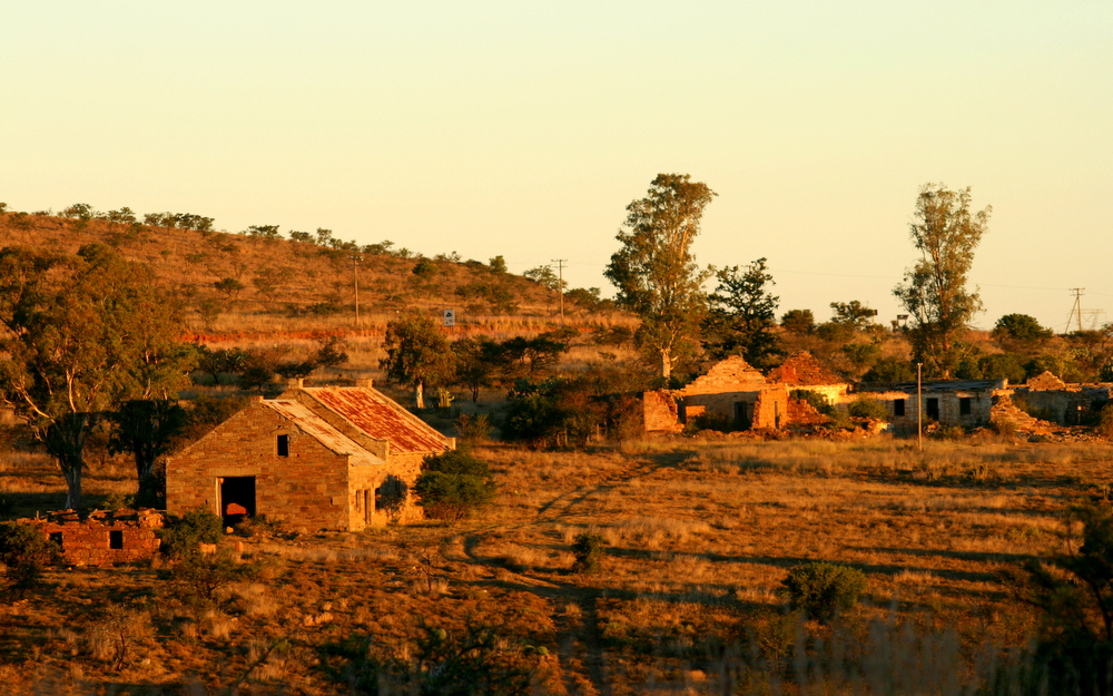
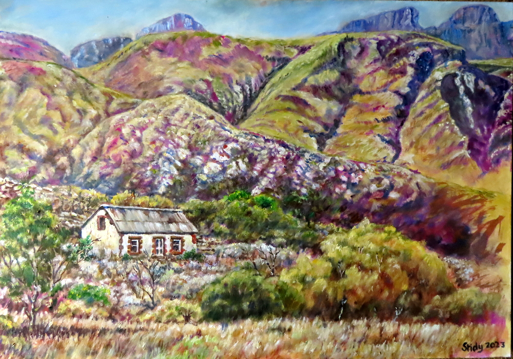
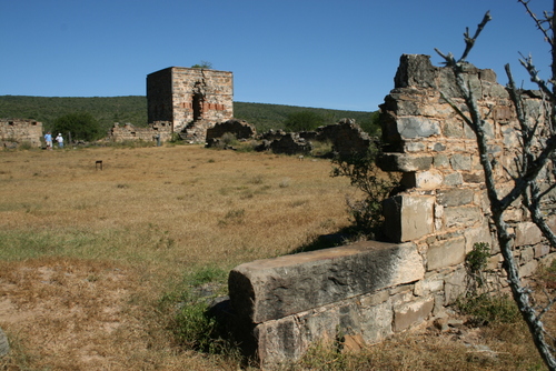
Rounding a sharp corner, I spot a solitary homestead which fits my artistic needs perfectly. I pull over onto the side of the road and step out to take a few photographs of it. Like a deserted ship marooned in a vast ocean of rock, there is a melancholy, a haunting sadness about it as it stands alone and neglected, completely dwarfed by a huge slab of mountainside behind it. I find myself wondering about who its owners were and what drove them to carve out a life in such an isolated spot? And why did they leave? Even though it is no longer physically inhabited you can still feel their shadowy presence. Once there was life here, it housed not only people but hopes and dreams. Now, it stands deserted and empty, a humbling reminder of life’s impermanence and time’s inexorable march.
Another abandoned homestead, the Kouga Mountains area.
Having, for the sake of my painting, tried to absorb as much of the spirit of the place (the genii loci) as possible in such a ridiculously short time, I jump back into the car and drive down the winding road. As the car’s wheels crunch along the gravel, I find my mind drifting back to the farm (subsequently part of a black resettlement scheme) I was raised on, in Nyanga North, in Zimbabwe’s Eastern Highlands. It was also situated in a stunningly beautiful part of the world. It, too, imprinted itself on my youthful mind and remains forever locked in my heart. It was here my obsession with mountainscapes and remote places began.
It is never easy to leave a place, a home with its familiar sights and sounds, its rhythms and associations, its flowers and trees, its birds and animals, its daily routines. Sometimes, however, one has no choice but to love and let go. Although one is physically no longer present it is never a complete break. Every person takes their experiences and memories away with them, They lodge themselves in our psyche, become part of who we are, and affect the way we see and understand the world.
One’s love of the land can also find expression in paintings…
“Art washes away from the soul the dust of everyday life”
Pablo Picasso
Confession time (in case it isn’t obvious): my name is Anthony Stidolph (aka Stidy) and I am an art addict. It is my form of DIY therapy, my way of coping with what seems an increasingly dangerous and dysfunctional world. I am a believer in art’s healing properties, and its ability to refresh and reinvigorate. It can help the head, mend the heart (and – when it is not going the way you want it to – drive you to distraction).
When I studied art at school – obtaining a distinction at Ó’ Level – I always found myself naturally attracted to drawing rather than painting. I was certainly more proficient in it. My early attempts at putting paint (back then this was limited to prehistoric powder paints which I never got the hang of) on paper were mostly an unmitigated mess. And so pencil, pen and ink became my chosen instruments and when I decided to make a career out of my art, it was to cartooning I turned.
It was only later, with the prospect of retirement looming, that I finally plucked up the courage to venture into colour once more. Thinking big, I decided to go the whole hog and start with oils, which I had never used before. I did this mostly because I knew oil can stand much more abuse in its handling than other mediums (such as watercolour). Any mistakes or errors can be easily covered. You can constantly construct and reconstruct, at leisure.
My first efforts were very tentative and not too successful. Expanding my range made me only more conscious of my lack of experience in this field. I went through periods of doubt and self-questioning. Had I left it too late in my creative life to indulge my craving for colour and pick up the necessary skills to be any good at it? Held on a leash for so long, I did not know quite how to channel my creative energy.
I am nothing if not obsessive, however. I battled on doggedly. My moods continued to alternate between youthful enthusiasm and discouragement. Finally, I began to enjoy it. I discovered that if you are more relaxed, you can concentrate better.
Although I did not take up painting until the middle years of my life, intimations of a desire to do so appeared much earlier. In some ways, my long career as a cartoonist laid the groundwork for what followed. For a start, I had learnt that it is not necessarily part of the job to copy nature exactly as it is and that by simplifying it and omitting the superfluous you could signal just as much and also make your art more immediately accessible.
As with cartooning, too, you begin to develop your own style over time too, almost unconsciously. It is like a signature, your personal handwriting, something that develops without you having to think too much about it. Aspects of your personality, preoccupations and predispositions begin to shine through.
Having decided to take the plunge into oils, it was almost inevitable that I should be drawn to landscape painting. I grew up on a remote but beautiful farm in Zimbabwe’s Eastern Highlands. It was situated in a wilderness of mountains, kopjes and hills. In every distance stood strange shrouded landscapes, dotted with baobabs and inset with rivers and fleeting pools. Mysterious, unmortared, stone ruins, scarcely touched by archaeologists, stretched for miles upon miles along the valley floors and right up onto the mountain slopes into the narrowest of crevasses and the steepest cliff faces.
Pit enclosure, NyangaRuins on Nyahokwe Hill, NyangaNyahokwe Hill, NyangaThe road home…
These magical scenes provided a treasury of wonders for a lively, enquiring mind.
To take up landscape painting – or at least be successful – I think you have to have this inherent sensitivity or “feel” for scenery. This is the unteachable part of it. In my lifetime, I have seen way too many landscape paintings which, while technically competent, just lack this intrinsic thrill – or SOUL. It is merely painting by formula, there is no sense of an aesthetic experience, they lack the understanding that comes from constant association with a scene. It is landscape done through a tourist’s rather than a painter’s eye.
Over the succeeding years, I have continued to plug away at my painting, trying hard to establish a balance between seeing and imagining while exploring the possibilities and harmonies of colour and form. I lay no claim to having in any way mastered the subject. I am only too aware of my limitations and shortcomings (I battle with my greens, for example). However, I am not yet ready to throw in the towel or toss away my paintbrushes. I plan to carry on looking and thinking and experiencing and practising, knowing that in art, knowledge assists invention and helps you overcome creative obstacles.
The alternative – which I don’t fancy – is to do an “art detox” and quit…
PORTFOLIO:
Herewith is a selection of my paintings which I have divided into sections.
NYANGA SCENES
I have cherished my memories of the Nyanga landscape all my life so it was inevitable they should insinuate their way into my painting and that I should try to recapture the warm feelings I had about them.
World’s View, NyangaMt NyanganiNyazengu Gorge, NyangaSummit of Mt Nyangani.
BAOBAB PAINTINGS
With its gigantesque bulk and primitive appearance, the baobab is undoubtedly the tree of Africa. I also love painting them…
Baobab near Mopane, Kruger.Baobab at Makwekwete, Zimbabwe.
KZN SCENES
These days I don’t have to stray to find too far to find scenes to paint. The beautiful Karkloof Valley, where I live, is full of them…
Loskop, Karkloof ValleyKarkloof Hills from Kusane Farm
OTHER PAINTINGS
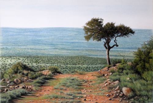
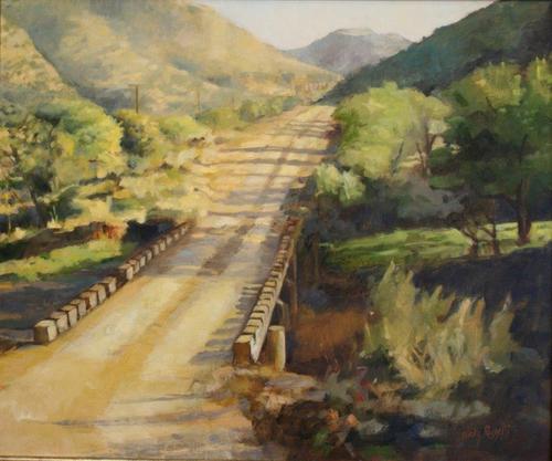
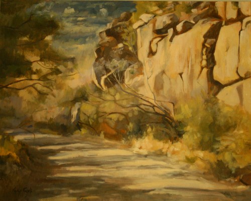
I still love travelling further afield though. The Bushveld and the Karoo are two favourite destinations…
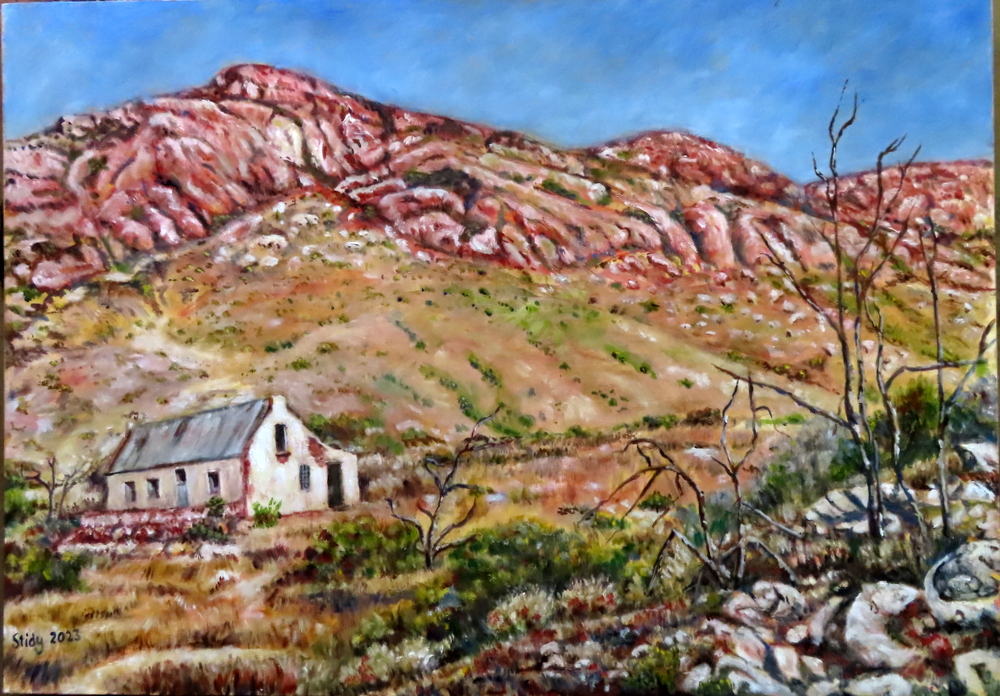
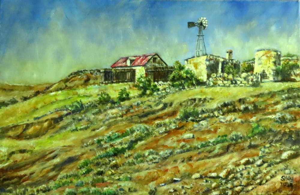
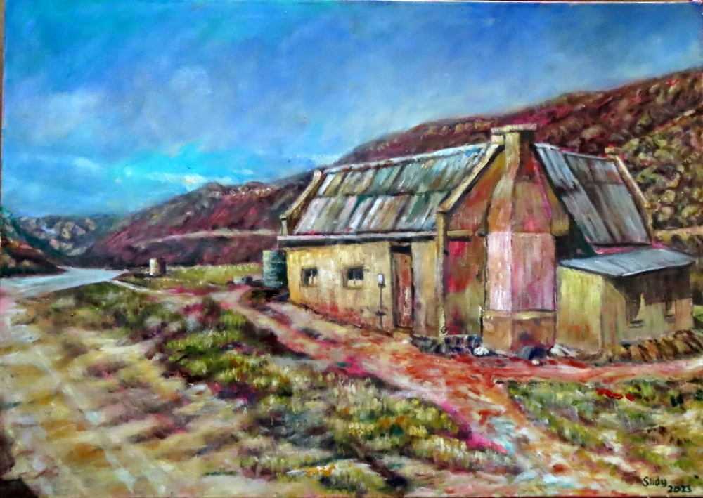
Granite kopje, Mbombela areaKaroo scene near MurraysbergBaviaanskloofFarmhouse, Kouga mountains
The urge to migrate, to quest, to go on a journey lies deep-rooted in our DNA. For hundreds of thousands of years before we became sedentary, urban dwellers it was how we lived. We were hunter-gatherers, nomads. I certainly still feel this instinctual pull. It is the reason you so often find me hundreds – sometimes thousands – of kilometres from home and it is why I am always quick to respond to an invitation to do a road trip. For me, there is something magical about going to a place you have never been before and feeling an immediate connection to it.
Thus it was with the Baviaanskloof.
The Baviaanskloof
The Baviaanskloof – ‘Valley of the Baboons’ – lies mostly in the East Cape and is dominated by the Baviaanskloof and Kouga mountains which run parallel to one another in an East-West orientation. Separating the wet coastal belt from the dry interior these mountains form part of a ragged chain that make up much of the South-East coastline of South Africa. Two main rivers drain it, namely the Baviaanskloof and Kouga. They converge at Smitskraal where they travel in an easterly direction to the Kouga dam. The Grootrivier and Witrivier also flow through the reserve and there are a few other minor rivers, streams and odd springs formed where the rare rains come down from the mountains. Here birds and animals come to water.
As a first time visitor to the Baviaanskloof, I was most fortunate to have Goonie Marsh as my guide. Besides making a good travelling companion, he lectures in Geology so was able to explain to my sister Sally and me how this world of marvels came into being. He is also a man with a deep interest in the world around him and as a long time East Cape resident has acquired a great general knowledge of the area.
Goonie Marsh explains how the Baviaanskloof came into being...
Driving down the dusty, twisting, often tortuous road, it is hard to believe there was a time when the climate and landscape were different but some of the Baviaanskloof was once underwater. As part of what is known as the Cape Super Group, its geology consists of alternating layers of sandstone and shale that were deposited on the bed of a large inland sea between 300-400 million years ago. Since then it has been tilted, folded, twisted, faulted, buckled, redeposited in new layers and eroded into its current fantastical shapes (see notes below by Goonie Marsh)*.
Enon conglomerate, Andrieskraal, on which the profile of Queen Victoria can be seen. Made up of quartzite boulders derived by erosion from Table Mountain Group which form the high mountains in the area.
‘The Skull’ – also Enon conglomerates as seen in the Baviaanskloof Cretacious basin. The colour of these sediments is redder compared to Andrieskraal possibly because the latter was open to the ocean whereas these were probably entirely terrestial.
Strata of Table Mountain quartzite which have been pushed vertically, perhaps even overturned.
More Table Mountain quartzite in which the strata are clearly folded – horizontal at the top before flattening out at the base,
We were not, of course, the only nomads, driven by curiosity, to come wandering into this almost mythic landscape. The first anatomically modern humans emerged in the Baviaanskoof during the Middle Stone Age – between 120 000 and 30 000 years ago. They are believed to have been the ancestors of the San who would later live in the area. They left their traces in a large number of caves and overhangs which provided them with both shelter and walls to decorate.
They were displaced and eliminated by the Khoekhoe and early European settlers. Although various explorers and hunters had passed that way before, the first white farmers settled in the Gamtoos Valley in the 1730s. As more arrived, the deeper into the Baviaanskloof they penetrated.
Lonely, sparse and cut off by its mountains from the rest of the world, life could not have been easy for these early settlers. Initial access into the area was by way of an ox wagon. Because of the difficulty of travelling over the terrain, many farmers only made the journey out the valley once a year using the Ouberg track. Getting in and out got just a little bit easier with the construction of a dirt road between 1880 and 1890 by the hard-working, prodigous Victorian road-builder Thomas Bains, son of Andrew Geddes Bains, South Africa’s first geologist and another great road-maker.
Having approached the Baviaanskloof from the East, through the important citrus growing region of the Gamtoos Valley and the towns of Hankey and Patensie, it was along this road that we now travelled. On both sides of us, dry trees rose towards the dusty mountains. Above them would normally hang the hazy blue sky of Africa but – as if to thwart my sunny mood – it was cloudy and cold on our first day. It was still mightily impressive. Here one could sense what the continent must have been like before its wild animals were not confined to a few parks but roamed everywhere and man had not had such an indelible – and, at times, destructive – impact on the environment.
We began by taking a detour off the main road to the Kouga dam. Although a marvel of engineering it made a sorry sight. The East Cape is battling a severe drought with its dams averaging out at only 15% full. At 4,5% of its capacity, the Kouga dam is currently at its lowest level since it was constructed in 1957. Here, like everywhere else, climate change is taking its toll…
Kouga Dam
Dam wall. Pic courtesy of Sally Scott.
It is not always so dry in the valley. Sometimes there are floods. In 1916, for example, over 350mm of rain fell in the catchment area and a great solid bank of water came tearing down the narrow valleys sweeping all before it. Four members of the Campbell family lost their lives when the tree they had climbed to escape the raging torrent gave way under them. There is now a memorial to them.
We spent our first night at Bruintjieskraal in the Rivierspoort, just outside the entrance to the park, on a sheep farm, enclosed in a narrow valley between two ramparts of dark mountain. Our thatched-roofed, timber-framed accommodation proved more modern and more stylish than I had expected, blending seamlessly into the surrounding bush and the mountain itself.
Kudu Cottage, Bruintjieskraal
Sheep, Bruintjieskraal/Glencoe area.
The sky was clearing as we set off the next morning. Pale wisps of cloud danced and dissolved along the mountain peaks casting shifting shadows on the valleys below. After stopping at the Park’s Interpretative Centre (the whole park has now been classified as a World Heritage Site), we followed the road that snakes its way up the Combrink Pass. The higher we went, the more spectacular the scenery got. It was along this stretch of road that we encountered the only other travellers we were to meet in the park – two Germans on motorbikes who stopped to enjoy the same view we did.
Heading towards Combrink Pass.
Combrink Pass. Pic courtesy of Sally Scott.
A fellow traveller.
Near top of Combrink Pass.
At the top of the pass, the country opens up into the extensive Bergplaas grassland plateau which, when we visited, had an almost Alpine feel to it on account of all the swirling cloud, mist and drizzle on its upper peaks. Crossing it, we were greeted by yet more breathtaking views. An interesting oddity here is Winston LeRoux’s rusting, cable system which spans the gaping Waterpoort Gorge. It was once used to link the Enkeldoorn and Bergplaas farming communities and to transport goods between the two but was abandoned in the 1960s.
On the Bergplaas Plateau, looking up to cloud-covered mountains
The old cable system across the Waterpoort Gorge
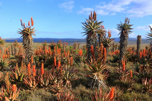
From Bergplaas we descended the twisting Holgat Pass through more craggy overhangs, clefts and soaring rock The surrounding slopes were covered in fynbos and proteas and – further down – spekboom, aloes (Aloes ferox, africa, speciosa, striata and arborescens all occur in the area) and euphorbia. Strange plants and succulents, that have adapted to vertical living, clutched onto the cliffs. A pair of Black Eagle wheeled overhead.
The Holgat Pass.
The country grew steadily drier the further west we went. In places, the desolation was offset by the dense growth of trees which grew along some of the river banks. The water in these rivers was beautifully cool, clear, tasty and refreshing. In places, pondweed, lilies and something like giant cress grew so thick they looked like little green islands rising out of the water. We stopped at one of the streams, scooping up handfuls of the precious liquid and then sipping it with the all the reverence a person in a parched desert might do.
Drinking from mountain streams.
Lilies.
At mid-morning we pulled into the Smitskraal picnic site for a coffee break. Goonie hauled out his furnace, gathered some kindling, and then fired it up. It was a sight to behold. In no time, the water inside was boiling and the metal contraption was belching out plumes of steam and smoke like an active mini-volcano.
The firing of the furnace…
Coffee break at Smitskraal.
Aside from a bored-looking baboon who watched us from the shade of a tree, we were the only ones around – or, at least, so it appeared. There are buffalo in the park but they must have been lying low that day for we didn’t see any of them although their dung was everywhere scattered across the roads. Black rhino also lurk in the thickets around here but they, too, declined to show themselves. It did not bother me. With their poor vision and small powers of deduction, they are, like the fierce buffalo, notoriously short-tempered. I would prefer not to have a face to face encounter with either and always keep a close eye out for hospitable trees to climb when I am in their presence. Here, unfortunately, the available trees consisted mostly of sharp-needled Vachellia karroo (Sweet Thorn).
An audience of one…note thorns!
There are still leopards living in this mountain wilderness. Maybe one was even watching us from some rock ledge with eyes that see everything but reveal nothing? Cape Mountain Zebra have been reintroduced into the area and there are also Klipspringer, Mountain Reedbuck and several types of highly poisonous snake (including Puff-Adder and the fearsome Cape Cobra). Them I was happy to avoid too…
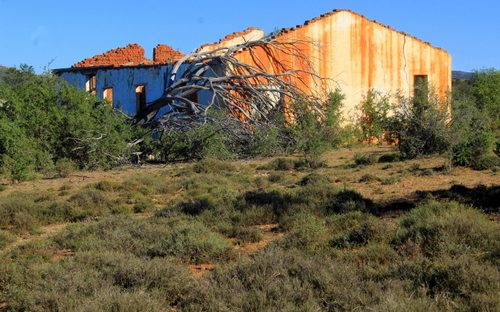
From the picnic site, we headed up the Grasnek Pass, stopping high up on its neck so I could take yet more photographs of its panoramic view. Pressing on, we passed several tattered and long-abandoned old habitations, disintegrating memorials to those who had tried their luck in this harsh environment before calling it quits. We stopped for a roadside lunch directly opposite one such derelict farmhouse. Looking at its collapsing walls and sun-bleached, corrugated iron roof, I decided it might make a meaningful painting about the fragility and uncertainty of human life (a subject much on my mind since the outbreak of the Covid-19 pandemic) so I hauled out my camera again and photographed it from various angles.
Grasnek Pass
View near the top.
Grasnek Pass
Deserted farmhouse in the Baviaanskloof
Exiting the park we found ourselves back in farmland. Down the hills came herds of goats and sheep, little white flecks against a vast expanse of rock. The scenery remained as majestic as before.
We spent our second night at Speekhout farm, nestling in a vast amphitheatre of mountains with a crocodile-shaped outcrop of red rock at the one end. Sitting outside the flimsy, reed-walled house, that served as our night’s accommodation, with our evening drinks, we watched the dying sun turn the mountain tops gold. Below us, a small band of springbok slipped across a field. Nomads themselves, these buck (once called trekbokke or “travelling buck”) used to migrate across the Karoo in their hundreds of thousands, trampling all before them. Now their movements have been restricted and the few that remain exist mostly behind fences, like these. As a wanderer myself, it was hard not to feel sorry for them.
Speekhout farm, with springbok.
Lying on my own, later that night, in a tent I had found erected around the back of the reed shack, I got to experience just how cold the Karoo can get when the sky is clear and the stars are out. I slept poorly.
The next day we resumed our journey west, heading up through the jagged walls of Nuwekloof Pass which links the western section of the Baviaanskloof with the higher Karoo hinterland and the towns of Willowmore and Uniondale.
The Nuweklood Pass
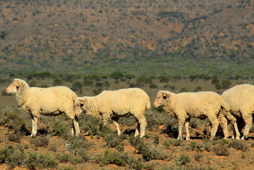
The moorland-type country, at the top, was covered with low bushes with tough, wiry leaves that can survive where grass cannot. At certain times of the year – like now – little perennial daisy plants pop up all over the place, providing a cheerful contrast to all the greys, browns and ochres. Hardy succulents of many kinds also thrive here, providing additional food for the fat merino sheep who blend in so well with their surroundings.
Blending in with the scenery.
Up here in sheep country, the valleys start getting a lot wider than the mountains they separate. The further west one goes, the more enormous the landscape becomes, and the straighter and emptier the roads. Once you get onto them, it is hard to believe you will ever reach your destination. It certainly felt like that when we hit the N9, about halfway between the towns of Willowmore and Uniondale. Instead of continuing West towards the jagged outlines of the Swartberg mountains, running along the far horizon, however, we turned East again heading back towards the more densely populated Indian Ocean side of the sub-continent.
We stopped in Uniondale for coffee and a quick shop (succulent Karoo lamb was on the menu for that night). The town is famous for, among other things, its ghost, a young woman who stands alongside the same lonely stretch of road we had just driven down. When people stop to offer her a lift she gets in and then scarily vanishes. The story has inspired an Afrikaans film and a song by Andrew Goosen, both titled “Die Spook van Uniondale”.
Uniondale
Uniondale scene
Back on the ghost road, I kept watching out of the corner of my eye but did not see her although, in this deserted landscape, it was quite easy to believe she exists. We passed through Unionpoort and carried on to where the road branches off eastwards, down the Langkloof – the ‘long valley’ that separates the Kouga and Tsitsikamma móuntain ranges – following a long-used route that runs roughly parallel to the one we had been on in the Baviaanskloof.
The Ghost Road with Swartberg mountains in the distance.
A bit of family history here. Many of my ancestors have felt the same, restless urge that had caused me to be cruising down this road. One of them, Benjamin Moodie, the last Laird of Melsetter, had, in 1817, crossed the globe from his home on the Isle of Hoy in the Orkney Islands and set himself up in an old Dutch-style farmhouse at Grootvadersbosch, near Swellendam, at the base of the Langeberg. He was later joined by two of his brothers, John Wedderburn and Donald Moodie. Although he later emigrated to Canada (his two brothers remained, both founding South African dynasties that spread across the country and into neighbouring Zimbabwe). John Wedderburn left an extremely entertaining – and insightful – account of his time in the country in his book Ten Years in South Africa (first published in 1835).
A few years after he arrived, John Wedderburn (who had fought in the Napoleonic Wars and had returned home to find there were few jobs available for ex-soldiers) also came travelling down the Langkloof, en-route to the Grahamstown area where he and his brothers hoped to be granted some land. Like a lot of early travellers on the sub-continent, John Wedderburn found the parched and ancient Karoo a frightening, hostile, place. He was not overly impressed by the more arid and treeless upper parts of the Langkloof even though its fruit growing potential had already been recognised:
“I was much disappointed in the appearance of this tract of country, which, notwithstanding the number of farmhouses and well-watered gardens, was rather bleak and forbidding, from the total absence of wood, and the uniformity of its mountains,” he would later write.
As a Scotsman, he possessed an obvious natural bias towards wet weather and greener pastures and it is only when he reached the coastal end of the valley, where the rainfall is higher and the vegetation more luxuriant, that his opinions began to improve:
“The eastern extremity of the Lange Kloof opens into the valley of the Kromme river; and here the landscape becomes interesting and romantic.”
The greener coastal end – much preferred by John Wedderburn Moodie.
John Wedderburn is generally a reliable guide and I find myself in agreement with much of what he writes but here I am very much at odds with his views. I think the Kouga mountain range, of which he was so dismissive, is an area of extraordinary variety, beauty and – dare I say it? – romance.
Our destination lay in a remote, secluded valley in the Kouga Mountains Wilderness Area. To get to it you have to drive down another rough and lonely road, through a perilously steep gorge and then up the other side. It made for a dizzying, jittery ride.
The road into the Kouga mountains.
The closer you get to the mountains the more impressive they become. Stream beds and ravines trench the foothills. Ahead of the house, in which were to spend the night, a steep gorge cleaved through the mountains, well-wooded in parts, belying John Wedderburn’s thoughts on the matter. In the late afternoon, my sister and I wandered through the peach and apricot orchards which were in full blossom, entranced by the light. Afterwards, we followed up the stream into the mountain gorge. In places, the water flowed straight over the road, so we had to cross on stepping stones.
The gorge in which our guest cottage was situated.
This was, – and still is – Ferreira country. Long before John Wedderburn came riding down the Langkloof, there had been Ferreiras living in the Onder-Kouga. Among these hardy frontiersmen was Johannes Stephanus Ferreira (1848-1896) also known as “Jan Been” on account of his bandy legs (hoepel been), a legacy from his being shot during one of the countless Frontier Wars. According to Bartle Logie, in his book Boots in the Baviaans, Johannes may have been the inspiration for the famous Afrikaans folk-song “Vat jou goed en trek Ferreira” [literal translation: “Take your stuff and move on, Ferreira”]. The romantic in me wanted to believe it was true.
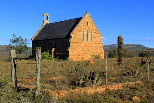
Isolated by its topography it, too, must have been a tough environment to live in although I imagine they must have also developed a strong sense of community still embodied, in many of the Karoo dorps you pass through, by their beautifully built churches, in which the faithful gathered on Sundays. Although in some places houses have been modernised or rebuilt, many of the whitewashed outbuildings are still the same as when they were when constructed.
The church at Uniondale.
Other aspects remain the same. Back doors open up to vegetable gardens which run into orchards which stretch down to sheep paddocks which, in turn, melt into the rough, rock-strewn hillsides. Chickens scratch around in dusty backyards, ducks and geese float on ponds, Border collies snooze in the shade, Ostrich eye-ball you…
In the orchards…
Getting eye-balled by two Ostrich…
Here generations of children have grown up and taken over the running of their parents farm, building on what has gone before.
I was to get further glimpses into the continuity of life in these isolated communities as we headed out along a dirt road that runs along the base of the range the next morning. There are still many working farms in the Onder-Kouga but inter-dispersed amongst them are yet more abandoned old homes which are slowly being reclaimed by the fynbos. The sites of these houses had usually been carefully chosen, often with a mountain as a backdrop and a view that looked on to yet another mountain.
A working farm.
A deserted farmouse…
and another…
…and another.
Having crossed the Kouga river yet again we found ourselves back on R62, near Kareedouw where we stopped for more coffee…
And so my journey into the Baviaanskloof came to an end. As we headed back to Grahamstown, along the N2, I realised that travelling through it had been far too big an undertaking for me to be able to give anything other than a shallow summing-up of my thoughts, impressions and experiences. Nevertheless, I still emerged from the journey feeling I had learnt a little bit more about my country and – just as important if travel is to prove redemptive – myself.
My life had been both broadened and enriched by my foray into the Valley of the Baboons…
GALLERY:
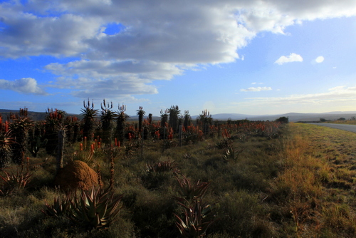
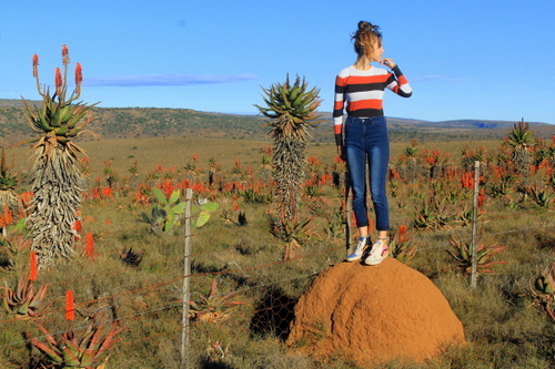
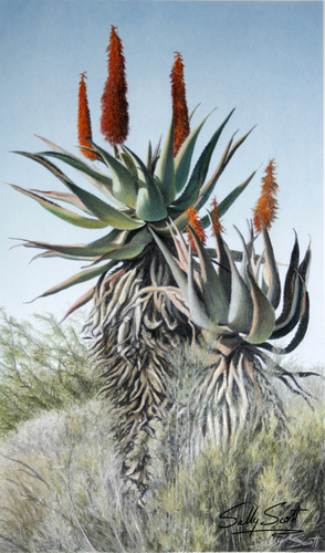
Aloe ferox. Baviaanskloof.
Aloe ferox near Uniondale.
Sombre Greenbul.
Blue Crane.
Ostrich
Cape Bunting
African Black Duck.
Old boots abandoned on side of road.
Sheep sheltering in shade.
Ruined house.
Conglomerate.
Lunch break in the Baviaanskloof.
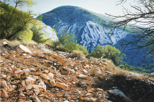
Kouga mountains.
More fold mountains, Baviaanskloof. Pic courtesy of Sally Scott.
*NOTES ON CAPE FOLD BELT
by Goonie Marsh
The Cape Fold Belt has a long history starting about 500 million years ago with the
formation of a shallow marine basin, the Agulhas Sea, along the southern margin of
Gondwana, a single land mass or supercontinent, which was made up of the continents
currently known as Antarctica, Australia, India, Africa and South America.
For the next 170 million years until about 330 million years ago, this basin received sandy
and muddy sediment derived by erosion from the interior of Gondwana. With compaction
and cementation the accumulated sediment formed a succession of sandstones and shales
more than 8 km in thickness. This succession is known in formal terminology as the Cape
Supergroup and it is subdivided into 3 major units depending on the proportion of
sandstone to shale in the sequence. The oldest and lowermost unit is the Table Mountain
Group which is dominated by quartz sandstone of exceptional purity. This is overlain by
the Bokkeveld Group which has thick units of shale interleaved with thinner sandstone
layers. The topmost, and therefore youngest unit, is the Witteberg Group with
intercalated shales and sandstones in approximately equal proportions.
Starting about 330 million years ago and continuing for over 100 million years, the
southern margin of Gondwana was subjected to powerful laterally compressive forces
directed northwards. These forces destroyed the Agulhas Sea and Cape Basin, squeezing it
against the continental mass of Gondwana, rumpling, folding and uplifting the sedimentary
strata that had accumulated to form a major fold mountain belt, the Cape Mountains. The
folding process also fuses the grains in the rocks tightly together and they harden,
particularly the quartz sandstones, which are converted into exceptionally hard quartzites.
The general processes and products of this fold mountain building event are known as the
Cape Orogeny. A good ‘modern’ analogy would be the creation of the Himalayas – Earth’s
still active major fold mountain chain formed by India pushing into Asia
ACKNOWLEDGEMENTS:
Baviaanskloof – A World Untouched. Compiled by Liesl Hattingh (published by Baviaans Tourism).
Boots in the Baviaans by Bartle Logie (Bluecliff Publishing).
Ten Years in South Africa by Lieut. J.W.D Moodie published by Richard Bentley)
SPECIAL THANKS to Goonie Marsh and Sally Scott for organising this trip and being happy to stop whenever I wanted to take a photograph – which was very often – or have a cup of coffee…
I sometimes think that when I travel what I am really looking for is proof that the world is at varied as I want it to be. That is certainly the case when I drive between my home in Kwa Zulu-Natal and Grahamstown, in the East Cape, where my sister, Sally, lives. It is a journey I have made many times and on each occasion I am struck by just how different the two provinces are even though they border on to one another.
Once you get past
Queenstown and descend the Nico Malan Pass, near Seymour, an entirely
new geography asserts itself.
You are now on the
fringes of the Karoo, that immense, dry, sun-scorched, almost
mythical, landscape that was once part of a vast, shallow lake. In
ancient times all sorts of strange reptilian creatures and other
odd-looking beasts roamed this area, thoughtfully leaving their bones
behind, embedded in the rocks, for the scientists to study.
The air here is
drier, the distances much clearer; the more you travel in to it, the
more the sky asserts itself. I can think of nowhere else where it
seems so big and blue and empty.
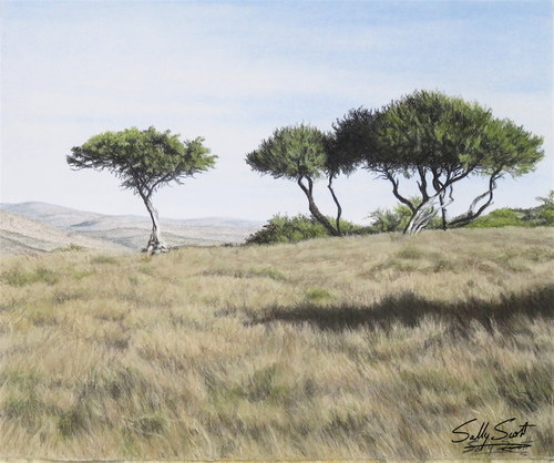
The weather can be extreme, the summers blazing hot, the winters freezing cold. The rainfall is patchy and unreliable and the vegetation has adapted to meet its capriciousness. There are lots of succulents and aloes and squat, low bushes with tiny, tough leaves. Here, almost no tree grows higher than a man’s head except in the mountain valleys and along the river lines.
Typical Karoo Country.
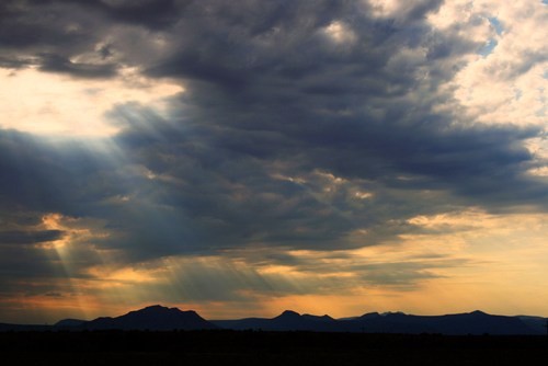
There is a spirit too, a presence, an unseen power that is very old and has little to do with man. After a while the sheer breadth and weight of the land gets to you. You begin to forget the world you have just come from existed, you can’t help thinking that the whole country looks like this.
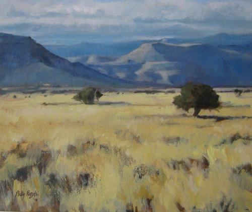
The Karoo has the capacity to inspire wonder in all who behold it.
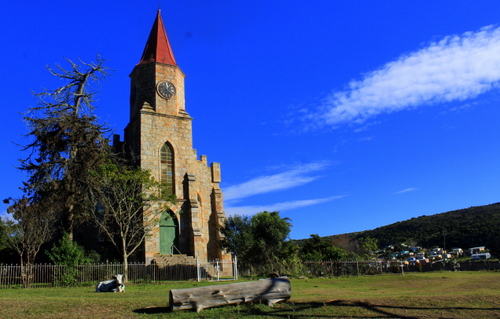
Perhaps not surprisingly, many famous South African writers and artists haled from here. Olive Schreiner, author of the early South African classic, Story of an African Farm, grew up in Cradock. So, too, did the poet and writer Guy Butler.
Schreiner House, Cradock.
Thomas Pringle, who came to the Cape as leader of the Scottish party of British settlers of 1820, was allocated land in the valley of the Baviaans River near present-day Bedford. It is still known locally as “Pringle Country”. Eve Palmer who wrote that other classic book about the Karoo, The Plains of Camdeboo, grew up on the farm, Cranemere, down the road from the Bruintjeshoogte and between the towns of Somerset East and Graaf-Reinet. The artist, Walter Battiss, also spent his childhood years in Somerset East (you can see his work in the local gallery dedicated to him).
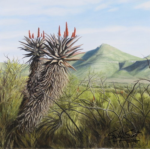
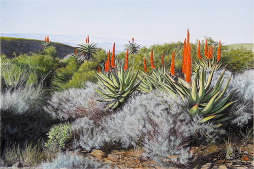
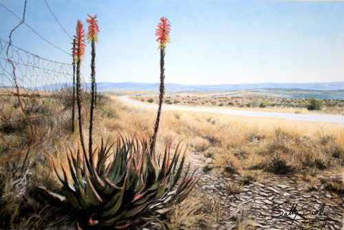
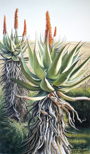
Even members of my
own family have found themselves succumbing to the insistent blue
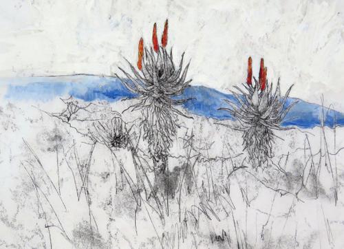
skies and lyrical qualities of the Karoo. Sally, an art teacher, has
built up a big following with her East Cape landscapes which often
have, as their focal point, the aloes which are such a feature of
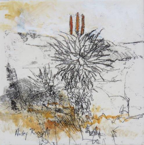
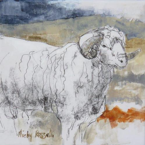
this region. My other, Nicky, also an art teacher, who lived in
Somerset East for a while, also felt the urge to record the
unchanging strength of the countryside.
How strong this
influence has proved can be seen in the examples of their work I have
included in the gallery below.
The area around
Grahamstown, to which I recently returned, used to be known as the
Zuurveld, and later as the Albany district. It is also known as
“Settler Country” for it was to this part of the Cape Colony that
the early 1820 British settler party came.
To these early settlers this harsh, dry country also marked the beginning of the hinterland, that half-known, half-feared region that stretched endlessly onwards. The further west you travel the wider and emptier it seemed to get. In the far distance stretched ranges of mountains. What lay beyond them was just a rumour, a region of fancy and conjecture.
Karoo Mountains beyond Plains of Camdeboo.
Even today the land
still feels like frontier country, wild and sparsely populated. Far
more than in Kwa-Zulu-Natal, where, I come from, you get a real feel
of what it must have been like for those early settlers, struggling
to eke out a living in these remote and isolated outposts.
In KZN development
after development has blighted the province: holiday homes,
retirement homes, bungalows, duplexes, massive walled complexes that
stretch for miles. Factories belch out smoke, power lines criss-cross
the countryside, an endless stream of traffic pours down its main
arteries, the urban sprawl and shack-towns seems to grow bigger by
the day.
Aside from its coastal areas, you don’t get that feel at all in the East Cape. You can travel for miles through the Karoo without seeing another vehicle. It is like you have the universe all to yourself.
Every time I pass
through it, I find myself trying to imagine the feelings of those
early arrivals. How alien the harsh landscape must have seemed after
the soft green of England.
Many of them must have felt they had been hoodwinked. The pamphlets that had been dangled in front of their faces, back home, promised the prospect of great self-improvement, a land of milk and honey, an amazing opportunity. The reality was completely different with many of them finding themselves stuck in the middle of the no-man’s-land between the white settlers moving north from the Cape and black settlers moving southwards. The Fish River which winds its way through this area was often seen as the dividing line with the British authorities building a line of defensive forts along its banks. In places you can still see the remains of these.
Old British fort, Fish River.
Some settlers stayed
on on these outlying farms, braving the dangers and determined to
make a go of it; others found the country uninhabitable, packed up
their belongings and headed off, blazing a trail of retreat that
others would follow.
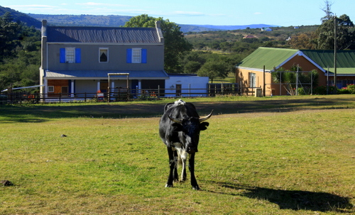
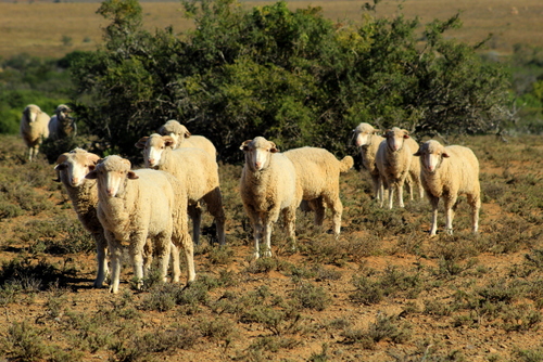
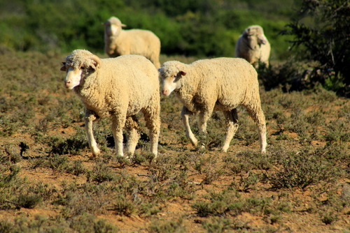
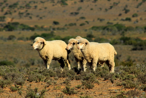
Every so often you come upon a solitary farmhouse, each one part of a narrow stream of civilization that wound itself through the wilderness. Sometimes there will be a steel wind pump and a circular water tank around which some cattle have listlessly gathered. Mostly, though, this is sheep country.
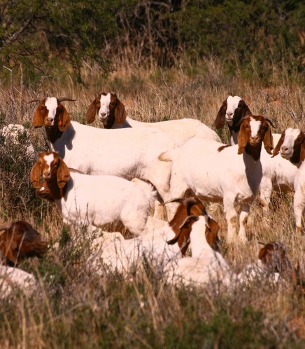
And goat country. There are lots of goats in the Karoo.
Angora Goats.
Boer Goats.
We did a day trip out of Grahamstown, taking the road, which leads past Table Farm with its wonderful old, double-story settler house and small stone church, and ends up in Riebeek East. Situated in some hilly country, the town – if such it can be called – was founded in 1842 and initially named Riebeek after Jan van Riebeek, one year after the local church was built. It was erected on part of the farm Mooimeisjesfontein that was subdivided and sold by the subsequent Voortrekker leader, Piet Retief. His old home is situated just east of the town and has been declared a national heritage site.
Old Settler home, Table Farm.
Old Church, Table Farm.
As in most small South African dorps, the church dominates the town. When we stopped outside it the only sign of a congregation was a herd of cattle grazing in its grounds. It was a very impressive structure, nevertheless, which seemed far too large and grand for such a sleepy little hamlet.
Church in Riebeek East.
Old settler home, Riebeek East.
Maybe it had once
been different around here. Indeed, visiting many of these old Karoo
towns, one gets the feeling that at one time they supported much
larger populations, especially when the wool industry was in its
heyday. With the boom years gone most of the young folk trekked off
to the cities and towns.
From Riebeek East we
followed the dirt road that eventually leads to the main Port
Elizabeth highway although we planned to turn off before that.
To our left, ran a long, low range of hills where you could see how the exposed rock had been buckled and folded, like a carpet you have just shoved with your foot. In front of us the road rose in to crests and sank in to hollows.
Eventually we came
to a junction where we branched off down another dirt road leading to
the curiously named, Kommadagga. It was a place I was keen to see.
Kommadagga (the
name is believed to be Khoekoen meaning “ox land” or “ox hill”)
was a small, purpose-built, settlement constructed by the South
African Railways, in the early 1950s, to house the workers involved
in the construction of the nearby railway line. At the time it had
over 1 000 residents, with an elementary school and a recreation
hall. Once their work was finished, its population was uprooted and
moved further north to the next section of the new railway line.
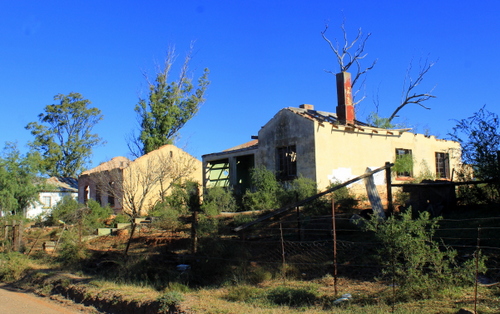
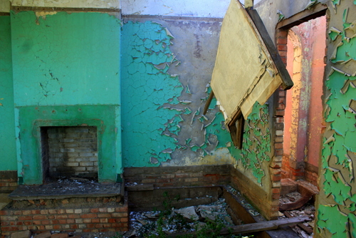
Now it is a ghost town, its reason for existence long since vanished. The houses are just shells. You can see right through them, the sunlit, empty rooms with their peeling walls; windowless, door-less, their roofs caved in. In places they had broke clean in half, the bricks scattered over the veld.
Old buildings, Kommadagga.
Across the road, a
couple of hundred yards away, crowning a low hill is an old water
tower and to the side of that some concrete pillars whose former
purpose I could not fathom although I imagined it had something to do
with the railway line..
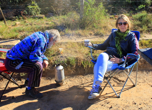
We pulled up beside one of the wrecked houses and while Professor Goonie Marsh, our amiable driver, long-time Grateful Dead fan and expert on matters local, fired up his volcano for coffee on the side of the road, I set off to explore. I made my way through the remains of gardens, past rusting fences, auto parts, old cement water storage tanks and all the other scattered detritus that suggested a civilisation of sorts.
Goonie fires up his Volcano. Sally plays Lady of the Manor.
There was one house which was in better shape than the rest, an empty wine glass on the verandah wall suggesting it might still be occupied but by whom I had no idea. Near another house there was an outbuilding full of old shoes, in another a collection of goat skulls which got me wondering just how they had passed their time around here.
In such a place, one
can imagine there was not much to do. They probably smoked, played
cards, drank too much. On Sundays, the more God-fearing among them
most likely trekked off to that fine-looking church in nearby Riebeek
East.
From Kommadagga, we followed the old rail bed until we reached the Kommadagga Station, some distance away, where the railway line and the road diverged. Cresting a rise we found ourselves looking over a vast basin through which the Fish River flowed, its presence marked by a line of trees.
Along its edge a large expanse of land had been cleared and bought under irrigation, the verdant green contrasting sharply with the surrounding dry bush. To the south and the west, glowing in the morning light, the thin, distant, blue outline of the Bosberg rose through the haze.
View towards Bosberg.
We drove on, stopping every now and again to take photos of the aloes which grow is such profusion around here. Their candelabra of flowers were aflutter with sunbirds (mostly Malachite and Greater Double-collared with a few Amethyst) – such a bright, fragile, flowering of plants and birds in this hot, dry, khaki and grey landscape.
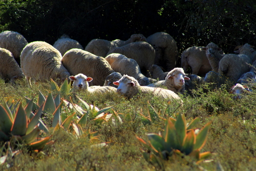
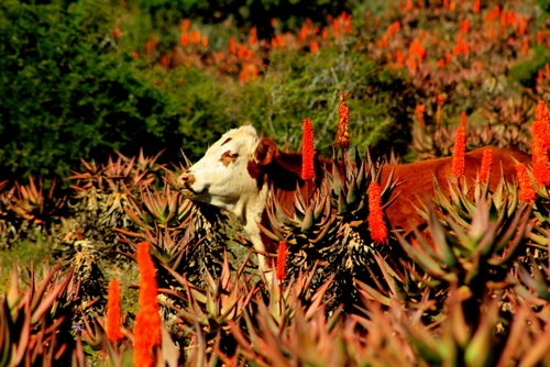
Out here, one gets the feeling no one seems to be in a hurry. Flocks of lazing sheep gaze at you from underneath the shrubbery. Small groups of cattle pose amongst the aloes, nonchalantly chewing the cud. They give the feel of being completely cut off from the world and not minding a bit.
Sheep with Aloe striata in foreground.
Cow in Aloe ferox.
This, we discovered, was not altogether true. Crime – the curse of modern South Africa – has spread its tentacles even to out here in the boon-docks. When we stopped to take pictures of some sheep, grazing in a field, the local farmer came hurtling up in a cloud of dust with a bakkie full of security guards. He was worried we were rustlers!
Karoo rush hour traffic jam…
Having convinced the farmer we had no ill-intentions, we continued on our way. As we drove the views changed but not suddenly or sharply. Nearing the main Grahamstown to Bedford road more mountains hove in to view – the Winterberg, the Katberg, the Hogsback. Between them and us there was yet another huge, aloe-dotted, plain.
Aloe ferox next to Grahamstown to Bedford road.
Katie finds a view point.
Despite its timeless
feel, some things are changing. In this harsh environment, many
farmers have discovered that tourists pay better than sheep, cattle
and crops. As a result they have started restocking their properties
with many of the same game species their ancestors so casually shot
out.
Back on the tar I
continued to study the ground topology. To me it looked like the
worst soil imaginable but the termites obviously liked it because the
veld was littered with their pinkish-yellow, nipple-shaped mounds. In
between their habitations were yet more flowering aloes full of
twittering sunbirds.
Then we were driving
back through the outskirts of Grahamstown, past the municipal dump
out of which much of the rubbish had been blown and now lay piled up
along the side of the road. Or had been left hanging on the fences
like some sort of weird, welcome-to-town, decoration.
There had obviously
been a big fire in the dump recently, too judging, by its burnt
colouring and the pungent smell in the air.
At this point, I found myself wishing we could turn around and head back the way we had just come. Then I remembered I had an appointment at the local craft beer brewery, in the hills outside town, and changed my mind again…
GALLERY:
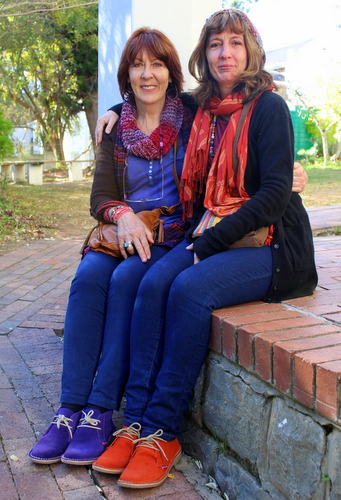
My two talented artist sisters, Sally Scott (on left) and Nicky Rosselli.