Country of my Heart: Going back to Mapungubwe

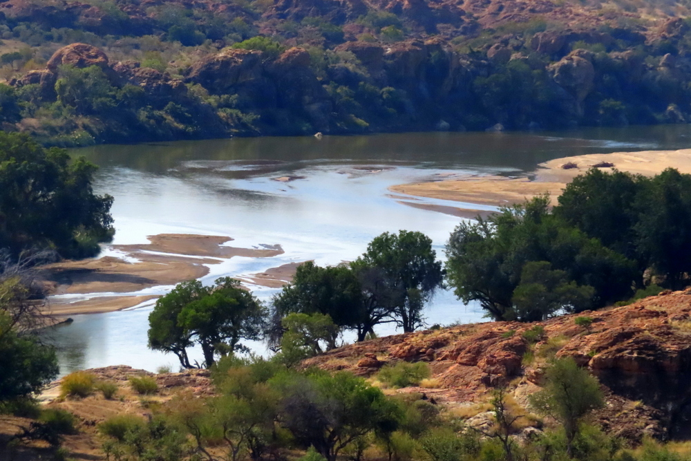
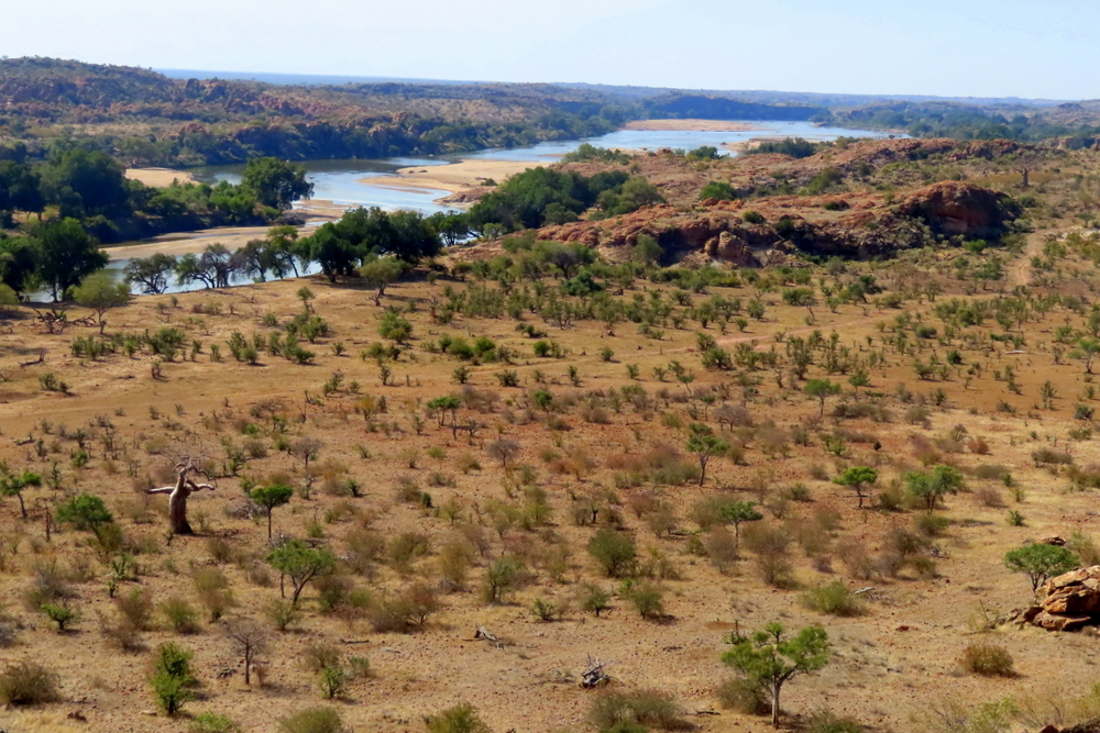
It is a dramatic view in every sense. Directly below the hilltop viewpoint (once an old army base), on which I now stand, the wide-banked, sand-filled Shashe river has its confluence with the legendary Limpopo River, immortalised by Rudyard Kipling in one of his Just So Stories, The Elephant’s Child. In making this union, the two rivers provide a meeting point for the three countries that have provided me with a home, ingrained themselves in my soul and helped shape my life – Zimbabwe, South Africa and Botswana. From there, the now enlarged river runs eastwards through a series of hills and plains, broadening out in places, and narrowing in others. Behind and to the south of me, the land stretches back into the blue haze of the distant ramparts of the Soutspanberg mountain range.

Confluence of Shasdhe and Limpopo Rivers.

Having paid my nostalgic dues, I make my way back to the car. Overhead a Martial Eagle soars – a huge, unmistakable bird even to the naked eye. The leisure of its circles seems to express a total assurance in its power and domination of the amazing landscape below.

For we are in the heart of Africa.

I fell in love with Mapungubwe the first time I went there. I have always had an interest in archaeology and knew something about the region’s history. I knew that it was home to an important early Southern African kingdom whose trade links stretched to the shores of the Indian Ocean and beyond. I knew that one of South Africa’s most iconic archaeological artefacts – a gold rhino – had been found there. I knew that, for reasons that are still not entirely clear (climate change, exhaustion of resources?), it eventually fell into decline and was supplanted in importance by Great Zimbabwe.

Nothing, however, prepared me for reality.

Situated in the extreme north-west of the country Mapungubwe is a strange but fascinating place where everything seems for me infused with a mysterious significance. Each rock and feature and tree exudes its own peculiar energy. In this magnificent theatre of nature, you can still feel something of the ancient spirit of the continent.

A magnificent theatre of nature…

Each time I return – and I have now done so many times – I feel the same stirring of the soul and quickening of the senses. On this trip, I had an added reason for being glad to be back. My sister, who lives in Mpumalanga, had organised a reunion of the four siblings who live in South Africa. Given our mutual love of landscape (three of us are artists, the other a social anthropologist) – and in particular the bushveld – it was the perfect place for such a gathering of the clan.

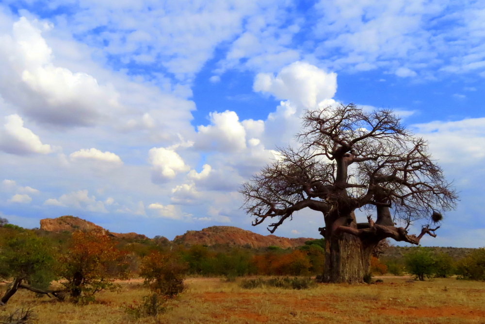
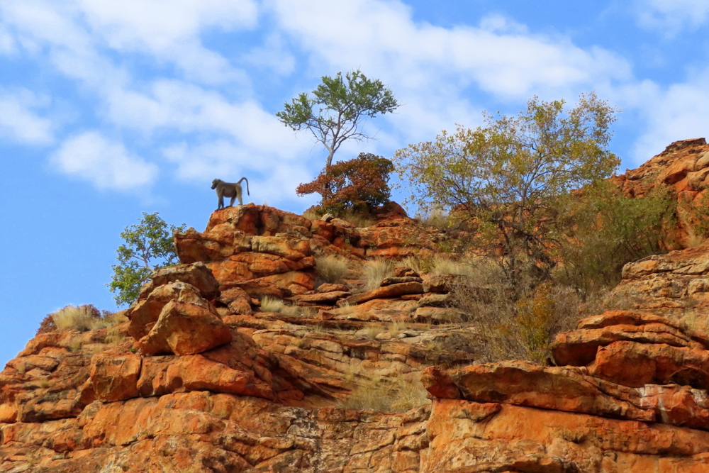
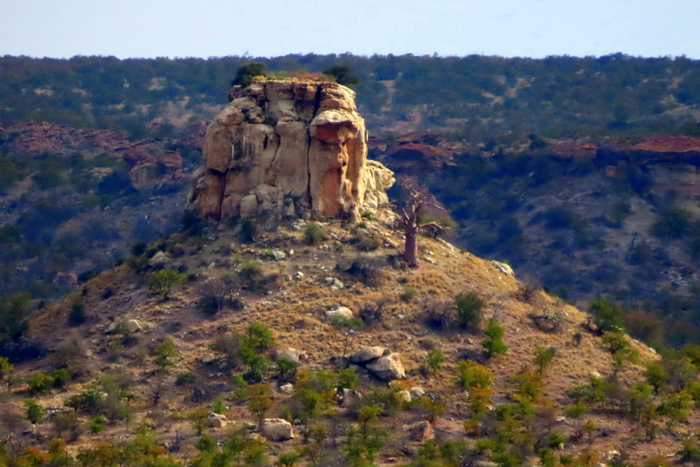
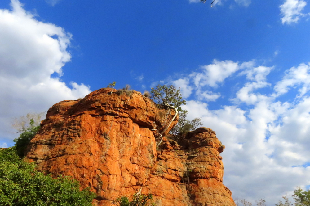
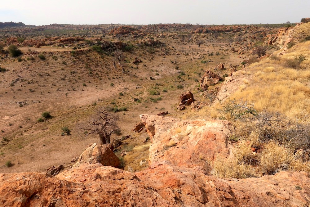
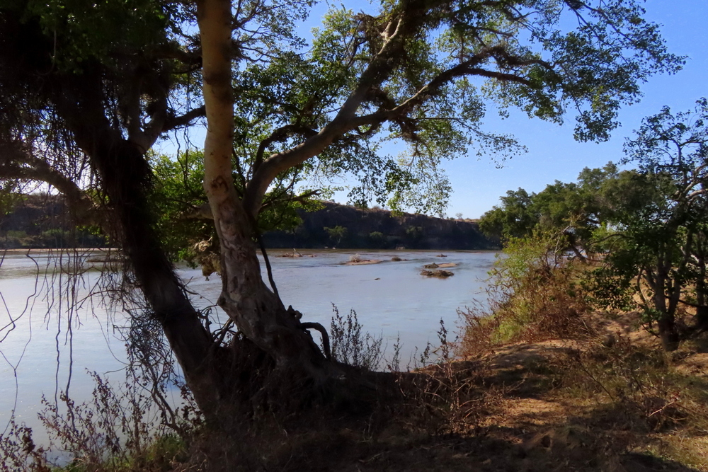
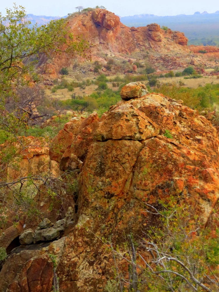
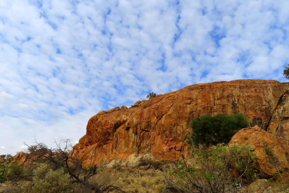
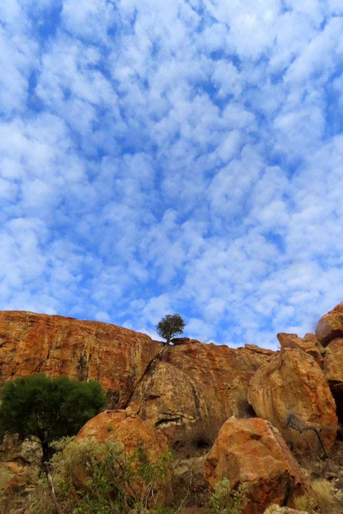
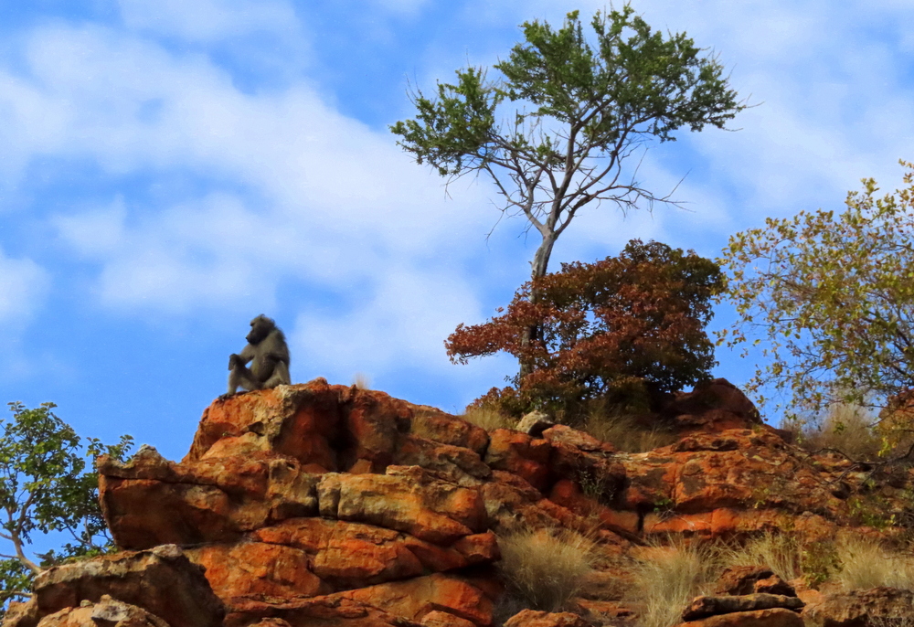
Much of Mapungubwe’s magic stems from its convergence of habitats, geology and especially its dramatic red sandstone scenery – the rocks which glow like hot embers in the early morning and when the sun sets, only adding to its mythical, otherworldly feel. Stunted mopane dominates much of the landscape. From the Main Entrance Gate, the road passes through a tumbled landscape of heavily eroded and deeply gouged hills. Ghostly Large-Leafed Rock Figs (Ficus abutilfolia) curl around the rocks and send their enormous white roots shooting down through the fissures (hence their other name – rock-splitter figs). Further down, the scuffed and sparse terrain of the hillier parts gives way to rich and luxurious trees that grow along the Limpopo flood plain.

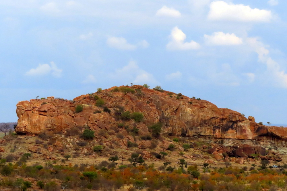
It was here, between 900 and 1300AD, that the kingdom of Mapungubwe was established by Bantu-speaking people who had moved down from the north. It is now widely accepted as being southern Africa’s first state. At its heart was a large sandstone hill, flat-topped and kidney-shaped, with steep cliffs on all sides. Its summit was the exclusive abode of royalty with the commoners living in the surrounding low-lying land. According to Mike Main and Tom Huffman, in their book Palaces of Stone, this separation marked a “dramatic change from traditional ways…now the elite was no longer part of the commoners but physically separated from them”


I had hoped to climb the hill but because I was still recovering from a bout of flu which had badly affected my breathing, I decided not to risk I because of the steep climb involved – although the others did.

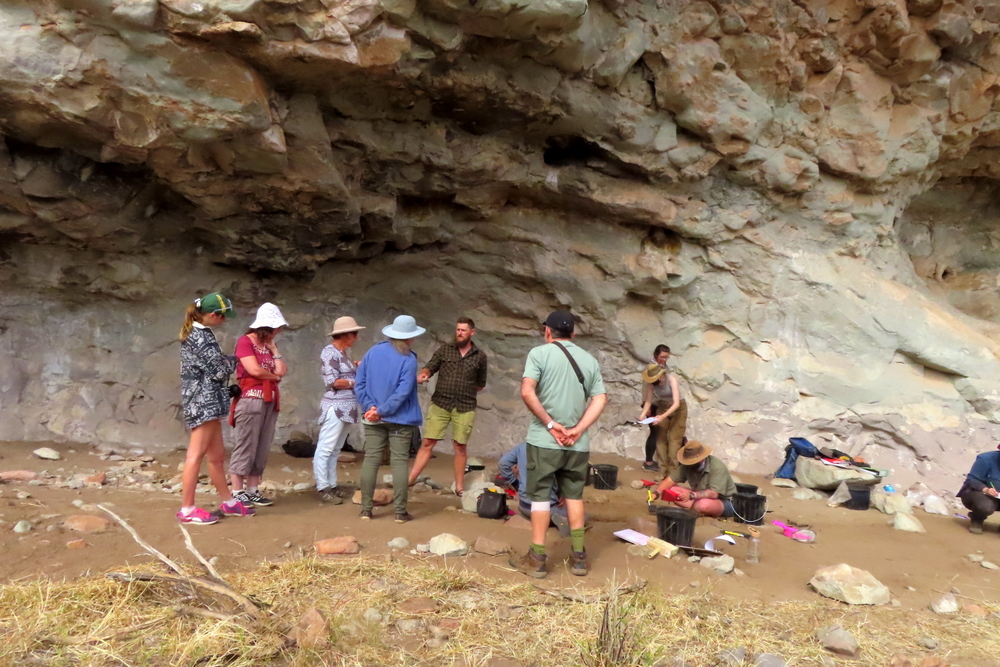
Fortunately, my sister had also arranged for us to visit an archaeological dig at an old settlement, that was being supervised by one of her university colleagues, to the south of the Mapungubwe complex. We set off for it the next morning.

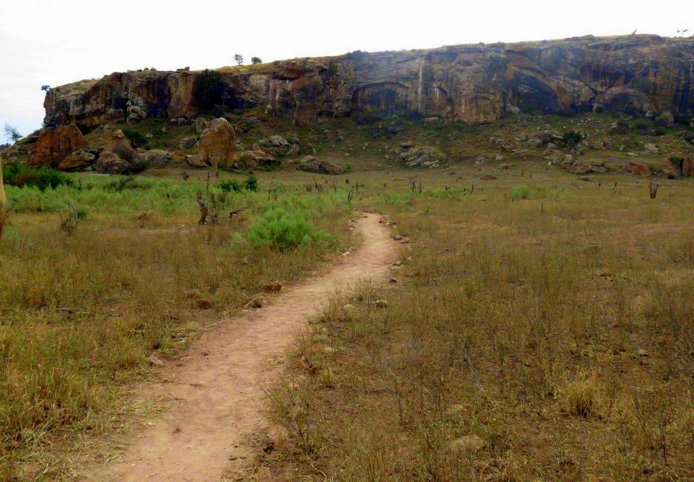
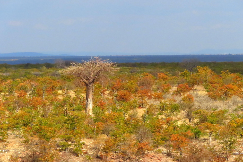
To get there, we drove down a rough dirt track crisscrossed with game and elephant tracks and surrounded by a sea of mopane trees out of which rose balancing rocks and oddly-shaped sandstone islands. I saw one that looked like a fossilised terrapin, another that resembled a crocodile and a third which looked like it had swallowed a large fish which now lay there, entombed until the very end of time. Even though it was still mid-winter I could feel a steady thickening of the heat. In front of us, the clouds were piling up like castles in the sky. A great baobab thrust itself up from the earth in front of us, dwarfing all the surrounding trees.

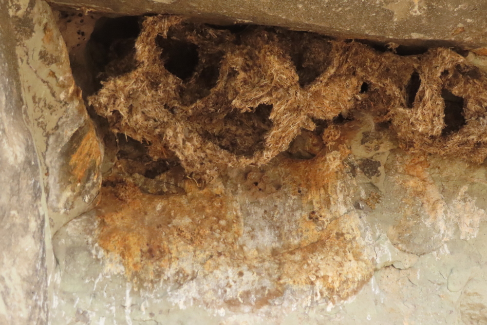
Nestled at the base of a long ridge of stone, entirely hidden from the world, lay the site where a now-vanished people had left their traces in the patches of dry stone walling, clay-lined huts, grain bins and shards of fired pottery. There was evidence of a more recent occupation. For want of decent clay, the swallows that nest under its arch had constructed their nests out of what appeared to be elephant dung.

Watching the team of students laboriously sifting through the sand while keeping an eye out for something which might reveal a tell-tale clue about the past, I got a real whiff of history, a tentative and somewhat blurry outline of how this area must once have been.

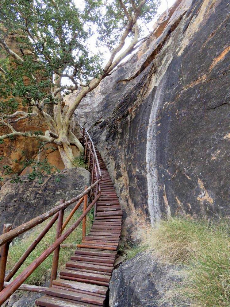
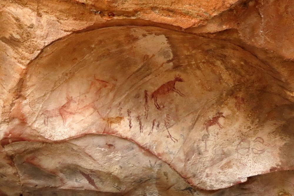
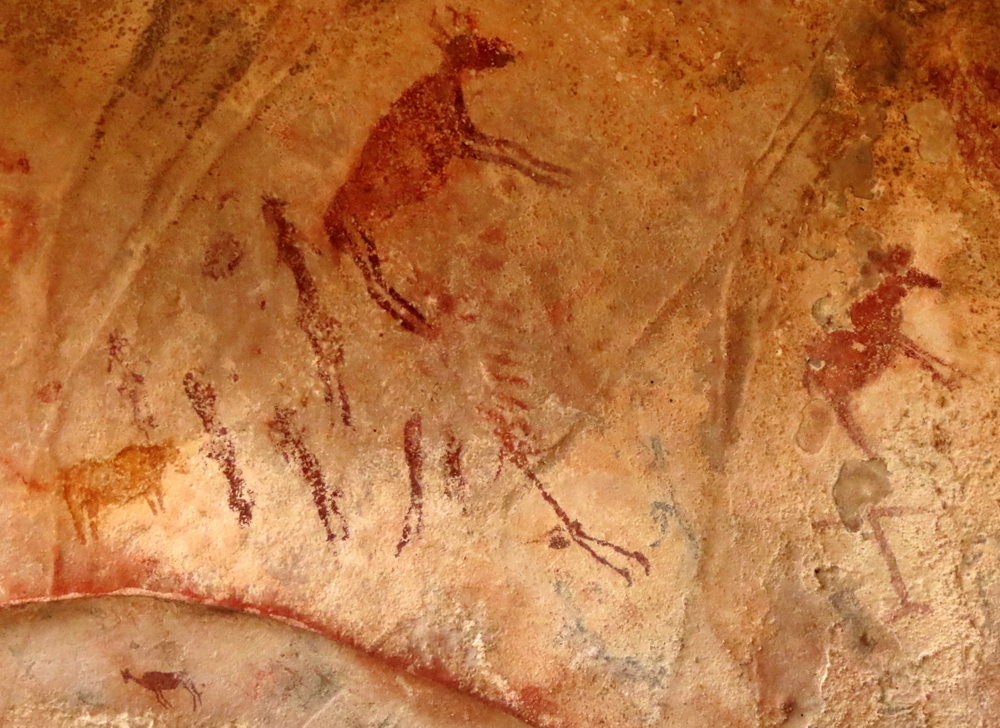
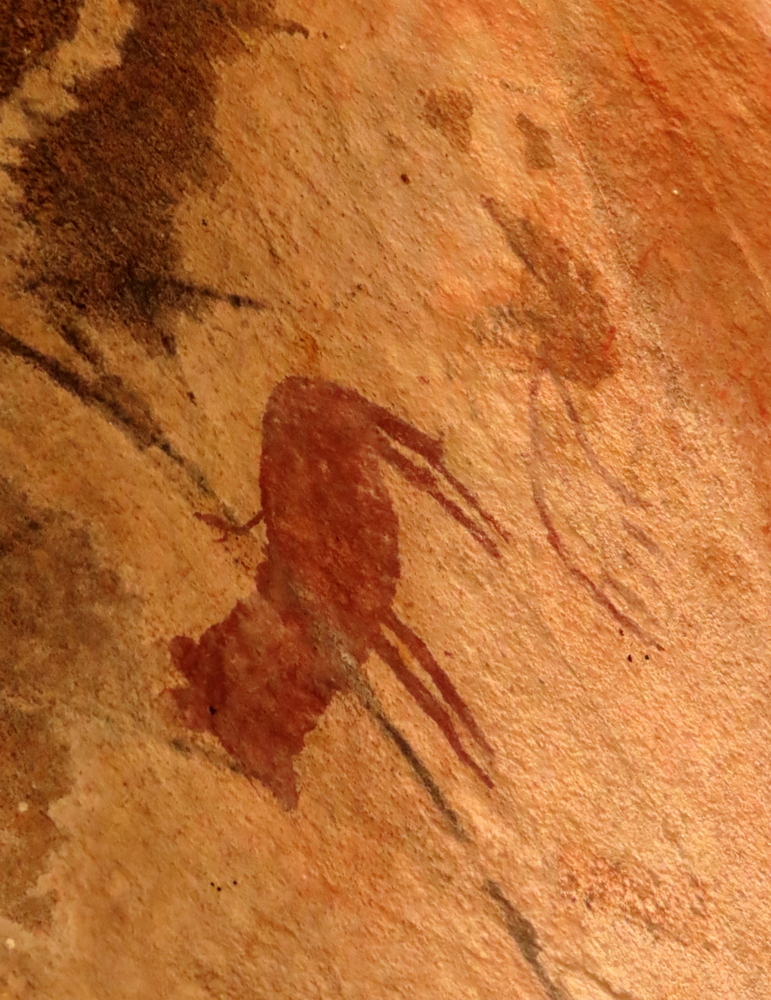
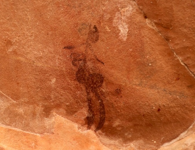
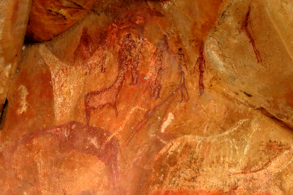
The original inhabitants of South Africa were, of course, the San who had travelled and hunted in this valley in small nomadic bands since time immemorial. Their cultural presence is conserved in the many cave paintings that lie scattered throughout southern Africa. Not far from the dig lies a boulder-strewn canyon which contains some wonderful samples of their rock art.

Kaoxa’s Shelter. San rock art site

A hot climb bought us to the ledge under the overhang, also well hidden from the rest of the world, where the paintings are. We stood before them in a line, awed by the artistry. Painted mostly in red ochre, the site contains images of 16 species of animal among its roughly 200 images including rare depictions of locusts, mongoose, spring hare and a hippopotamus. Alive to the constant movements of nature, spirits and human moods, others show supernaturally potent animals and various ritual activities. Some of the paintings are believed to be thousands of years old.

San rock art. Kaoxa’s Shelter.

It would be interesting to know how the San reacted to having to share their ancestral ground and what sort of dealings they had with the Bantu-speaking people, one of whose old settlements we had just visited. A fundamental continuity would, presumably, have been the hunting of wild animals although the introduction of cattle into this habitat might well have provided a point of friction, as they competed for valuable grazing. There is some evidence to suggest that the new settlers regarded the San as powerful rain-makers and made use of these skills. In a low rainfall area such as this, it must have been a useful talent to possess.

Hopefully, further archaeological investigation will reveal more about this

What is beyond doubt, however, is that when the first Europeans arrived in Africa they regarded the diminutive race in a very negative light The concept of private property lay outside the world of the San and this, alone, would be enough to condemn them in the eyes of the Europeans, with their clear notions of orderly land use and rational planning. Nor did their mobile lifestyle fit in with European ideas. There were inevitable clashes and confrontations while the “primitive” San’s apparently haphazard and wasteful ways provided justification to stereotype them as ‘savages’ and drive them out and, in other instances, exterminate them.
The treatment of the San provides one of the most shameful footnotes to South African history.

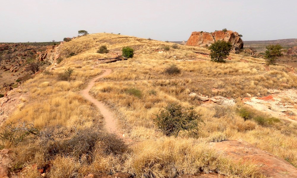
After visiting the cave, I clambered breathlessly up a large nearby boulder-topped kopje that provided a stunning view over the surrounding hills which included several other important archaeological sites – Leokwe Hill, K2, Little Muck – and tried to imagine the landscape as it must once have been when this was still a relatively well-inhabited area.

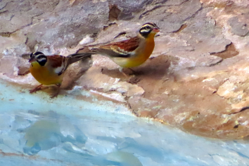
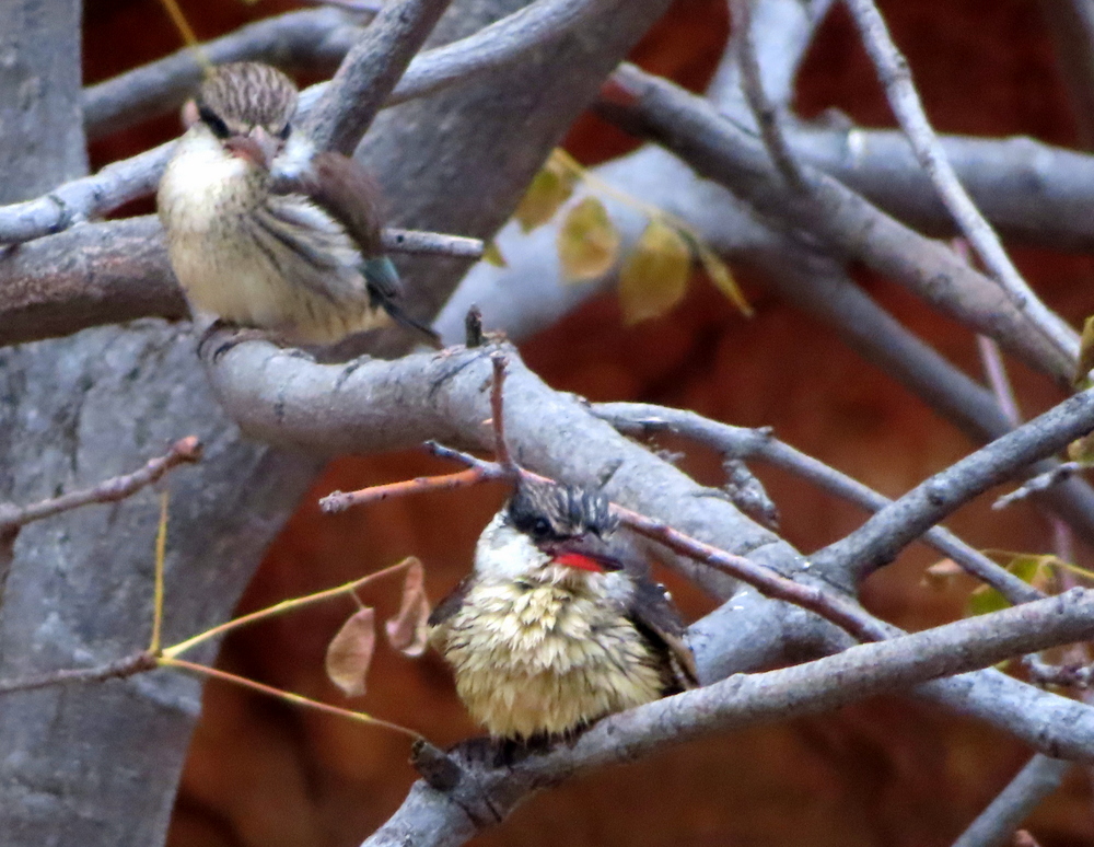
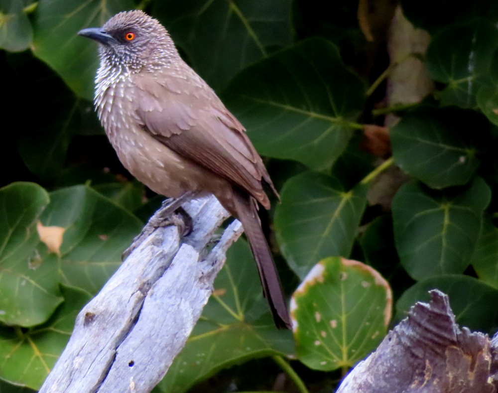
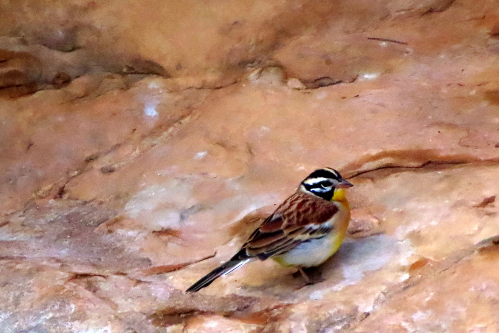
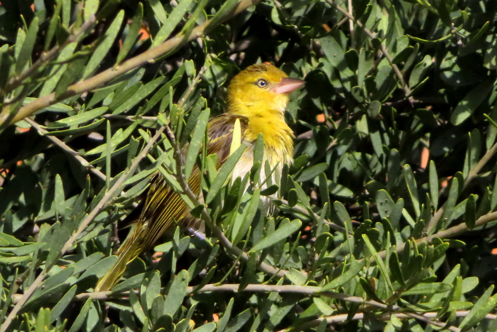
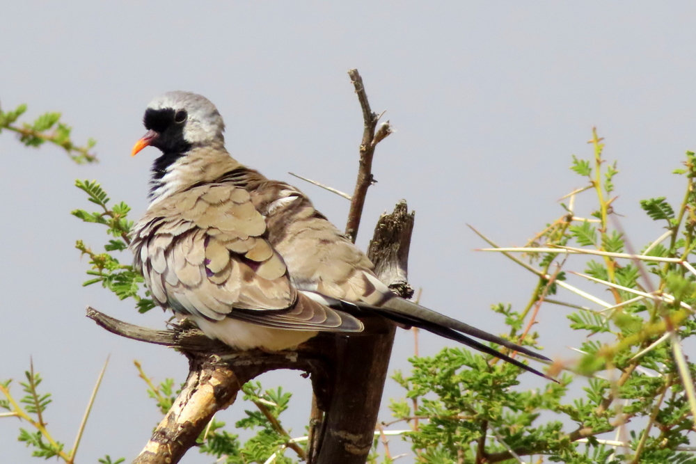
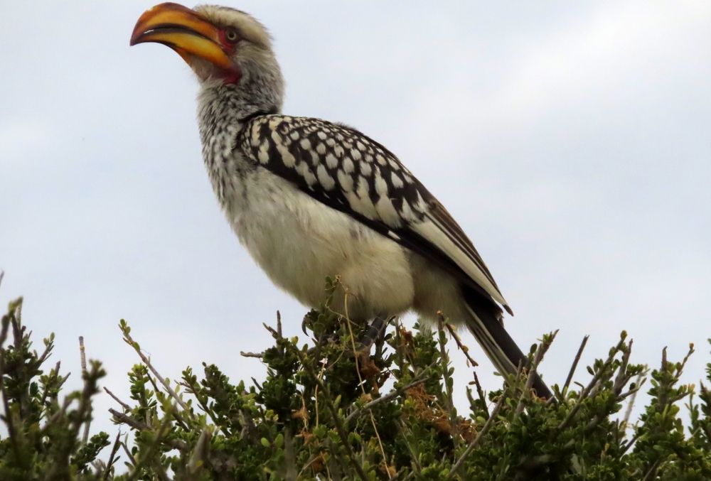
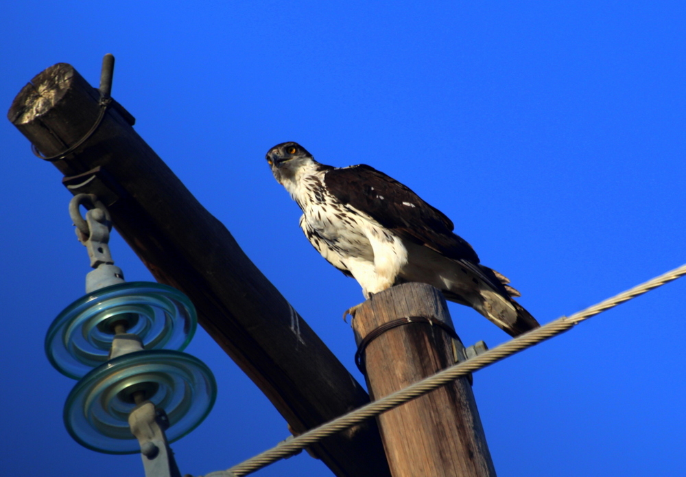
Then, I did what any sensible twitcher would do in such a situation. I went in search of birds – for Mapungubwe – situated at an environmental crossroad where any bird could turn up -is just as good a place for birding as it is for its cultural history. Although we arrived in winter when all the migrants were away there is still plenty to see. For a start, there are the dry-land specials you don’t get in my neck of the woods – Pied Babbler, Cut-throat Finch, Great Sparrow, White-browed Sparrow-Weaver, Red-billed Buffalo-Weaver, and Chestnut-backed and Grey-backed Sparrow-Lark. In the riverine forest and along the water line you get unusual species such as White-crowned Plover, Maeve’s Starling and – most eagerly sought after of all – the Pel’s Fishing Owl, as well as several predominantly Zimbabwean birds whose territory extends just across the river into South Africa (Tropical Boubou, Meyer’s Parrot, Senegal Coucal and Three-banded Courser – I have seen this relatively uncommon bird twice in the park). This is also great bunting country. Our lodge supported a huge flock of Golden-breasted Buntings who gathered at the swimming pool to drink each morning and evening along with an assortment of doves, Mocking Cliff Chat, Arrow-marked Babbler, Glossy Starling, Striped Kingfisher, Red-headed Weaver, Lesser-masked Weaver, Dark-capped Bulbul and a family of squirrels. Strangely enough, there was also a resident Klaas Cuckoo. It had obviously decided not to join the annual migration northwards (unlike other Cuckoos some Klaas Cuckoos do overwinter).

There was more to be discovered. The next day, I came across both a Red-crested Korhaan and a Kori Bustard, the largest flying bird in the world. In the Western section of the park (Mapungubwe is split into two) a solitary African Hawk Eagle sailed overhead, followed, a bit later, by a flock of White-backed Vultures looking for suitable thermals to take them up still higher into the heavens where it would be easier to spot recent kills. On the drive home, an African Hoopoe floated alongside us. I am always pleased to see them – they are considered to be good omens in some societies, messengers from the gods. I can believe that.

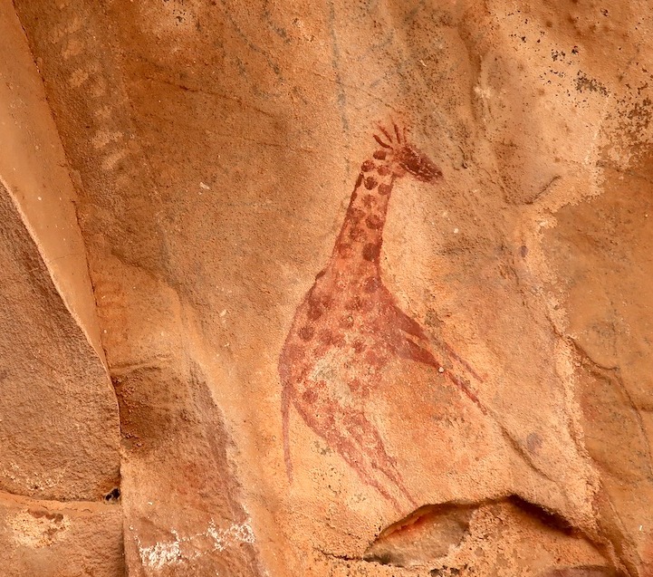
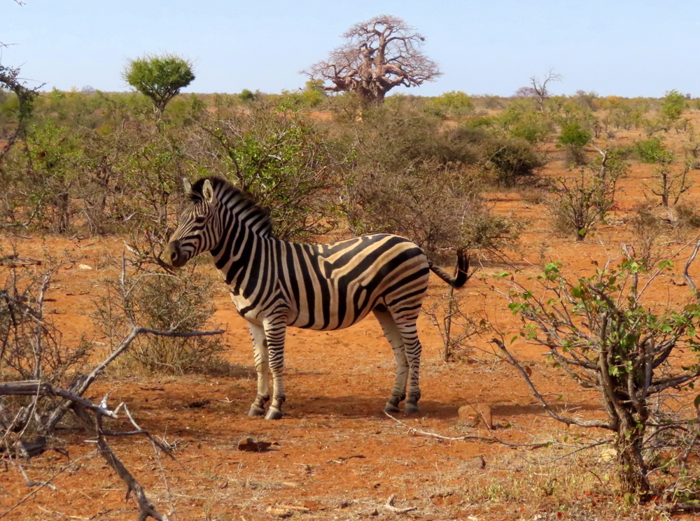
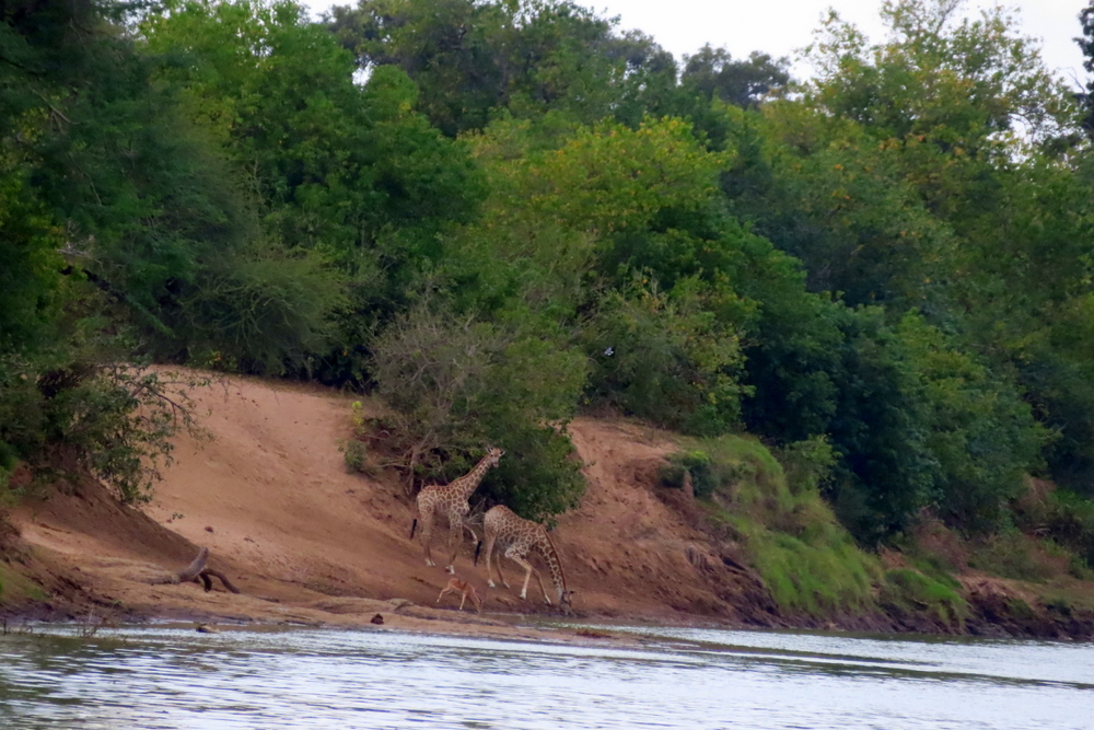
And then there are the animals. Because of its arid climate, Mapungubwe doesn’t support the density of population you get in wetter parks, like Kruger, but they are there to be found if you look for them. As you drive through the park, the heads of giraffes can be spotted. gently swaying above the tree tops, pausing every now and again to nibble on the leaves. A sudden cloud of dust might indicate the direction a herd of Zebra had taken after being spooked by some phantom in the shadows.

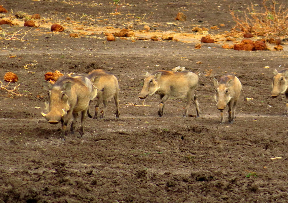
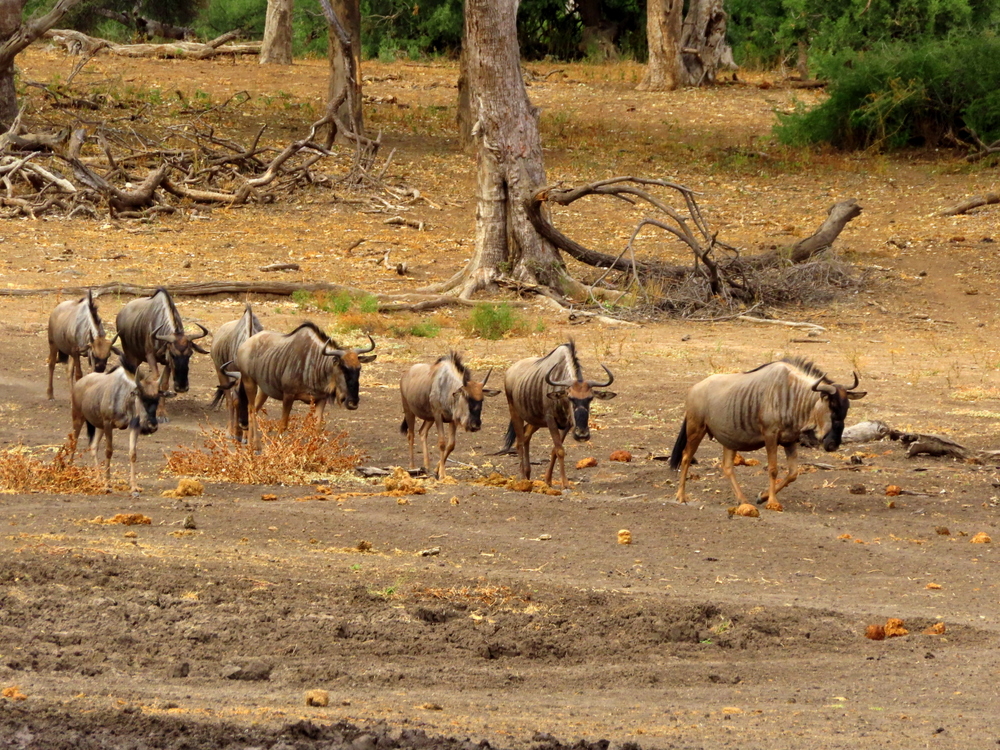
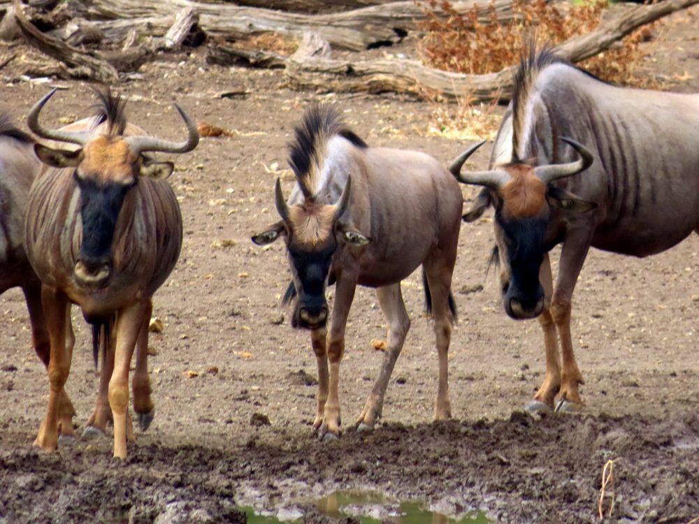
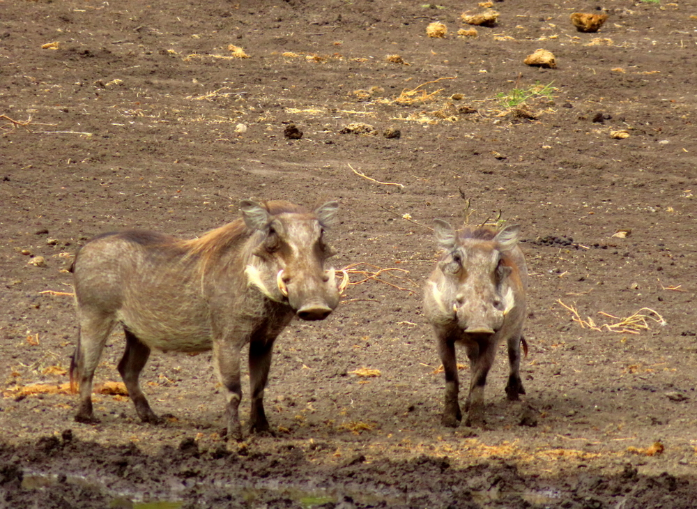
At the Maloutswa Hide, we watched a group of warthogs trotting in file down to the water’s edge, followed shortly afterwards by another family. Having checked to ensure there were no predators lurking around, a herd of Wildebeest joined them.

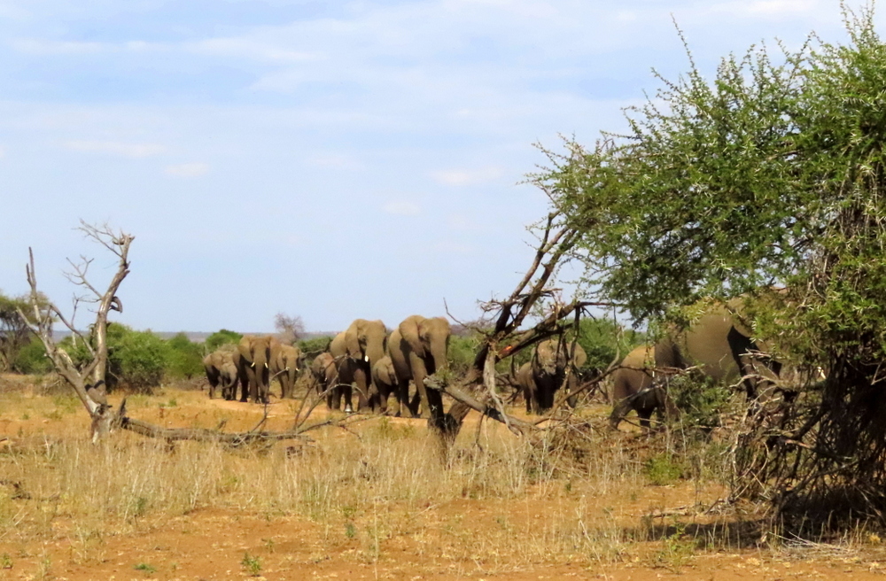
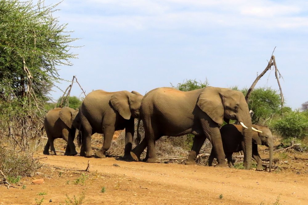
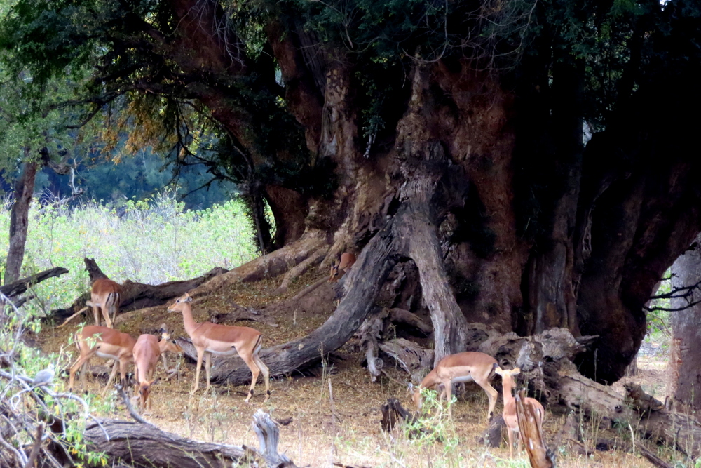
Heading from the hide towards the Mazhou campsite, which lies alongside the Limpopo, we were greeted by a great company of elephants coming out of the woodland. They paid not the slightest heed to our presence as we sat in the car watching their slow-stepping mass crossing the road in front of us, heading towards the denser bush that demarcated the course of the river. The largest cows were on the outer flanks and the bulls and young calves scattered in between. Closer to the river, impala, bright rust red in the falling light, frolicked and scampered over the roots of the massive Nyala Berry trees that are a common feature of the flood plain on which the nearby campsite has been built…

A great company of elephants…

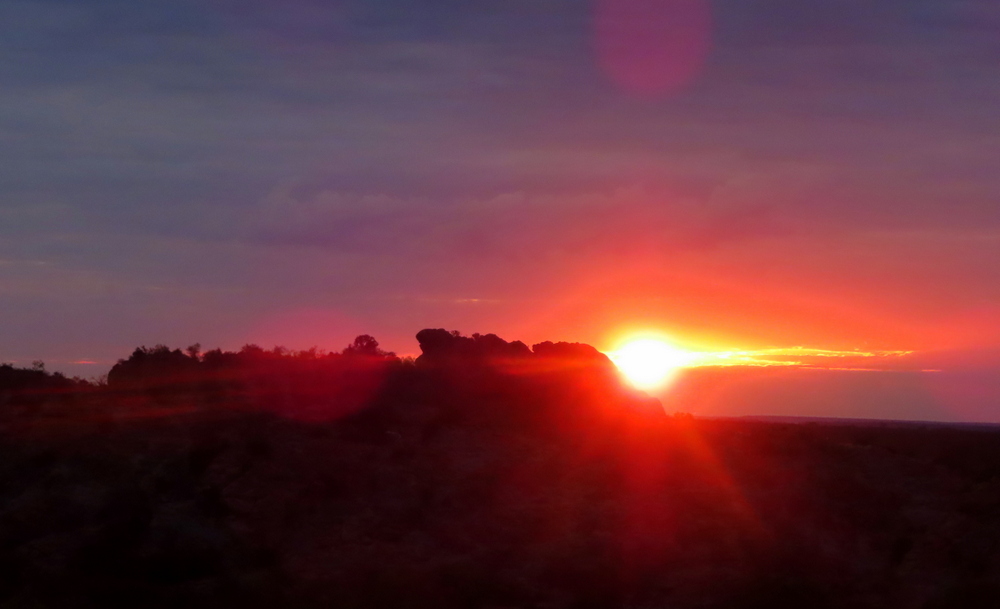
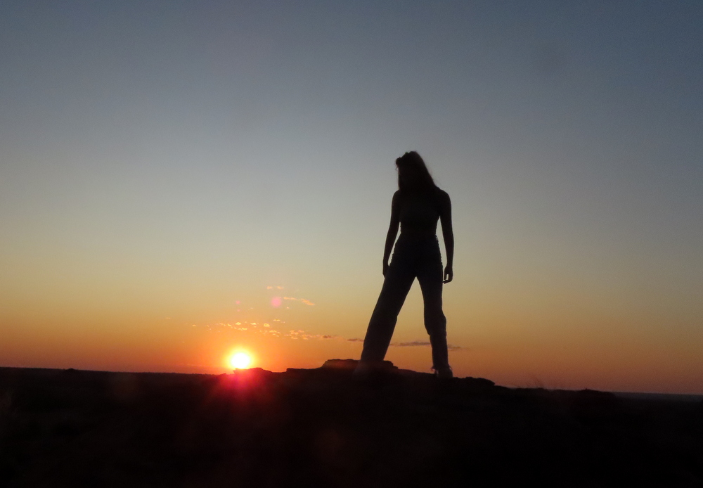
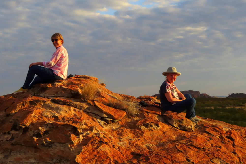
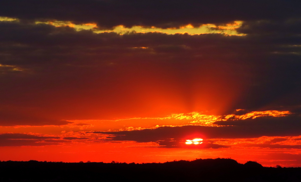
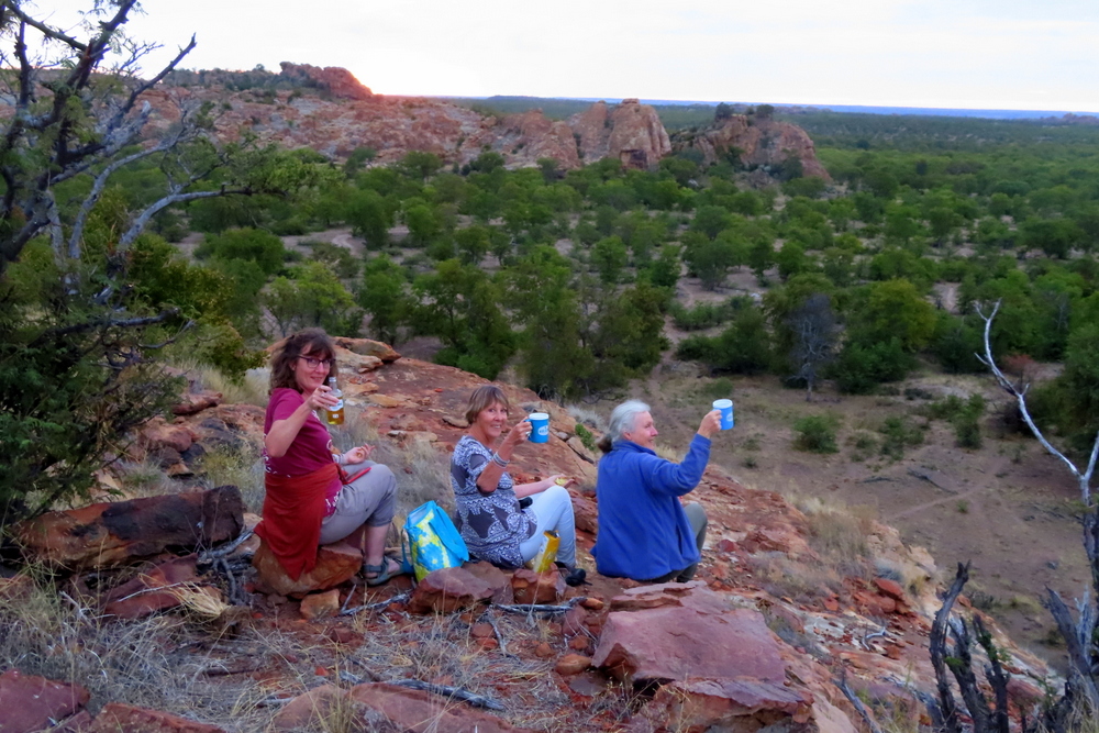
On our final night, my three sisters and I put some drinks in a cool box and drove to a viewpoint, on the crest of a stony ridge, to watch the sun go down over a labyrinth chaos of rock. Apart from the sudden trumpeting of an elephant, somewhere down in the valley below, the magnificent scene that greeted was intimate and peaceful. There seemed no limit to our vision. As it sank through the thin layer of cloud and over a line of jagged hills directly in front of us the dying sun put on a spectacular light show. Except for the birds and animals, it felt like we were all alone in this mythical kingdom. When the air grew cold we came down off the rocks. Although the sun had departed an enormous full moon was shining overhead lighting up the random boulders and ground around us.

Sunset over Mapungubwe.

I looked and listened, felt the air, and wondered if there is an evolutionary explanation for the deep sense of affinity I feel for this place. Our past is composed of images, experiences, and memories. I knew that someplace around here my ancestors (including my grandmother, then a very young child) crossed the Limpopo by ox wagon on their arduous trek * up to Gazaland in the old Rhodesia. Could this provide another connection?

I was still thinking about all this when we got back into our car and headed home through the dusk…

*Footnote: The wagon train was held up in Macloutsie, on the other side of the river, by foot and mouth disease and many of their cattle became so weak they were devoured alive by the hyaena that prowled around the camp. Thomas Moodie (or “Groot Tom” as he was known) the leader of the trek and brother of my great grandmother, died of blackwater fever within a year of reaching his Promised Land – Melsetter in the Eastern Highlands.
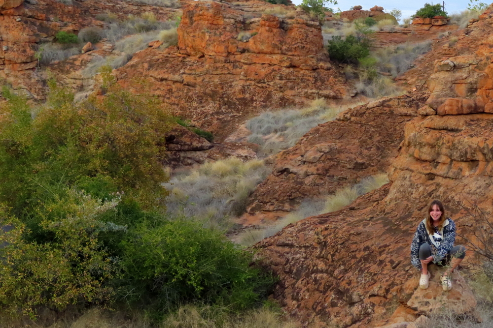
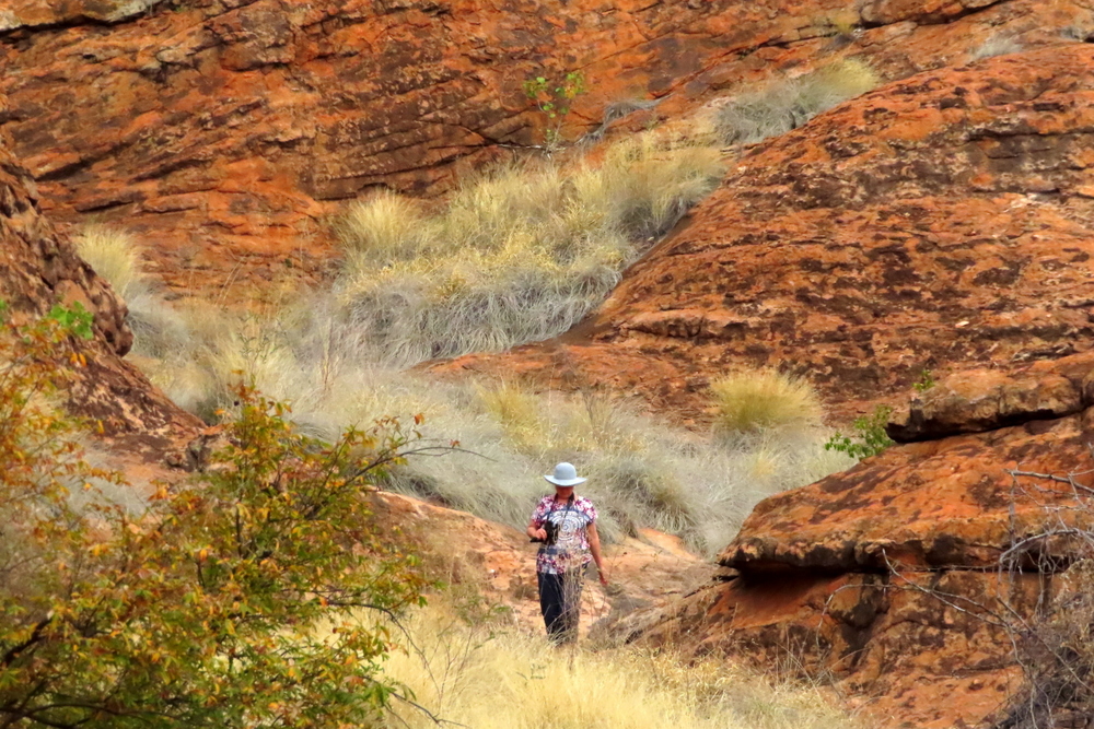
GALLERY:

More Mapungubwe scenery:

More San paintings:

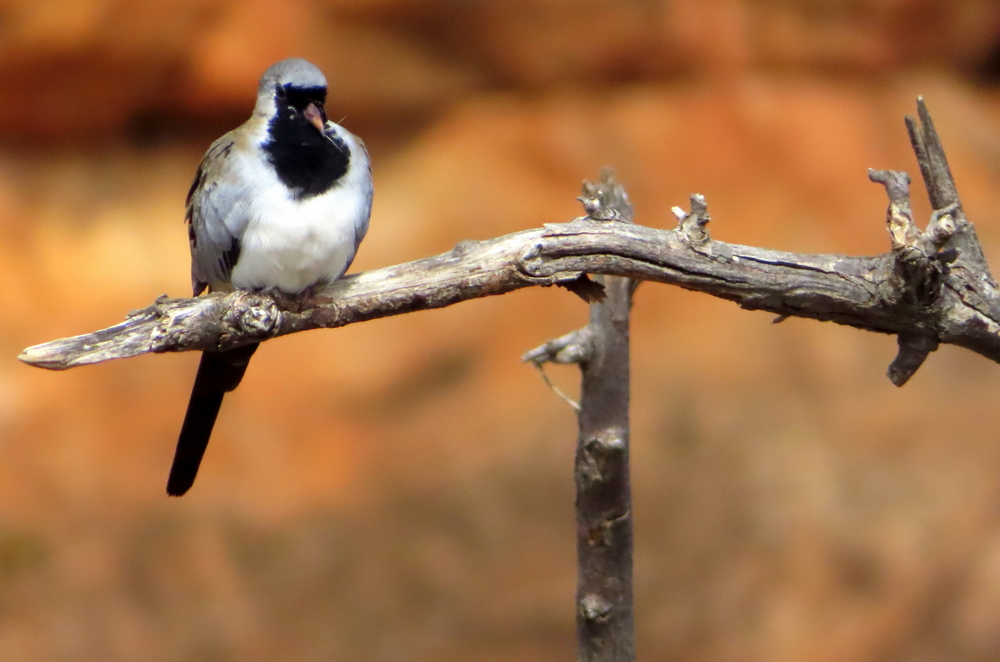
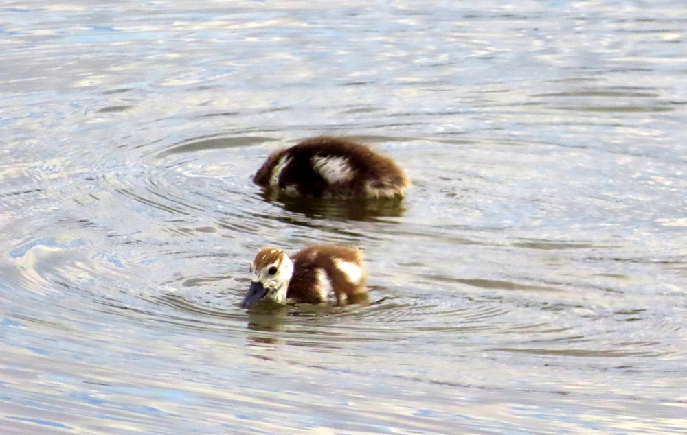
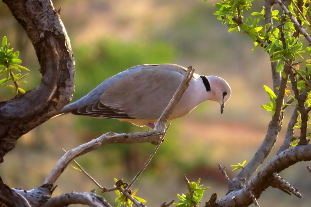
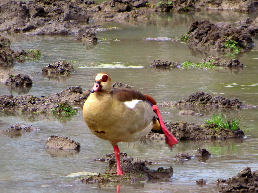
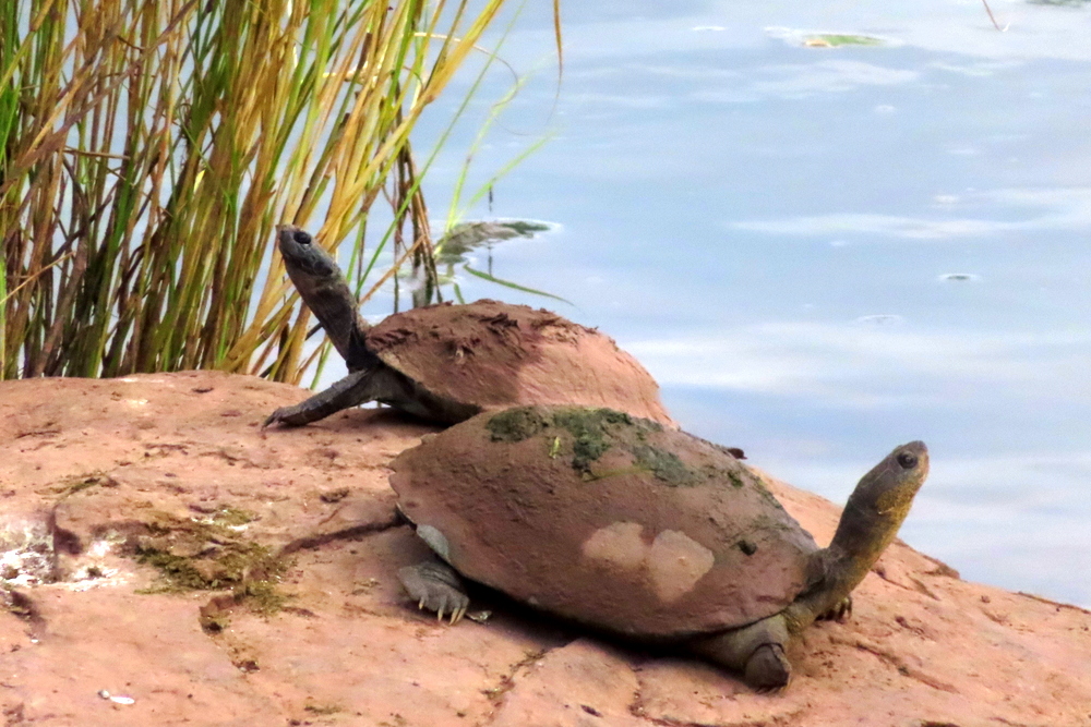
More Mapungubwe birds (and a butterfly and some terrapin):

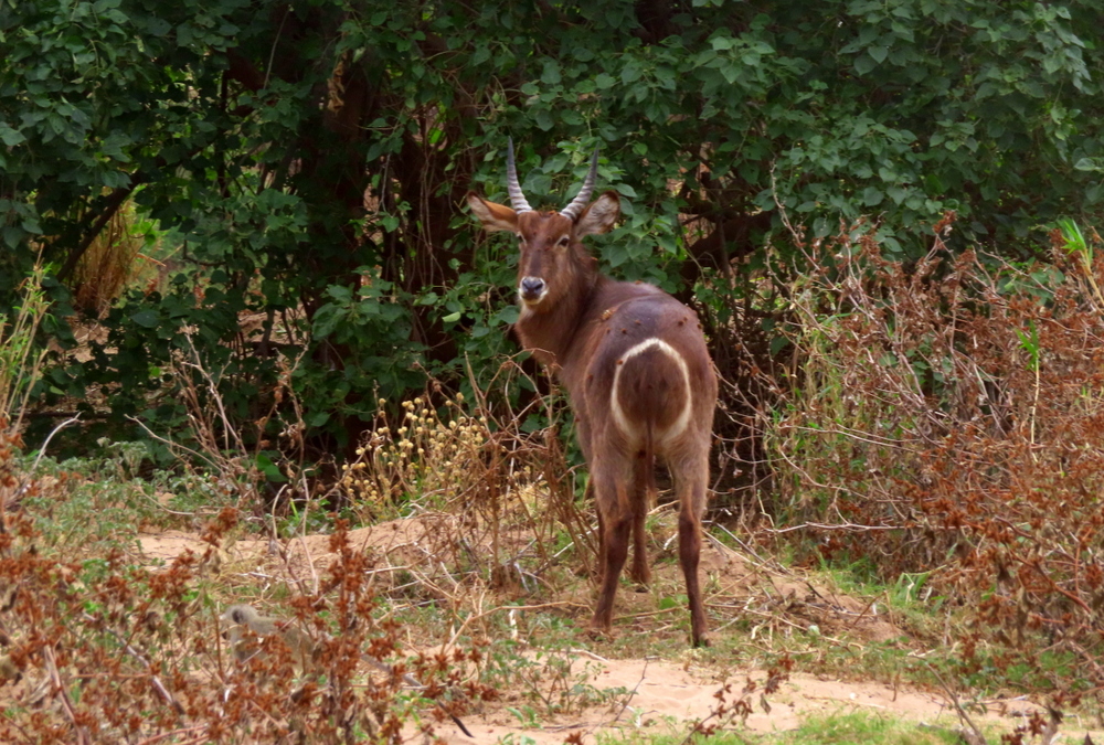
More Mapungubwe animals:

ACKNOWLEDGEMENT:

Palaces of Stone: Uncovering ancient southern African kingdoms by Mike Main & Tom Huffman (Published by Struik Travel and Heritage)

Gods, Graves and the Lure of the Matopos

The granite of the ancient north. A return visit to the Matopos hills with my English cousin, Rebecca.

When I was seven-years-old I was despatched, by train, to a boarding school on the other side of the then Southern Rhodesia and my world changed. From a life of being surrounded by family and a familiar, comforting, routine, I found myself thrust into a society whose mores, customs and rules were all terra incognita to me. Caught in a fusion of fear and fascination I didn’t know quite what to expect from this new arrangement. Whether I was ready for whatever challenges lay ahead of me only time would tell.

My departure, by train, on that balmy summer’s evening, would set the pattern for the next six years of my life. Three times a year my parents would drop me off at Salisbury station and three times a year they would be waiting at the same station to collect me.

The all-boy boarding school I found myself clanking towards in that old, coal-fired, steam train was named Rhodes Estate Preparatory School (REPS), after the man whose devious machinations laid the groundwork for the seizure of a country: Cecil John Rhodes. Overlooking the glorious Matopos Hills, the school specialised, as its name implied, in preparing impressionable young white boys for the rigours of life in the colony, and fostering a simple pride in the country. It also served as the main feeder school for Plumtree High, one of the oldest and most prestigious schools in Southern Rhodesia, situated alongside the main railway line to South Africa, near where it crossed the border into Botswana.

The headmaster of REPS, when I got there, was a Scotsman, Mr McClaren, a strict disciplinarian who was nevertheless loved by the boys for his dry, depreciating, wit. In my mind, I can still hear him thundering at me in his thick Scottish brogue when I had messed up an answer: “You are up the pole boy – COME DOWN!!!”

I was always a fairly shy child and, initially at least, I found the forced gregariousness, regimentation and lack of privacy difficult to deal with. I suppose I was lucky in that my one brother, Pete, a couple of years my senior, was already at R.E.P.S. Unlike me, however, he had faced his separation from home in a manner entirely consistent with his straightforward, practical approach to life. He had taken it all in his stride. Determined that I, too, should learn to stand on my own two feet he made a point of leaving me to my own devices for the first couple of weeks.

Fortunately, I think my easy-going nature and innate cheerfulness helped here, for I soon managed to acquire a circle of friends, was never really picked on or bullied and ended up enjoying my days at R.E.P.S. It that sort of setting it would have been hard not to.

Made up of labyrinthine chaos of granite rocks, kopjes, domes, whale-backs and other formations*, pushed out of the earth aeons ago, the Matopos Hills are an area of breath-taking beauty. Both the Shona and, later, the Ndebele believed them to be the residence of their high God – Mwari for the Shona, Mlimo for the Ndebele – and regarded them as sacred. Mzilikazi, the first king of the Ndebele, was buried there. Eager to stamp his authority on the land, Cecil John Rhodes also chose World’s View (or Marindidzuma – the haunt of the ancestral spirits) as the site of his grave, so impressed was he by “The peacefulness of it…the chaotic grandeur of it all”.

Worlds View.

In his funeral poem, “The Burial”, Rudyard Kipling, who had been Rhodes house guest in Cape Town, refers to the hills in his oft-quoted line “The Granite of the ancient North, Great spaces washed with sun.” Whether Rhodes was worthy of all the praise Kipling lavished on him in the poem (“The immense and brooding spirit…Living he was the land, and dead, His soul shall be her soul”.) is, of course, a matter open to debate…

During the Matabele Rebellion, Rhodes had, indeed, shown considerable bravery by riding unarmed in to the Matopos, with a small group of companions, to negotiate a peace deal with the Matabele leaders. Also interred at World’s View are the remains of his sidekick, Doctor Leander Starr Jameson, whose impetuous and ill-considered Jameson Raid into the Transvaal, had precipitated the Boer War. Encouraged by its failure and the absence of so many white troops outside the country, the Matabele (or Ndebele) – a northern offshoot of the warlike Zulu – launched the first sustained campaign against colonial authority in Africa. Many of Matabele impi would subsequently operate from and seek refuge amongst the hills where even the likes of Colonel Robert Baden – Powell, despite all his scouting experience, would be hard-pressed to flush them out.

On the same smooth granite batholith on which the two lies buried there is another, larger monument, erected, on Rhodes’ instructions, in memory of the ill-fated Shangani Patrol.

On the afternoon of December 3rd, 1893, Major Allan Wilson had led a patrol of 16 volunteers across the rising Shangani River in pursuit of Lobengula, king of the Matabele. Cut off from the main force under Major Forbes by the swollen waters, Wilson found himself surrounded, the next day, by an estimated 3 000 Matabele warriors. Fighting to the last round he and his men were all eventually killed.

Before they met their death, the final six reputedly took off their hats and sang “God Save the Queen”. Because of his brave actions – although some historians consider his pursuit of the much larger Matabele force to have been a reckless gamble, on par with General Custer’s last stand at Little Bighorn – Wilson would be elevated to the level of national hero and have a school named in his honour. For his part, Lobengula, protected by the remnants of his loyal impi, continued northwards. He died, by taking poison, when he heard his army had surrendered and was buried, sitting up, in a cave. Disciplined as it was by pre-colonial standards, his forces were no match for the lethal British Maxim gun, which was used for the first time here.

It was a sad ending for a man who, by all accounts, had been an impressive figure and a shrewd opponent.

In the school dining room there was, in my time (I imagine it has long since been removed), a reproduction of the 1896 painting by Allan Stewart depicting this famous episode (the painting would go on to inspire two films: the 1899 short silent war film, Major Wilson’s Last Stand and The Shangani Patrol (1970)). Also hanging from the dining room walls was a large portrait of Rhodes, himself. It used to spook us at mealtimes because his penetrating, pale-looking eyes appeared to follow you around no matter where you sat…

Shangani Patrol by Allan Stewart.

It was at R.E.P.S. that I was to commit one of those life-defining, acts of stupidity that I seem to have a peculiar talent for.

It happened like this. At the centre of the school, there was a swimming pool, below which was a small room that was always locked. Returning from classes one day, I noticed there was a pipe protruding from under its door out of which a strange yellow-green cloud of gas was rising. Intrigued, I wandered over to it, lifted it up and took a good whiff. Words cannot describe the searing pain that engulfed my whole chest. I felt like my lungs had caught fire. I broke out in an immediate fit of non-stop coughing.

The gas I had inhaled was chlorine, one of the weapons of choice in the trenches of the First World War until its usage was banned by international treaty. It is also used, in diluted quantities, to keep swimming pools clean and sparkling but I was too young to know about either of this. Another boy, I don’t remember who, saw me staggering around like a crazy person and realising I was in serious trouble led me, choking and gagging, off to see the sickbay matron. In between further fits of coughing I spluttered out the story of what had happened. I was rushed to Bulawayo Central Hospital, injected and fed all sorts of medicine, and placed in an oxygen tent.

When I got back to school, a week or so later, the pipe was gone. In my absence, I had also become something of a local legend – Chlorine Stidolph was but one of the many names I would be remembered by – attracting a lot of sympathy and solicitude and some good-natured ribbing as well. Later in life, the consequences of my inhalation of poisonous gas would come back to haunt me, my scarred lungs making me susceptible to a variety of respiratory problems.

This moment of madness notwithstanding, I don’t think my parents could have chosen a more right school for me than R.E.P.S.

Based on the British models, it was a school that believed firmly in the importance of open-air life. The headmaster and staff placed great emphasis on physical exercise and besides playing lots of sport, which I was never much good at, we were encouraged to go for long hikes – or “exeats” as they were called – into the country over the weekends. I, for one, needed little prompting. Walking is a pleasure I have always enjoyed for its own sake and I exulted in the freedom of escaping the school’s bounds and getting out into the natural world.

Reliving old memories. A return trip to the Matopos hills. Pic courtesy of Nicky Rosselli.

All three of my brothers, who had been at REPS before me, had been keen egg collectors, a hobby I also took up (the older me is strongly disapproving). We were always very careful to only take one egg from the nest, leaving the others for the birds to hatch and rear.

With over 50 species of raptor being recorded in the nearby Rhodes Matopos National Park , it was certainly a birder’s paradise. The park was especially famous for its number of Black (Verreaux’s) Eagles. It still contains the most concentrated population of an eagle species anywhere in the world. The Ndebele believe these magnificent birds are the spirits of the departed dead. Watching them soaring in the thermals it is not difficult to understand why.

Wildlife was also plentiful in the park. There were leopards lurking in the hills while herds of round-haunched zebras, sable, giraffe and fidgety wildebeest grazed in the plains below. White Rhinos were still relatively common. This was classic klipspringer country as well and on our hikes, we would often see them standing outlined on a rock’s crest, like some sort of spirit guardians, as we tramped below.

Balancing rocks. We used to call this formation Rhodes’s Chair.

In such idyllic surroundings, there was certainly enough to satisfy both my curiosity and spirit of adventure. It was in the Matopos that I really began to develop an eye for the detail of country life and nature’s endless variety and mystery. Like many a schoolboy before me, I had that peculiarly – although not exclusively – British desire to explore the unknown and amongst the Matopos kopjes there was more than enough to keep me occupied.

Each term was thirteen weeks broken by a half-term holiday (more when there were public holidays such as Easter and Rhodes and Founders Day). Because my parents lived so far away I never got to go home during these breaks but had to stay at school with a few other, similarly unlucky, boys. To soften the blow, the master who had been left on weekend duty would usually organise a whole day outing for us, often taking us, by vehicle deep, into the hills. Once we reached our destination, we would be left free to climb the kopjes and summit such imposing domes as Mount Efifi. On their top we would stand, awed by the view, with endless roves of monumental granites, of all shapes and sizes, radiating out in every direction, seemingly forever. Sculpted by a millennia of erosion, it was certainly a vista fit for any re-incarnate god.

After rain, the rocks and domes glimmered silver, which added a slightly supernatural quality to the landscape and contributing to my sense of privilege at being able to observe these ancient forms.

There were also numerous dams – the Matopos, Maleme, Mtshelele, Toghwana among others – bordered by rocks and dense thickets where we would often go to picnic and explore. There was plenty of fish in them while fast swimming duck jinked along the surface and weavers and widow birds chattered in the reed beds. As beautiful and as inviting as the water looked, especially on a hot day, it also concealed a hidden menace – bilharzia, a parasitic worms that penetrates human skin and enters the bloodstream and migrates to the liver, intestines and other organs.

The cure for this back then (I speak from first-hand experience having been treated several times while I was at REPS) was almost worse than the infection – a large pill that turned your skin a weird yellowish colour, made you feel nauseous and sick and often induced vomiting.

Even in paradise, it seems, there is evil…

In the past, other people had inhabited this wilderness. The first had been the San Bushmen, peaceful hunter-gatherers who had used the outcrops of elephant-coloured boulders as a canvas on which to record both the physical and spiritual aspects of their lives. Often, after hours of clambering and squeezing your way through huge boulders and vines, you would stumble across their beautiful paintings on the under-surfaces of the rock, exquisitely executed in red, cream and ochre-coloured silhouettes. Indeed, the Matopos contain the highest concentration of rock paintings in southern Africa with many dating back to the Late Stone Age.

In other cases, we used to find clay pots, iron smelters and grain bins, often very well preserved, although these were probably of more recent origin.

Sitting up there, amongst the encircling piles of boulders, in the heat and silence, alone with my lazy thoughts, it was easy to see why the Bushmen had chosen the Matopos as a site for their enigmatic outdoor art galleries and why both the Shona and Ndebele continued to revere these mysterious hills.

They certainly cast their unique grip upon me.

NOTE: In my day, the area I write about was still known as the Rhodes Matopos National Park so, for this story, I have retained the old spelling. Since then it has been renamed the Matobo National Park and become a UNESCO World Heritage Cultural Site. For similar reasons, I have used the old word Matabele rather that Ndebele.

*The word matobo means “bald heads” in Ndebele.

A Tale of Two Rivers. Part Two – The Limpopo

The Limpopo at Mapungubwe.

My love affair with the Limpopo began relatively late in life.

Although it forms the southern boundary of the country I grew up in, until I moved to South Africa in 1984, my sole acquaintance with the river had been crossing over it at the Beit Bridge border post.

In the back of my mind, though, I always had this strange feeling that it was waiting for me, beckoning me, and that I was duty bound to answer its call.

And so I did.

All rivers have their own personalities and the Limpopo is no exception. In his “Just So” stories, Rudyard Kipling famously characterised it as the “great, grey-green, greasy Limpopo, all set about with fever trees”.

Fever trees at Pafuri, Limpopo.

It is an apt description. There is something rather wild and romantic about the Limpopo; it is both a purveyor of adventure and a river which seems to have its origins in the realms of legend and folk lore.

Even the name sounds made up.

Approximately 1600 kilometres long, it flows in a huge arc after leaving its headwaters in the Krokodil (Crocodile) River in the Witwatersrand. Skirting the edges of the Kalahari it passes through some of the driest, least populated areas in South Africa before making a dog leg in to Mozambique and then disgorging itself in to the ocean near the port town of Xai Xai.

In its own way, it is the embodiment of both the sheer size and the mystery of Africa. The sky above it is huge, the horizon stretches out forever. Travelling towards that horizon you are always conscious of the distance between it and you.

Despite being the second largest river in Africa – next to the Zambezi – that flows in to the Indian Ocean, for a substantial part of the year it contains very little actual water. In dry years its upper reaches flow for 40 days or less.

This can change very rapidly. The one time I visited, a heavy rain storm somewhere up near its source had seduced the river in to breaking loose. Standing on the bank the raging torrent whooshed past us, the colour of caramel, swirling around rocks and eddying over tree roots.

It was a brute demonstration that the Limpopo was not to be messed with when aroused. The next day it had dwindled back to almost nothing…

For my first foray up to the drier western section of the river, I arranged to stay at Ratho, a large agricultural estate, just upstream from the Pontdrift Border Post with Botswana, which has camping facilities on its banks.

To get there you travel north from Jo’burg on the N1, branching off at Polokwane and heading towards Vivo. Beyond this tiny settlement, the road runs through open, rather lonely country. About 100 kilometres further on you reach the oddly named Alldays, a straggling, dusty town only a few streets deep from front to back.

Here you veer left.

As the horribly pot-holed road drops down to the border post at Pontdrift, a change suddenly takes place: at this point of its long journey to the sea, the Limpopo opens in to an immense valley hemmed in by sandstone cliffs, mesas and buttes that glow as if they were red hot. In places they have been honeycombed by erosion and blackened by fires. Out of the sides of the cliffs and the rocky outcrops grow fig trees with long, trailing, ghost-white roots. These are Large-leaved Rock Figs or Ficus abutilifolia.

There is something both wonderful and tantalising about this strange, eroded scenery.

The road to Ratho.

There was no water flowing in the river when we arrived at Ratho although, on our walk the next day, we did find a long, rather greasy-looking pool further upstream, concealed in a grove of tall, thorn trees. There was something a little scarifying about this shadowy section of the river.

I found myself wondering what dangers lurked beneath its placid surface. It looked like the sort of place where an elephant could have easily got his trunk, courtesy of an enormous crocodile.

There was plenty of evidence of elephant being about as well, which also made me a bit nervous…

Back in camp, dangerously untroubled by doubts, my birding colleague decided to take advantage of this absence of a liquid barrier in front of us and sallied forth across the dry river bed, disappearing in to foreign territory. More circumspect by nature, I declined to join him.

In the end I was rather glad he didn’t get trampled on by an elephant or eaten by a lion or carted off in irons because if he hadn’t made it back safely he would not have been able to find me the elusive Pel’s Fishing Owl, that evening. We heard it before we saw it, a strange, pig-like grunt which was then followed by a deep, booming ‘hoo-huuuum‘. Grabbing his binoculars and powerful spotlight my birding colleague eventually located it sitting in a tall thorn tree.

It was a bird I had long wanted to tick off my “Lifer” list. What made it all the more exciting was that we hadn’t needed a guide to find it for us which is usually the case with this bird, which Roberts describes as: “Vulnerable… largely confined to to protected areas, threatened by disturbance…” We were also lucky to find it because we were on the western-most extreme of its range.

From Ratho, we returned to the main tar road and then struck eastwards towards one of South Africa’s most important Stone Age archaeological sites – Mapungubwe.

I have a tenuous family link with this area. Somewhere between Pontdrift and Mapugubwe a bunch of my ancestors forded the Limpopo on the 1892 Moodie Trek to Gazaland. In the diary she kept of the journey, my great-grandmother, Sarah Susannah Nesbitt, describes the river as being “very rough and stormy” and says they crossed at a point called “Selika’s Wegdraii” (this could possibly be the old crossing which is today known as “Rhodes’ Drift”).

Every night they heard lion, sometimes close by, sometimes further off across the river. The sound sent chills through my great-grandmother because she had her two infant daughters (who included my grandmother, Josephine) with her and was worried for their safety as they lay there in their wagon.

This was not their only concern. Having crossed the river the trek-party found themselves faced with another problem when they got delayed at Macloutsie, in Bechuanand (now Botswana), by an outbreak of foot and mouth disease with many of their animals becoming so weak they fell easy prey to hyena.

Travel was a lot more difficult in those days.

Mapungubwe is one of those places I find myself drawn to like a pin to a magnet. Once a thriving city and important trade centre with links as far afield as China, India and Egypt, it was abandoned in the 14th Century for reasons largely unknown.


There is still a rather eerie feel to it. This is a place of secrets and questions…

Mapungubwe. A strangely puckered landscape…

Driving through its strangely puckered landscape, I found myself wondering why its original inhabitants had chosen to settle here. It seemed to me this wasn’t a country to live in at all with the heat and the desolation but – who know? – maybe the climate was different back then?

It is good country for birds, however, including yet more varieties of owl. At night you can regularly hear Wood Owl, Pearl-spotted Owl and African Scops Owl. Pel’s occurs here too although I haven’t seen it.

On the one occasion, driving out from camp, just before dark, we hadn’t got very far when we spotted a Giant Eagle Owl squatting on the ground, next to an old termite mound. It was so close I felt I could lean out and touch it. Perhaps suspecting I might actually attempt something so impertinent the huge bird suddenly rose in the air and flapped off to a nearby tree.

Giant Eagle-Owl, Mapungubwe.

In the half light of the forest it sat and regarded us from this perch. Relaxed, enormous, extraordinary with formidable talons, curved black beak, deep, luminous, saucer- like eyes and finely barred grey overalls it seemed quite unconcerned by our presence.

Every now and again it would blink at us, like a camera shutter going off, and tilt its head sideways as if trying to get a better angle to observe us from. Or maybe it was just sizing up my birding colleague as a potential meal.

It was difficult to tell.

Watching it, I could not help but reflect on what a marvellously well adapted creature it was. Shaped by millions of years of evolution everything about it is tuned to hunt and kill at night. In the dark it can see with precision things which for you and I are just a generalised blur.

Perhaps because it is such harsh and difficult country, the park is always a scene of restless, unremitting activity devoted to the purpose of staying alive. There is always something to see.

The Maroutswa Pan in the Western section of the Park is usually well worth a visit as there are invariably herds of animals and flocks of birds coming down to drink, especially in the dry season.

One of my special memories of the pan, is returning at dusk as the sun was touching the leaves of the tall Lala palms in the rectangular-shaped clearing nearby and golden sheets of silken light came pouring down. It was an extraordinarily beautiful scene.

Lala Palms. Western section, Mapungubwe.

The Eastern section is more broken country but is also full of scurrying, browsing and fluttering life. From a raised walkway that leads through the canopy you can view the river in both directions. There are usually elephant here. It is also a good place to get Meyer’s Parrot and Broad-billed Roller too.

A kilometre or so downstream from here there is hill top view point which once served as an old SANDF army base during Apartheid day because of the immense view it gave over the surrounding bush.

It has become a place of pilgrimage for me. It is here, at the confluence of the Shashe and Limpopo rivers, that the borders of the three countries – Zimbabwe, Botswana and South Africa – that have played such a pivotal role in shaping my life converge.

Confluence of Shashe and Limpopo rivers.

It is difficult to exaggerate the wild, romantic beauty of this spot with its great baobabs and fig trees growing out of a chaos of rocks. Standing on the edge of the cliff face I sometimes feel like I have been magicked into some parallel world. This is the ancient Africa of myth which the old writers and cartographers had heard about but weren’t too certain how to depict in their books and their maps.

Mapungubwe. Limpopo in mid-ground.

From Mapungubwe the Limpopo continues its long, leisurely loop along the border with Zimbabwe before crossing in to Mozambique at Pafuri. When I do this route I normally stop off at the town Musina to stock up with provisions.

The quickest way to get from Musina to Pafuri is probably to take the tar road that goes via the hot springs at Tschipise – but by using this route you miss out on seeing the Limpopo so we usually go on the old SANDF dirt road that runs alongside where the old minefield once was. In the past we have seen taxis parked here, picking up the Zimbabwean refugees fleeing across the river.

The Limpopo, east of Musina. View from old SANDF dirt road.

The road is in fairly good condition although, on the one trip, my birding colleague did manage to crack his car’s sump. Somehow we managed to get back to the tar and then limp all the to Tschipise without the engine seizing. At the local garage we gummed up the leak with soap and topped up the oil. That got us back to Musina where we were obliged to stay over while it got repaired.

Musina is an armpit of a place and not somewhere I would normally choose to stop for a night’s sleep on account of its perspiring proximity to the Limpopo river. It is definitely not the sort of town you want to get stuck in for any length of time especially in summer.

Apparently not everyone agrees with me. The copper mine which provided it with its reason for being might have closed but it is still a bustling, clamorous hub full of all the usual transients who ebb and flow around border towns – in this case mostly Zimbabweans come down to shop or escape that country’s collapsing economy and hoping to find employment in South Africa (the bush mechanic who fixed our car was one such refugee).

We checked in to a hotel on the main road. Towering cumulonimbus clouds were massing all around us and it looked like we were about to be inundated as fractious gusts of rain kept splattering against the windows of my room. The storm surge held back, however, as if it had had a sudden rethink, and then veered off to the West.

It had been a long day. Neither the sweltering heat, the music from the nearby bar nor the constant rumbling of trucks along the Great North Road, could disturb me. I fell instantly asleep.

Next morning, the car repaired, we resumed our journey along the Limpopo to Kruger.

Covering a huge swathe of the country Kruger is undoubtedly South Africa’s best known and most visited game park. Although most people are attracted by its animals – which includes the Big Five – it is also a Mecca for birders with over 500 recoded species.

One of the most popular of its birding spots, Pafuri, benefits from its proximity to the Mocambique coast and the Limpopo river that acts as a migration corridor to birds normally found further east and north. It was here, that I obtained my first sighting of the elusive Bohm’s Spinetail, a localised and uncommon species that favours riparian forest and is usually linked to baobab trees which this area has in abundance.

It is also where I saw my first Ayres Hawk Eagle, perched in a massive Jackalberry tree alongside the Luvuvhu River.

To get to Crooks Corner, another place I get a little sentimental about because it demarcates the meeting point of South Africa, Zimbabwe and Mozambique, you drive along the muddy Luvuvhu River, a tributary of the Limpopo. In the foreground the riverbank rises two to three metres and is capped by a flat plain whose edges are packed dense with tall Nyala, Jackalberry, Ana and Fever trees. Behind them, stretching away forever lies a sea of Mopani trees.

Luvuvhu river from bridge. Elephant below

I like to stop for lunch at the picnic site on the Luvuvhu where the sunlight is subdued and dappled by the trees, and the place is alive with birds.

Crook’s Corner – which is where the Luvuvhu (strangely enough I have never seen this river without water) and Limpopo meet – is another spot where it would be quite easy to slip across the border by just strolling over the often dry, river. In fact, this is how it actually got its odd moniker – because in the early days fugitives from the law used to do just that.

Here is another odd fact about it: in July 1950 a Zambezi Shark (Carcharinus lucas) was caught at the confluence of the Luvuvhu and Limpopo, hundreds of miles from the sea. Why it had decided to swim so far inland is a mystery.

Maybe, like me, it just responded to the river’s call…