“There are three ways,” he said at last, “by which a very ordinary person like me can improve himself – or at least partly rise above insignificance. Through religion, through public service, or through study and reflection on the natural world”.
The Ten Thousand Things by John Spurling ( published by Duckworth Overlook).
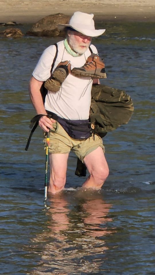
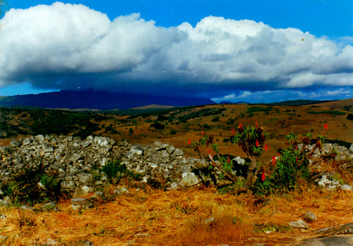
Pic courtesy of Sally Scott
As a professional political cartoonist, working to a deadline, I have always done the bulk of my drawing at my studio desk. Sketching out in the open, direct from nature – en plein air as the French call it – I left to the Fine Artists (who I have always regarded as a separate species from me.) That changed on holiday in Mpumalanga. Watching my sister, the landscape artist Sally Scott, sitting down by a river drawing – a study in intense focus and concentration – got me thinking I wanted to try my hand at what she was doing.
And so I did.
I found it a singularly liberating exercise. I have always liked to think of myself as a fairly observant person but you don’t realise how much you are not seeing until you try and draw it. Drawing, in situ, trains the eye wonderfully. It forces you to concentrate your mind on what is happening in front of you.
Sitting there, on a rock or a log, with the swallows wheeling overhead like World War Two fighter planes, you come to view the natural world differently. You start to see your surroundings in a minute and comprehensive detail, noticing all sorts of little things you had overlooked before. The jagged shape of a rock, the dark texture of a strip of bark, and the rumpled sky overhead – all excite.
There is also spontaneity, fluency and freshness about drawings done like this; that is something which you often lose in a cartoon or a painting you have laboured over for a long time. There are, I was further pleased to discover, other benefits. I have always believed in the value of physical exercise and sketching outdoors has allowed me to combine my two passions – walking and art.
Armed with a satchel containing my sketchpad and pencils, a boyish exuberance reasserts itself. My old passion for ‘expeditions’ and boarding school-style ‘exeats’ comes to the fore again. I am like an excited schoolboy with a secret.
Already I can notice the difference. As a cartoonist, confined to my kitchen/studio I grew flabby and pallid. Since I started walking, the surplus kilos have melted away and I have picked up something resembling a tan. I feel as fit as the ubiquitous fiddle.
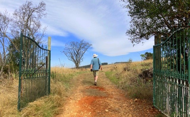
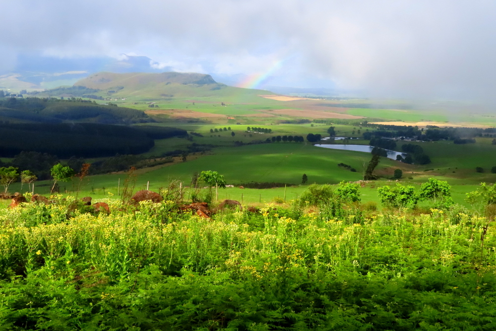
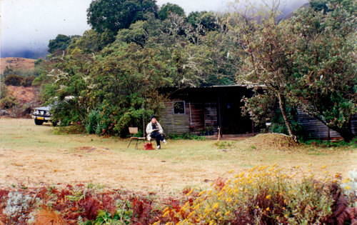
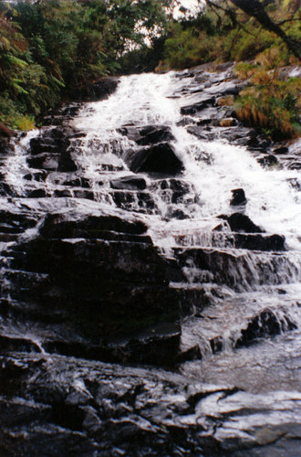
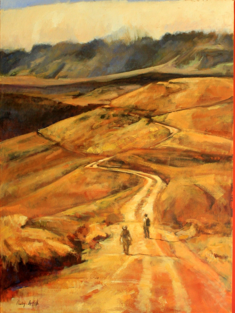
Moving up to Kusane Farm, in the KwaZulu-Natal Midlands, has, of course, helped me in all of this. There is something to draw at every turn of the path – a gappy stone wall, a stream, a tumbling waterfall, a few ancient pine trees, a collection of farm buildings. Kusane has become my new heartland. It is beautiful country to walk in and also to draw. The views take your breath away. The land rises and falls in long swells and because it has not been farmed for years you can still get a glimpse of its beautiful past.
Kusane – beautiful country to walk in...
In pursuing this new way of life I have anointed myself with the title of gentleman artist although I still bristle at any suggestion that what I do is a ‘hobby’. That strikes me as a strange and utterly inappropriate description for an intensely felt passion. Extending my range has made me more conscious of my lack of experience in outdoor drawing. While each completed drawing brings its particular feeling of triumph there is invariably some detail I am not happy about.
There is nothing unusual in any of this, of course. I have been a newspaper cartoonist for over thirty years and I still obsess over the small imperfections in my technique and seek ways to improve my style.
Such is the nature of art. A ratio of failures is built into it.
What I strive for, above all, is a naturalness of style; I don’t want my work to be overly-intellectual, too-clever, pretentious or contrived. By the same token, I don’t want it to look like it was done by some amateurish Sunday dabbler. One of the important lessons I have finally learnt is not to get too anxious about mistakes. For this reason, I no longer carry a rubber with me. If a drawing does not work out, I will scrap it and start again.
I have also had to break the habits of a lifetime. As a cartoonist, hunched over my drawing, I have always worked with a fairly controlled line. Now I am deliberately trying to loosen up my style, ignoring the superfluous and working as quickly and as intuitively as possible. Remembering what my Scottish art teacher, Jock Forsyth, told me at school, all those years ago, about squinting enabling you to make out the key points more clearly, I sometimes try that. Often it is only on the third or fourth attempt that the picture begins to take a coherent shape.
All of which leads back to a fundamental question – why draw? I obviously can’t speak for others but in my case, it has always felt like it was something that was passed down to me. It is an in-built compulsion. A trust bestowed upon me. My vocation.
There is a blank piece of paper in front of me and I must fill it.
Like Wang Meng, the famous Chinese artist who lived during the last days of the Mongol occupation – and is the central character in the book quoted above – early on in my life I decided I did not want to follow the paths that led to either religion or public service. That left art and the contemplation of nature as the only way open to me if I wanted to rise above my insignificance. Like Wang Cheng, too, I don’t do this primarily for commercial reasons (although I am happy to accept payment!). For me, it is about solitude, contemplation, observation and the sheer joy of self-expression.
: If you are in a bad mood go for a walk, if you are still in a bad mood, go for another walk.”-Hippocrates
Pic courtesy of Sally Scott.
I can feel the sun on my back, already warm as toast, as I set out through the farm gate following the road that leads down to the protea field and then past the tall pines where a clamorous row of black crows are having a huge argument over which direction to fly. I know in a general way where I am headed and what I will most likely encounter along the way although each day always brings its subtle differences. I don’t, normally, wonder too deeply about my motivations for doing what I am doing. Going for a walk is just something I do and enjoy. I find it healing. Outdoor therapy. It helps me to think. It is my form of meditation. If I am feeling down in the dumps it gets me – mostly – back on the right track.
There are no limits to where I walk. I am quite happy to keep exploring the same patch of ground because over time you develop a sense of intimacy with it that comes from an accumulation of particular observations. Likewise, there is a special fascination in testing one’s expectations in less familiar backgrounds. The important point, I think, is to be able to relish both the ordinary and the extraordinary.
The habit of walking manifested itself at a very early age. When I was about three years old my father, an airline pilot with a yen for country life, decided to relocate us from our house in the then Salisbury (now Harare) to a smallholding in Umwindsidale, about thirty kilometres outside town. He chose to call our new home “Dovery” after the crooning Cape Turtle Doves that were such a feature of the place. For me, their call remains one of Africa’s most beautiful, evocative and comforting sounds.
My main memory of the property is the view which was spectacular. From our front verandah, we looked over an open stretch of land, extensively cultivated, along whose edges the Umwindsi (now Mvinzi) River flowed, its path marked by an outline of dark green. Beyond this fertile plain stretched a further succession of hills and valleys, blue and hazy, each one becoming successively paler, in turn, as they rose to meet the sky. From an early age, I liked to create worlds of my own, in which I could slip away unnoticed and undisturbed and the countryside that surrounded our home provided plenty of places where I could do just that.
Umwindsi (Mvinzi) river with my brothers and sister. I am on the left.
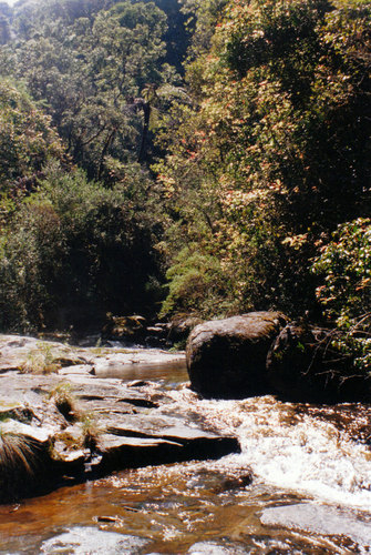
The Umwindsi was a lovely little rivulet that tumbled and crawled and blundered its way through a network of rocks, roots and tall shady trees. For a young child, it was a magical place and I spent a lot of time adventuring up and down it, playing in the pools and exploring its secret places to see what lay hidden there.
It was also the ideal preparation ground for our next grand adventure – a move to a remote farm at the northern extreme of the Nyanga mountain range.
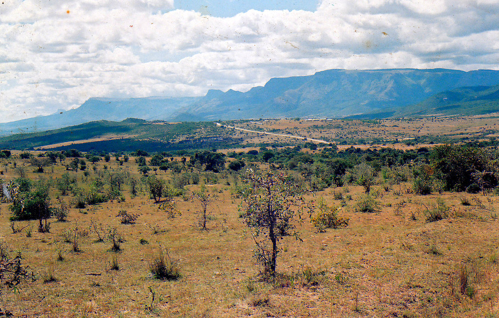
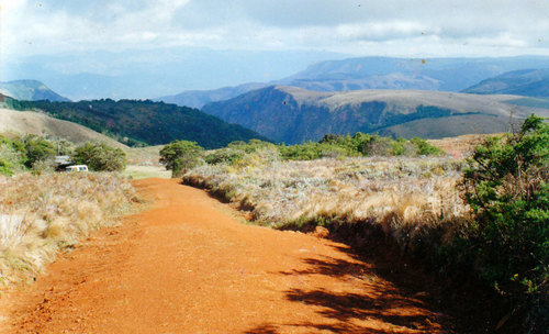
The farm occupied a broad stretch of land, mostly valley but bordered on two sides by mountains. Jutting out from the main range were several castellated buttresses which stood like imperious guardians, mute witnesses to the goings on below. Along the floor of the valley stretched miles of grassland with woody patches, winding rivers which fed into one another and soft hills inset with elephant-coloured boulders, many covered with old stone walls, left behind by some forgotten people. Over it hung the intense blue sky of Africa.
The Old Dutch Settlement Road, Nyanga. Our farm was at the end of the range.
The land on our farm hadn’t been worked for many years and felt wild and untamed. At the night the wind would howl down from the mountains and the very air seemed to seethe with phantoms, both good and bad. They whispered to me as I lay in my bed with only a flickering candle, on the table next to me, to keep the shadows at bay. In the moonlight, the whole landscape beyond my window seemed to possess a strange alchemy all of its own, a spirit ancient and impassive permeating the land.
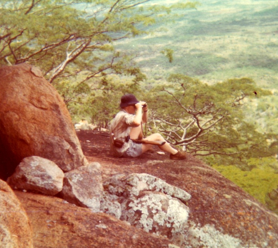
My brother Pete, bird-watching on Muchena Mountain…Granite mountains on west side of farm. Pic courtesy of Patrick Stidolph.
There was much to discover and endless opportunities for exploration. Most mornings when the sky was clean and ready for whatever lay ahead I would set out into the wilderness to see what I could find. I learnt to watch, wonder and recognise all the landmarks: the curves in the road, the shape of the hills, the twists and turns of the mountain streams, the outlines of the fields, the size and weird contortions of the baobab trees. No horizon seemed too far away. The more I saw, the more the place insinuated its way into my soul. It deepened my love for Africa. Sometimes I would go with my elder brother Pete – an avid birder even back then – mostly I would go on my own with just the farm dogs for company. My memory of these walks and the years on the farm have never left me.
It wasn’t just at home that I walked. Bastions of robust sportsmanship, all three of the boarding schools I attended -REPS in the Matopos, Plumtree on the Botswana border and UBHS in the Eastern Highlands – encouraged healthy outdoor activities, seeing it as an essential element in character-building. Most weekends would find me exploring the surrounding countryside.
On the summit of Cecil Kop, Umtali (now Mutare). I am in the middle. My brother Pete is on the left and my friend Stu Taylor is on the right.
Eventually, the idyll came to an end. My life took a turn for the worse. Bad replaced good. War broke out. I got called up.
As an ordinary foot soldier in the army, I got to do a great deal of walking although most of it was not voluntary or even pleasant. Having bullets and mortar bombs whizz past me didn’t add to the enjoyment.
Getting shot at or mortared was not the only thing which occupied my mind patrolling in the stupefying heat of the Zambezi valley. On foot in Africa, one will sooner or later have a hair-raising experience with a wild animal. Of them all, I think it was the lone Black Rhino I was most scared of. To have one suddenly come crashing through the bushes is not an experience I want to repeat too often although I had my fair share of scrapes with this cantankerous character.
On patrol in the Zambezi Valley
Still, the army toughened me up, got me superbly fit and introduced me to some wonderful new scenery so I mustn’t grumble.
The Rhodesian Bush War finally dragged on to its inevitable conclusion. I got discharged. Like all wars, the conflict marked our lives. It left a lasting legacy. In my case, I don’t think I emerged from it suffering from Post Combat Stress Syndrome or anything as dramatic or personality-changing as that. Still, it did leave me with a vague sense of melancholy, restlessness and an inability to settle down. Unsure what to do, the horizons seemed to close in around me. I felt trapped and constricted.
Bored stiff with my office job in the Mining Commissioner’s office in Gweru, I resigned and moved onto my parent’s new farm at Battlefields, near the Midlands town of Kadoma. Needing time to think, I walked and walked. By the end of it, there was hardly an inch of the farm I didn’t know. Walking had, once again, become my solace, my cure. It also made me realise it was time to move on. To go somewhere new. To start my life again in a place where I wasn’t surrounded by the constant reminders of the futility of what I had been through.
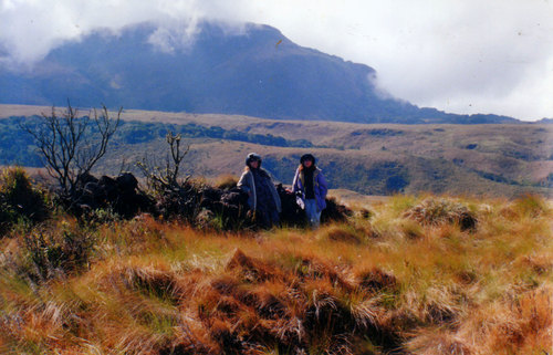
And so I packed my bags and moved to South Africa. With me went my nostalgia for landscape which I quickly transferred to my new surroundings. I set about exploring the country. I went on birding expeditions to Marakele, Mapungubwe, Kruger and the Richtersveld. I trundled through the Little Karoo and Baviaanskloof. I walked on the Wild Coast to the sound of crashing breakers. With my sister, the artist Sally Scott, and her family I made countless trips to the Drakensberg. We slept in caves, hiked along numerous mountain trails and plunged into icy rivers.
Orange River, Richtersveld.Hiking the Wild Coast…
The Drakensberg had a different feel from the mountains I had grown up amongst in Nyanga. Higher, more precipitous, austere, jagged, cold and with fewer trees they were inhabited by a different set of gods and mountain deities. I loved it all the same. Climbing them, I always felt I had risen above the material plane and entered another, more enchanted, realm. The scenery and views left me breathless.
Mont-aux-Sources, Drakensberg, with my nephew Craig Scott.
When I wasn’t out walking, I worked as a political cartoonist in Pietermaritzburg. As I got older, I grew increasingly disenchanted with city living. Some friends suggested I move up to their farm, high on a hill overlooking the Karkloof Valley. Viewed through the soft, filtered light of the swirling mist, there was something dream-like about its beauty; my heart was immediately smitten with delight. I accepted.
The Karkloof Valley. The view from our farm.
Moving into the country changed the shape of my life. It helped renew my sense of deep connection with the natural world. I spent many happy hours tramping over a familiar circuit of paths, seldom meeting a single person en route. Revelling in the sense of discovery and freedom that comes with this, I developed an increasingly close and intimate relationship with the local flora and fauna. However, nature still managed to spring surprises on me. Lockdown came. I had always thought that the advances in modern medicine would provide a solution for everything but Covid, at least initially, proved me wrong. The virus transported us all back to the fear-ridden, helpless days of the Great Plague. It reminded us of just how vulnerable we still are and demonstrated that we are still at the mercy of the whims of nature.
Over the next two years my life – like many others – took on a slightly surreal aspect. As part of the locked-down community, I found the days blurring together. Whether it was Monday or Friday came to hold no interest for me. Alone in the house, isolated from the world, I lived in silence and solitude, with only the sound of birdsong, the whistle of a reedbuck, the howl of a jackal and the croaking frogs to sustain me. When I went to town, which was not often, I talked through a mask to other people wearing masks. It felt a little weird and dehumanising at first but I got used to it.
The national confinement stretched on through the months that followed with intermittent breaks. In the end, I learnt to get used to a world with little direct communication, so much so that I almost began to prefer it that way. Again, it was my walks which brought me the most relief, gave meaning to my life, helped me feel less trapped and provided me with a sense of quietude which conquered despair. I was lucky living in the country because the people living in town weren’t permitted to go beyond their front gates whereas I had our entire farm to roam over.
Heading out…Pic courtesy of Craig Scott.
If you had to ask me then why I walk so much, I would have to concede that – apart from the obvious health benefits – it stems back to a longing to be the boy I once was, innocent again and seeing the world for the first time. My walks remind me of a more carefree period of my life. More than that, though, they have become part of a growing awareness of myself, an increasing reflectiveness and a developing sense of my place in the world and the environment. It nourishes my sense of self-sufficiency. It makes it easier to exist in these tumultuous times.
Time has, of course, dissipated some of my innate restlessness but while I still have the energy in my legs and air in my lungs I intend to keep walking…
The Great Fish River Valley near Committees Drift.
It is already early afternoon when I pull over on the top of the Nico Malan Pass, which drops a massive 673 vertical metres over 13,8 kilometres, into 1820 Settler Country. Taking a sip of the now lukewarm coffee in my Thermos, I look at the raw landscape around me. To my right, capped by a bluff of rock, are the Katberg which, in turn, become the Winterberg. To my left, the rest of the mountain chain stretches away toward the Hogsback and the Amatola.
The Katberg
Above me, I can see the pale puff of rain clouds receding over the mountain tops. The very air looks grey and dampness seems to rise up off the tarred road like mist. The road ahead tapers away through miles of dry East Cape thicket, sprinkled with aloes, euphorbia, succulents, sweet thorn, and spekboom..
Although I was not born here, I am, in a sense, back where it began, my home patch. It was here that many of my ancestors settled when they came to South Africa, way back in the early 1800s.
The first was Benjamin Moodie, the Seventh and last Laird of Melsetter in the Orkney Islands whose family fell upon hard times and who sailed from London on the brig Brilliant in March 1817, arriving at the Cape in June. From there he trekked up to Grootvadersbosch in the Overberg where he hoped to recreate his bit of feudal Scotland in the shadows of the Langeberg. It was his grandson, Thomas (Groot Tom) Moodie who led the Moodie Trek into the then Southern Rhodesia which explains how I came to be born and raised up there, among the beautiful Nyanga mountains.
And why I am driving down this road today.
Then there were the Nesbitts (my father’s mother’s side of the family), from Ireland, whose history I have only recently discovered, but whose story I am now trying to follow. Other ancestors too – the Colemans, the Arnotts, the Stirks as well as my immediate kin, the Stidolphs. All spent time in the Eastern Cape area.
As I descend the winding road that leads, through Seymour and Fort Beaufort, into the vast Great Fish River Valley, I feel my senses heightening, flaring. I look and listen, feel the air, try to see the country as they did, all those years ago. Coming from the lush, green pastures of Scotland and Ireland, it certainly must have seemed very different from anything they were used to.
There is an old military blockhouse at Fort Brown, where the modern bridge crosses over the Great Fish River, a reminder of the days when this was all disputed territory. It formed part of a chain of similar forts, strung along the banks of the river, which the British soldiers, garrisoned in them, used to pass messages to one other.
Fort Brown – still a police station.
It is here I establish my first connection. An ancestor of mine, on my father’s mother’s side, Lt Col Richard Athol Nesbitt CB, was posted to Fort Brown, as an inspector, in 1875. Later he would go on to form Nesbitt’s Horse which fought with distinction in both the Frontier and Anglo-Boer War. There is a memorial honouring their contribution, among others, to the war effort standing in Church Square, Grahamstown.
Monument honouring, amongst others, members of Nesbitt’s Horse.
Having stopped to snap an obligatory photo of the place, for record purposes, I continue on my way, still taking in the country as I go. Hill leads to hill leads to hill and in between is nothing but space and distance. The oceans my ancestors crossed to get here could hardly have been more solitary than this empty country still is.
It gets me thinking about the 1820 Settlers who settled in this region. Innocent of the reality of Africa, they must have been shocked to discover the arid country, with its harsh climate, they were about to settle on was nothing like the rich farm and pasture land that they had been promised by the propagandists back home. Although the land was theirs to do what they would with, there was another aspect the pamphlet writers had chosen to gloss over in their colourful descriptions– the fact that the settlers were to form part of a Government-approved military buffer zone, aimed at keeping the Xhosa on the other side of the Great Fish River. Inevitably they found themselves caught up in an escalating conflict for which they were mostly ill-prepared.
Perhaps not too surprisingly then, many found it too lonely and too harsh a life and, their faith shaken, put the country behind them to return to the comforts of town life. Others persevered; in some cases, their descendants are still on the same farms. For yet others, Africa proved to be a temporary aberration. Anxious to escape the heat, sweat, and weariness of it all, they packed up and sailed back to England.
For my part, I am bound for Grahamstown where my one sister, Sally, lives. It was here that the settlers decided to build their capital and – because the town never grew at the rate envisaged – you can still see many fine examples of colonial architecture and of their early houses (see Picture Library below). It is also now home to Rhodes University, as well as one of the most dysfunctional and corrupt municipalities in modern South Africa.
The military life seems to have run deep in the Nesbitt blood. Richard’s father, Alexander Nesbitt, had enlisted, at the age 19, in the 67th Regiment (South Hampshire) and was stationed for many years in Mauritius before being sent with the Reserve Battalion, in August 1851, to the Eastern Cape on HMS Hermes to participate in the 8th Xhosa War.
Not much is known about him but his wife occupies her own special spot in history, for she was a passenger on the HMS Birkenhead, which was conveying troops of ten different regiments from Ireland to participate in the Border War when it struck a rock near Danger Point on the Cape Coast and sank with a loss of 450 lives.
The sinking of the HMS Birkenhead is, of course, famous in the annals of maritime history because it was here the order “Women and children first…” originated. Safe in a lifeboat, Elizabeth Anne “Annie” Nesbitt and her third child, the self-same Richard Athol, were two of the only 193 survivors.
Many of the places the various Nesbitts (and there were many of them) had lived in while in the East Cape I have visited myself so I feel I have both set and principal actors. What I now need to do is write a few scenes. For a moment I think of going to the military cemetery in King William’s Town where Alexander Nesbitt lies buried but my time is short and I am not even sure where it is, so, instead I elect to explore the Great Fish River basin from where it crosses the N3 and then take the dirt road that backtracks all the way to Fort Brown – a part of the world that had changed little over time.
Frontier Country. The dirt road back to Fort Brown with Great Fish River in the mid-distance.
With its turbulent, blood-stained, history, the Great Fish has always loomed large in my imagination. Like the Zambezi and Limpopo, it is one of those rivers which has acquired almost mythical status.
The first section of the journey takes you along the crest of a ridge with extensive views on both sides. Although you probably won’t see it mentioned in any tourist brochure, I think it is one of the best drives in all of South Africa because of its wildness, its freedom, it’s feeling of immensity, the land sweeping back in great folds all the way to the distant range of mountains on the one side and the deep blue of Indian Ocean on the other.
Not far from Fraser’s Camp, we turn left off the tar onto a gravel road that runs roughly parallel with the looping river. Many of the place names around here carry echoes of their frontier past. Dropping down into the valley, the first settlement to come into view is Trumpeter’s Drift, one of the many strategically sited forts the British built along the Great Fish in an effort to secure the land south of the river. Unlike most of the others, which stand crumbling and neglected, this solid, block-like structure still forms part of a working farm and is in relatively good nick.
Trumpeter’s Drift – old fort on left of buildings.
We drive on. Alongside us, the river continues to follow the most circuitous of routes as it twists and turns its way through the landscape. Countless thorn trees swarm together along its banks creating a dense, impenetrable mass. Swollen by the recent unexpectedly good rains, its soup brown water gushes copiously along. Broken branches, old logs, chunks of floating vegetation, and mud sweep past. In places, driftwood is piled high along the banks.
Great Fish River – flowing fast. Note thorns.
Our next stop is Committees Drift, another military outpost established by the British during the Frontier war of 1819 (the name “committees” is pronounced by locals as “kommetjies” indicating that the origins may be Khoisan or Dutch).
A steel girder bridge, erected in 1887, spans the river at this point. On the other side of it lies former Ciskei, one of the Apartheid government’s grandiose, if ill-conceived, “homeland republics” where the National Party tried to entrench the principle of racial separation. Granted “independence” (but never internationally recognised as such) in 1980 after a rigged election, the idea that it could function as a separate state was, of course, a fantasy that could never work as the South African economy remained dependent on the black workers who lived in remote corners like this. Among the poorest and most neglected areas in South Africa, it was also too small and lacked the resources to ever manage its own affairs and govern itself. It would always be obliged to live in the pocket of its giant neighbour.
Bridge at Committees Drift.
We drive on again, passing a group of smartly attired church-goers as we do. I am not particularly religious myself but I rather approve of the fact that there are people who are still prepared to dress up to please their God. A solitary donkey walks along the side of the road with an air of utmost purposefulness as if it has a fixed destination in mind. A herd of goats scurries off as we approach them and force their way through a farm fence. Because of its large size, the ram is unable to get through and is obliged to reverse out. Mustering all the regal dignity he can he strides off, acting like this was all part of the plan.
Church goersDonkey on a mission. Ciskei on far side of river.Heading to Church through the mielie field…
Ahead, more hills, more flatness while the sun spreads a dry ruddiness everywhere. Occasionally we pass the empty shells of deserted farmhouses, rotting from the top downwards. Eventually, there will be little left to remind you that somebody lived there. Once they stood for Hope in the Future. Now they stand neglected and forlorn, a lonely reminder of the essential sadness and transience of life.
Our plan is to lunch at Double Drift, in the Great Fish River Nature Reserve, another old fort that once housed British troops sent out to Africa to defend the Empire. Completed in 1837, it protected the important route to Fort Willshire and the interior. Although in a rather dilapidated state of repair it, once again, serves as a memorial to a particular moment in South African history.
At the entrance gate to the reserve, we change our mind when we hear how much it will cost us for such a short visit (a substantial increase from when I visited last) so we decide to strike it off our list of Historic Places to Visit and have a tailgate lunch on the side of the road that leads to Kwandwe Private Game Reserve instead.
A tailgate lunch…
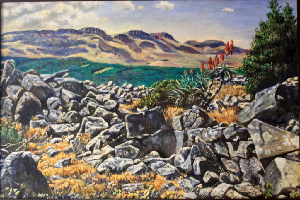
I don’t need to remind myself what the fort looks like anyway because Sally has done a beautiful painting of it (for more examples of her work see Sally Scott)
Double Drift fort. Chalk pastel. Painting by Sally Scott.
Entering Kwandwe, a little later on, I get a glimpse of another challenge the English settlers had to face – elephant. Although long shot out in most parts of the East Cape, they have been reintroduced into some of the larger local reserves, such as Kwandwe. We haven’t gone too far when we see one browsing in the dense thicket, his back stained a dusty yellow ochre from the local soil. A few kilometres on we see another, similarly camouflaged.
Elephants are awesome creatures. There is a mystery, a sense of enchantment, behind their wrinkled grey visage and massive bulk. I can watch them for hours. As intriguing as they are, they do, however, make difficult neighbours to live with, showing scant regard for fences or planted crops or humans for that matter. It is not wise to antagonize them.
On the crest of another ridge, we stop for a final look over the Great Fish River Basin. Below us roll plains, speckled with bush, patterned with cloud shadows, receding into the blue haze of the far mountains, indifferent to man. Once again, I feel overawed by the age and might of this old continent. In such a primaeval wilderness, is very easy to believe here is where all life originated.
A final look back.
By sleuthing around in these backwaters, I also feel I am beginning to get somewhere in establishing a link with my past. My discoveries may not be earth-shattering but they are a start. They provide the building blocks upon which my own life had been constructed.
The urge to migrate, to quest, to go on a journey lies deep-rooted in our DNA. For hundreds of thousands of years before we became sedentary, urban dwellers it was how we lived. We were hunter-gatherers, nomads. I certainly still feel this instinctual pull. It is the reason you so often find me hundreds – sometimes thousands – of kilometres from home and it is why I am always quick to respond to an invitation to do a road trip. For me, there is something magical about going to a place you have never been before and feeling an immediate connection to it.
Thus it was with the Baviaanskloof.
The Baviaanskloof
The Baviaanskloof – ‘Valley of the Baboons’ – lies mostly in the East Cape and is dominated by the Baviaanskloof and Kouga mountains which run parallel to one another in an East-West orientation. Separating the wet coastal belt from the dry interior these mountains form part of a ragged chain that make up much of the South-East coastline of South Africa. Two main rivers drain it, namely the Baviaanskloof and Kouga. They converge at Smitskraal where they travel in an easterly direction to the Kouga dam. The Grootrivier and Witrivier also flow through the reserve and there are a few other minor rivers, streams and odd springs formed where the rare rains come down from the mountains. Here birds and animals come to water.
As a first time visitor to the Baviaanskloof, I was most fortunate to have Goonie Marsh as my guide. Besides making a good travelling companion, he lectures in Geology so was able to explain to my sister Sally and me how this world of marvels came into being. He is also a man with a deep interest in the world around him and as a long time East Cape resident has acquired a great general knowledge of the area.
Goonie Marsh explains how the Baviaanskloof came into being...
Driving down the dusty, twisting, often tortuous road, it is hard to believe there was a time when the climate and landscape were different but some of the Baviaanskloof was once underwater. As part of what is known as the Cape Super Group, its geology consists of alternating layers of sandstone and shale that were deposited on the bed of a large inland sea between 300-400 million years ago. Since then it has been tilted, folded, twisted, faulted, buckled, redeposited in new layers and eroded into its current fantastical shapes (see notes below by Goonie Marsh)*.
Enon conglomerate, Andrieskraal, on which the profile of Queen Victoria can be seen. Made up of quartzite boulders derived by erosion from Table Mountain Group which form the high mountains in the area.
‘The Skull’ – also Enon conglomerates as seen in the Baviaanskloof Cretacious basin. The colour of these sediments is redder compared to Andrieskraal possibly because the latter was open to the ocean whereas these were probably entirely terrestial.
Strata of Table Mountain quartzite which have been pushed vertically, perhaps even overturned.
More Table Mountain quartzite in which the strata are clearly folded – horizontal at the top before flattening out at the base,
We were not, of course, the only nomads, driven by curiosity, to come wandering into this almost mythic landscape. The first anatomically modern humans emerged in the Baviaanskoof during the Middle Stone Age – between 120 000 and 30 000 years ago. They are believed to have been the ancestors of the San who would later live in the area. They left their traces in a large number of caves and overhangs which provided them with both shelter and walls to decorate.
They were displaced and eliminated by the Khoekhoe and early European settlers. Although various explorers and hunters had passed that way before, the first white farmers settled in the Gamtoos Valley in the 1730s. As more arrived, the deeper into the Baviaanskloof they penetrated.
Lonely, sparse and cut off by its mountains from the rest of the world, life could not have been easy for these early settlers. Initial access into the area was by way of an ox wagon. Because of the difficulty of travelling over the terrain, many farmers only made the journey out the valley once a year using the Ouberg track. Getting in and out got just a little bit easier with the construction of a dirt road between 1880 and 1890 by the hard-working, prodigous Victorian road-builder Thomas Bains, son of Andrew Geddes Bains, South Africa’s first geologist and another great road-maker.
Having approached the Baviaanskloof from the East, through the important citrus growing region of the Gamtoos Valley and the towns of Hankey and Patensie, it was along this road that we now travelled. On both sides of us, dry trees rose towards the dusty mountains. Above them would normally hang the hazy blue sky of Africa but – as if to thwart my sunny mood – it was cloudy and cold on our first day. It was still mightily impressive. Here one could sense what the continent must have been like before its wild animals were not confined to a few parks but roamed everywhere and man had not had such an indelible – and, at times, destructive – impact on the environment.
We began by taking a detour off the main road to the Kouga dam. Although a marvel of engineering it made a sorry sight. The East Cape is battling a severe drought with its dams averaging out at only 15% full. At 4,5% of its capacity, the Kouga dam is currently at its lowest level since it was constructed in 1957. Here, like everywhere else, climate change is taking its toll…
Kouga Dam
Dam wall. Pic courtesy of Sally Scott.
It is not always so dry in the valley. Sometimes there are floods. In 1916, for example, over 350mm of rain fell in the catchment area and a great solid bank of water came tearing down the narrow valleys sweeping all before it. Four members of the Campbell family lost their lives when the tree they had climbed to escape the raging torrent gave way under them. There is now a memorial to them.
We spent our first night at Bruintjieskraal in the Rivierspoort, just outside the entrance to the park, on a sheep farm, enclosed in a narrow valley between two ramparts of dark mountain. Our thatched-roofed, timber-framed accommodation proved more modern and more stylish than I had expected, blending seamlessly into the surrounding bush and the mountain itself.
Kudu Cottage, Bruintjieskraal
Sheep, Bruintjieskraal/Glencoe area.
The sky was clearing as we set off the next morning. Pale wisps of cloud danced and dissolved along the mountain peaks casting shifting shadows on the valleys below. After stopping at the Park’s Interpretative Centre (the whole park has now been classified as a World Heritage Site), we followed the road that snakes its way up the Combrink Pass. The higher we went, the more spectacular the scenery got. It was along this stretch of road that we encountered the only other travellers we were to meet in the park – two Germans on motorbikes who stopped to enjoy the same view we did.
Heading towards Combrink Pass.
Combrink Pass. Pic courtesy of Sally Scott.
A fellow traveller.
Near top of Combrink Pass.
At the top of the pass, the country opens up into the extensive Bergplaas grassland plateau which, when we visited, had an almost Alpine feel to it on account of all the swirling cloud, mist and drizzle on its upper peaks. Crossing it, we were greeted by yet more breathtaking views. An interesting oddity here is Winston LeRoux’s rusting, cable system which spans the gaping Waterpoort Gorge. It was once used to link the Enkeldoorn and Bergplaas farming communities and to transport goods between the two but was abandoned in the 1960s.
On the Bergplaas Plateau, looking up to cloud-covered mountains
The old cable system across the Waterpoort Gorge
From Bergplaas we descended the twisting Holgat Pass through more craggy overhangs, clefts and soaring rock The surrounding slopes were covered in fynbos and proteas and – further down – spekboom, aloes (Aloes ferox, africa, speciosa, striata and arborescens all occur in the area) and euphorbia. Strange plants and succulents, that have adapted to vertical living, clutched onto the cliffs. A pair of Black Eagle wheeled overhead.
The Holgat Pass.
The country grew steadily drier the further west we went. In places, the desolation was offset by the dense growth of trees which grew along some of the river banks. The water in these rivers was beautifully cool, clear, tasty and refreshing. In places, pondweed, lilies and something like giant cress grew so thick they looked like little green islands rising out of the water. We stopped at one of the streams, scooping up handfuls of the precious liquid and then sipping it with the all the reverence a person in a parched desert might do.
Drinking from mountain streams.
Lilies.
At mid-morning we pulled into the Smitskraal picnic site for a coffee break. Goonie hauled out his furnace, gathered some kindling, and then fired it up. It was a sight to behold. In no time, the water inside was boiling and the metal contraption was belching out plumes of steam and smoke like an active mini-volcano.
The firing of the furnace…
Coffee break at Smitskraal.
Aside from a bored-looking baboon who watched us from the shade of a tree, we were the only ones around – or, at least, so it appeared. There are buffalo in the park but they must have been lying low that day for we didn’t see any of them although their dung was everywhere scattered across the roads. Black rhino also lurk in the thickets around here but they, too, declined to show themselves. It did not bother me. With their poor vision and small powers of deduction, they are, like the fierce buffalo, notoriously short-tempered. I would prefer not to have a face to face encounter with either and always keep a close eye out for hospitable trees to climb when I am in their presence. Here, unfortunately, the available trees consisted mostly of sharp-needled Vachellia karroo (Sweet Thorn).
An audience of one…note thorns!
There are still leopards living in this mountain wilderness. Maybe one was even watching us from some rock ledge with eyes that see everything but reveal nothing? Cape Mountain Zebra have been reintroduced into the area and there are also Klipspringer, Mountain Reedbuck and several types of highly poisonous snake (including Puff-Adder and the fearsome Cape Cobra). Them I was happy to avoid too…
From the picnic site, we headed up the Grasnek Pass, stopping high up on its neck so I could take yet more photographs of its panoramic view. Pressing on, we passed several tattered and long-abandoned old habitations, disintegrating memorials to those who had tried their luck in this harsh environment before calling it quits. We stopped for a roadside lunch directly opposite one such derelict farmhouse. Looking at its collapsing walls and sun-bleached, corrugated iron roof, I decided it might make a meaningful painting about the fragility and uncertainty of human life (a subject much on my mind since the outbreak of the Covid-19 pandemic) so I hauled out my camera again and photographed it from various angles.
Grasnek Pass
View near the top.
Grasnek Pass
Deserted farmhouse in the Baviaanskloof
Exiting the park we found ourselves back in farmland. Down the hills came herds of goats and sheep, little white flecks against a vast expanse of rock. The scenery remained as majestic as before.
We spent our second night at Speekhout farm, nestling in a vast amphitheatre of mountains with a crocodile-shaped outcrop of red rock at the one end. Sitting outside the flimsy, reed-walled house, that served as our night’s accommodation, with our evening drinks, we watched the dying sun turn the mountain tops gold. Below us, a small band of springbok slipped across a field. Nomads themselves, these buck (once called trekbokke or “travelling buck”) used to migrate across the Karoo in their hundreds of thousands, trampling all before them. Now their movements have been restricted and the few that remain exist mostly behind fences, like these. As a wanderer myself, it was hard not to feel sorry for them.
Speekhout farm, with springbok.
Lying on my own, later that night, in a tent I had found erected around the back of the reed shack, I got to experience just how cold the Karoo can get when the sky is clear and the stars are out. I slept poorly.
The next day we resumed our journey west, heading up through the jagged walls of Nuwekloof Pass which links the western section of the Baviaanskloof with the higher Karoo hinterland and the towns of Willowmore and Uniondale.
The Nuweklood Pass
The moorland-type country, at the top, was covered with low bushes with tough, wiry leaves that can survive where grass cannot. At certain times of the year – like now – little perennial daisy plants pop up all over the place, providing a cheerful contrast to all the greys, browns and ochres. Hardy succulents of many kinds also thrive here, providing additional food for the fat merino sheep who blend in so well with their surroundings.
Blending in with the scenery.
Up here in sheep country, the valleys start getting a lot wider than the mountains they separate. The further west one goes, the more enormous the landscape becomes, and the straighter and emptier the roads. Once you get onto them, it is hard to believe you will ever reach your destination. It certainly felt like that when we hit the N9, about halfway between the towns of Willowmore and Uniondale. Instead of continuing West towards the jagged outlines of the Swartberg mountains, running along the far horizon, however, we turned East again heading back towards the more densely populated Indian Ocean side of the sub-continent.
We stopped in Uniondale for coffee and a quick shop (succulent Karoo lamb was on the menu for that night). The town is famous for, among other things, its ghost, a young woman who stands alongside the same lonely stretch of road we had just driven down. When people stop to offer her a lift she gets in and then scarily vanishes. The story has inspired an Afrikaans film and a song by Andrew Goosen, both titled “Die Spook van Uniondale”.
Uniondale
Uniondale scene
Back on the ghost road, I kept watching out of the corner of my eye but did not see her although, in this deserted landscape, it was quite easy to believe she exists. We passed through Unionpoort and carried on to where the road branches off eastwards, down the Langkloof – the ‘long valley’ that separates the Kouga and Tsitsikamma móuntain ranges – following a long-used route that runs roughly parallel to the one we had been on in the Baviaanskloof.
The Ghost Road with Swartberg mountains in the distance.
A bit of family history here. Many of my ancestors have felt the same, restless urge that had caused me to be cruising down this road. One of them, Benjamin Moodie, the last Laird of Melsetter, had, in 1817, crossed the globe from his home on the Isle of Hoy in the Orkney Islands and set himself up in an old Dutch-style farmhouse at Grootvadersbosch, near Swellendam, at the base of the Langeberg. He was later joined by two of his brothers, John Wedderburn and Donald Moodie. Although he later emigrated to Canada (his two brothers remained, both founding South African dynasties that spread across the country and into neighbouring Zimbabwe). John Wedderburn left an extremely entertaining – and insightful – account of his time in the country in his book Ten Years in South Africa (first published in 1835).
A few years after he arrived, John Wedderburn (who had fought in the Napoleonic Wars and had returned home to find there were few jobs available for ex-soldiers) also came travelling down the Langkloof, en-route to the Grahamstown area where he and his brothers hoped to be granted some land. Like a lot of early travellers on the sub-continent, John Wedderburn found the parched and ancient Karoo a frightening, hostile, place. He was not overly impressed by the more arid and treeless upper parts of the Langkloof even though its fruit growing potential had already been recognised:
“I was much disappointed in the appearance of this tract of country, which, notwithstanding the number of farmhouses and well-watered gardens, was rather bleak and forbidding, from the total absence of wood, and the uniformity of its mountains,” he would later write.
As a Scotsman, he possessed an obvious natural bias towards wet weather and greener pastures and it is only when he reached the coastal end of the valley, where the rainfall is higher and the vegetation more luxuriant, that his opinions began to improve:
“The eastern extremity of the Lange Kloof opens into the valley of the Kromme river; and here the landscape becomes interesting and romantic.”
The greener coastal end – much preferred by John Wedderburn Moodie.
John Wedderburn is generally a reliable guide and I find myself in agreement with much of what he writes but here I am very much at odds with his views. I think the Kouga mountain range, of which he was so dismissive, is an area of extraordinary variety, beauty and – dare I say it? – romance.
Our destination lay in a remote, secluded valley in the Kouga Mountains Wilderness Area. To get to it you have to drive down another rough and lonely road, through a perilously steep gorge and then up the other side. It made for a dizzying, jittery ride.
The road into the Kouga mountains.
The closer you get to the mountains the more impressive they become. Stream beds and ravines trench the foothills. Ahead of the house, in which were to spend the night, a steep gorge cleaved through the mountains, well-wooded in parts, belying John Wedderburn’s thoughts on the matter. In the late afternoon, my sister and I wandered through the peach and apricot orchards which were in full blossom, entranced by the light. Afterwards, we followed up the stream into the mountain gorge. In places, the water flowed straight over the road, so we had to cross on stepping stones.
The gorge in which our guest cottage was situated.
This was, – and still is – Ferreira country. Long before John Wedderburn came riding down the Langkloof, there had been Ferreiras living in the Onder-Kouga. Among these hardy frontiersmen was Johannes Stephanus Ferreira (1848-1896) also known as “Jan Been” on account of his bandy legs (hoepel been), a legacy from his being shot during one of the countless Frontier Wars. According to Bartle Logie, in his book Boots in the Baviaans, Johannes may have been the inspiration for the famous Afrikaans folk-song “Vat jou goed en trek Ferreira” [literal translation: “Take your stuff and move on, Ferreira”]. The romantic in me wanted to believe it was true.
Isolated by its topography it, too, must have been a tough environment to live in although I imagine they must have also developed a strong sense of community still embodied, in many of the Karoo dorps you pass through, by their beautifully built churches, in which the faithful gathered on Sundays. Although in some places houses have been modernised or rebuilt, many of the whitewashed outbuildings are still the same as when they were when constructed.
The church at Uniondale.
Other aspects remain the same. Back doors open up to vegetable gardens which run into orchards which stretch down to sheep paddocks which, in turn, melt into the rough, rock-strewn hillsides. Chickens scratch around in dusty backyards, ducks and geese float on ponds, Border collies snooze in the shade, Ostrich eye-ball you…
In the orchards…
Getting eye-balled by two Ostrich…
Here generations of children have grown up and taken over the running of their parents farm, building on what has gone before.
I was to get further glimpses into the continuity of life in these isolated communities as we headed out along a dirt road that runs along the base of the range the next morning. There are still many working farms in the Onder-Kouga but inter-dispersed amongst them are yet more abandoned old homes which are slowly being reclaimed by the fynbos. The sites of these houses had usually been carefully chosen, often with a mountain as a backdrop and a view that looked on to yet another mountain.
A working farm.
A deserted farmouse…
and another…
…and another.
Having crossed the Kouga river yet again we found ourselves back on R62, near Kareedouw where we stopped for more coffee…
And so my journey into the Baviaanskloof came to an end. As we headed back to Grahamstown, along the N2, I realised that travelling through it had been far too big an undertaking for me to be able to give anything other than a shallow summing-up of my thoughts, impressions and experiences. Nevertheless, I still emerged from the journey feeling I had learnt a little bit more about my country and – just as important if travel is to prove redemptive – myself.
My life had been both broadened and enriched by my foray into the Valley of the Baboons…
GALLERY:
Aloe ferox. Baviaanskloof.
Aloe ferox near Uniondale.
Sombre Greenbul.
Blue Crane.
Ostrich
Cape Bunting
African Black Duck.
Old boots abandoned on side of road.
Sheep sheltering in shade.
Ruined house.
Conglomerate.
Lunch break in the Baviaanskloof.
Kouga mountains.
More fold mountains, Baviaanskloof. Pic courtesy of Sally Scott.
*NOTES ON CAPE FOLD BELT
by Goonie Marsh
The Cape Fold Belt has a long history starting about 500 million years ago with the
formation of a shallow marine basin, the Agulhas Sea, along the southern margin of
Gondwana, a single land mass or supercontinent, which was made up of the continents
currently known as Antarctica, Australia, India, Africa and South America.
For the next 170 million years until about 330 million years ago, this basin received sandy
and muddy sediment derived by erosion from the interior of Gondwana. With compaction
and cementation the accumulated sediment formed a succession of sandstones and shales
more than 8 km in thickness. This succession is known in formal terminology as the Cape
Supergroup and it is subdivided into 3 major units depending on the proportion of
sandstone to shale in the sequence. The oldest and lowermost unit is the Table Mountain
Group which is dominated by quartz sandstone of exceptional purity. This is overlain by
the Bokkeveld Group which has thick units of shale interleaved with thinner sandstone
layers. The topmost, and therefore youngest unit, is the Witteberg Group with
intercalated shales and sandstones in approximately equal proportions.
Starting about 330 million years ago and continuing for over 100 million years, the
southern margin of Gondwana was subjected to powerful laterally compressive forces
directed northwards. These forces destroyed the Agulhas Sea and Cape Basin, squeezing it
against the continental mass of Gondwana, rumpling, folding and uplifting the sedimentary
strata that had accumulated to form a major fold mountain belt, the Cape Mountains. The
folding process also fuses the grains in the rocks tightly together and they harden,
particularly the quartz sandstones, which are converted into exceptionally hard quartzites.
The general processes and products of this fold mountain building event are known as the
Cape Orogeny. A good ‘modern’ analogy would be the creation of the Himalayas – Earth’s
still active major fold mountain chain formed by India pushing into Asia
ACKNOWLEDGEMENTS:
Baviaanskloof – A World Untouched. Compiled by Liesl Hattingh (published by Baviaans Tourism).
Boots in the Baviaans by Bartle Logie (Bluecliff Publishing).
Ten Years in South Africa by Lieut. J.W.D Moodie published by Richard Bentley)
SPECIAL THANKS to Goonie Marsh and Sally Scott for organising this trip and being happy to stop whenever I wanted to take a photograph – which was very often – or have a cup of coffee…
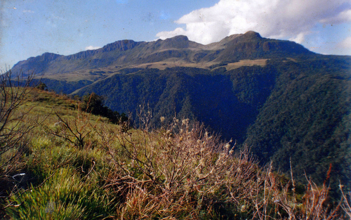
The foothills of Mt Nyangani. Nicky Rosselli and Sally Scott.
The weather was warm and welcoming as we bounced along the track that led up to Robin’s Nest cottage, nestling in the southern foothills of Mt Nyangani, at 2 592 metres (8 504 feet) Zimbabwe’s highest peak. There were three of us in the old bakkie – my two artist sisters, Sally Scott and Nicky Rosselli, and I – and we were finally making a journey we had often fantasized about. Below us the land rolled and sloped in an emphatic way, criss-crossed by streams and patches of plantation and jumbles of granite hills which reflected silver in the bright sunshine. It was good to be back. There was a healing magic in the air and I could have all but shouted out with joy, I was so excited to be in the landscape of my youth.
The Road to Robin’s Nest. ,Nyazengu Gorge in mid-distance. Honde Valley behind.
It was here I had made my first real discovery of that intangible sense of mystery some mountains have in abundance.
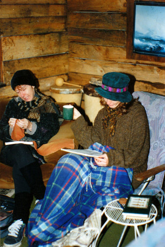
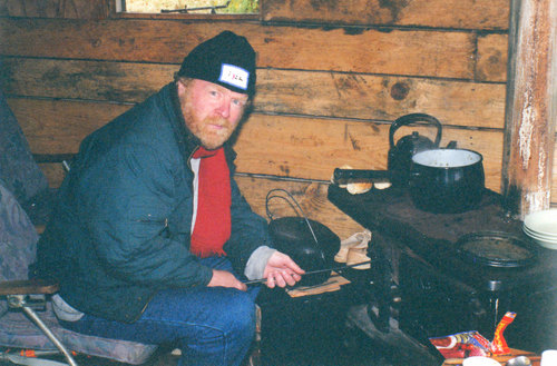
Sparse, rustic and startling basic, our windswept accommodation, could hardly have seemed more remote. Tucked away in a small grove of trees, it consisted of two wooden sheds linked by a roof of corrugated iron. It was like a hermits cell or the sort of place monks might have used when they wanted to get close to God. The two bedrooms with their rickety bunks were both extremely small. The kitchen area-cum- lounge, in the other section, contained a couple of battered, much-used, old chairs and a tiny wood stove which, I would soon learn, had a mind of its own.
Sally sketching atRobin’s Nest.
As I dumped my gear on the bed, I knew I was going to fall in love with the place. I have always been a bit of an ascetic with a taste for the Spartan. Robin’s Nest fitted my needs perfectly.
And if the building was on the ramshackle side, this, in no way, detracted from the magnificence of its setting. Directly behind us, the mist-shrouded mountain rose into steep pillars of rock, in front of us the land sloped away, gently at first, before suddenly plunging into a steep-sided, gaping abyss. The Nyazengu Gorge is not as well known as the Pungwe Gorge, into which it opens out, but, although of a smaller scale, it is equally beautiful. Protected from the worst of the winds but benefiting from the moisture-laden clouds they bring, it supports a profusion of plant life.
The morning sun was breaking through the cloud as we set out, early the next day, following a meandering path that led us over the downs. Everything about the morning was lovely. The call of the birds, the great blue sky, the sound of the river gurgling through the green hills. We hadn’t got too far when we came across some overgrown old stone-walled fortifications, remnants of what is now known as the Nyanga Uplands Culture. It seemed a bleak and lonely spot to have lived.
Old Ruins with Mt Nyangani in background.
Still glorying in the voluptuous sunlight we pressed on along the path. Now and again we would find ourselves entering patches of dark remnant forest. Scattered through the undergrowth were numerous large, mossy boulders that looked like sleeping animals while, in other places, the trail was almost overgrown with ferns and low foliage.
Wherever we went there was that rich, yeasty smell of damp and decomposing matter. Adding to the slightly Middle Earth atmosphere was the wispy- white streams of Old Man’s Beard hanging down from some of the trees. Faraway from the shrieking commotion of city life, I felt like I had entered a very secret and enchanted place.
There were all sorts of birds here although, because of the gloom of the forest, they were not always easy to see. I did manage to get one “lifer”- the White-tailed Crested Flycatcher, a beautiful little bird with a penchant for fanning its handsome tail. Something of a rarity, its distribution in Southern Africa is restricted to the montane forests of Zimbabwe’s the Eastern Highlands and adjacent Mozambique. The even rarer Blue Swallow is also supposed to occur in the surrounding grasslands but I did not see any.
We emerged out of the cool shadows of the forest to find ourselves on the very lip of the gorge, at a point where a high waterfall plunged down its side and into the gloom below. Taking off my hiking boots, I dipped my big toe into the water and took it out very quickly indeed. It was every bit as cold as I feared it would be but at least it gave me the excuse to boil some tea to warm ourselves up.
Where the waterfall plunges into Nyazengu Gorge.
Upstream of the waterfall.
Later we squelched down a valley that was half bog, half rock until we came to another waterfall that tumbled down a massive sheet of exposed rock. It was hard to imagine anywhere more unvisited, wild and sublime. There was something about the way the sunlight sparkled on the beautiful, clear water, the way the light and water bubbled and swam together, the pure energy of the current flowing over the smooth grey rock that made us want to stop and tarry there. It was as if the water spoke best of the passion of the place.
More waterfalls…
This was, of course, the other reason we had wanted to come back. All three of us are artists and we were looking for inspiration. There was no shortage of it here.
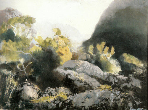
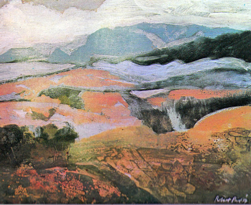
With its endless vistas and ever-changing moods and atmosphere, Nyanga has been a favourite venue for many painters including, most notably, Robert Paul. A friend of the British artist John Piper, Paul (1906-1980) – who has been described by Brian Bradshaw, the former director of the National Gallery in Salisbury (now Harare), as “a ‘genuine’ whose artistic dimensions exist not only in Rhodesia but would be recognised anywhere the values and evidence of art are understood” – returned to paint in Nyanga many times.
Deceptively slapdash in his brushwork, Paul had an uncanny ability to strip a scene down to its basics and select from nature only those elements which seemed to capture its essential spirit and feel. There is a perennial freshness about his work; in it. you immediately see a man who is comfortably at home in this scenery. It is why, whenever I am feeling homesick and want to reconnect with the landscape that exerted such a force on me in my childhood, I haul out a book* I have of his paintings.
Inyangani 1967. By Robert Paul. Oil.
Inyanga Landscape 1950. By Robert Paul. Oil.
By the time we eventually tore ourselves away from this hallowed spot and headed home to Robin’s Nest, the cloud had begun to build up again along the mountain. We had barely made it back to the cabin when the whole area was engulfed in a thick tablecloth of mist. As night fell it grew intensely cold. Alone in our chilly hut, on the edge of that imposing mountain, it felt we had the universe all to ourselves.
Poking the wood stove to get more warmth, listening to the murmurings of the mountain and the soft conversation between the wind and the trees, I could not have been happier. I felt I had found a place set apart, one with that quality of isolated purity that helped restore the soul.
Sally and Nicky full of inspiration…
The keeper of the flame.
Although I had grown up in the area, I had never actually climbed Mt Nyangani. So I decided I was going to stir my old bones and make my way up to its summit. My sister Sally elected to join me.
Mt Nyangani from far side of Nyazengu Gorge.
Although it is Zimbabwe’s highest mountain, the hike to the top only takes a few hours. The first section is the steepest to climb. Thereafter it opens up into a lush, gorse-covered, sprawling moors and undulating plateau.
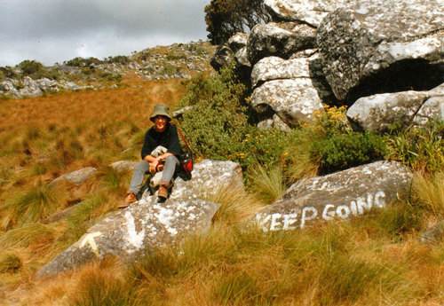
When the going gets tough. My sister Sally Scott pausing for a breather.
We were the only ones on the mountain that day which only added to the seremity of it all, the feeling of pure solitude.
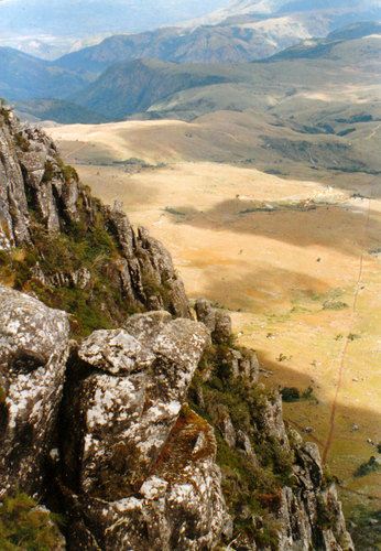
It was well worth the initial slog, too, because the view from the top is one of the most beautiful I have ever beheld. Sitting on the apex of grey-green rock, with the sun shining through the clouds and anointing our heads, I really did feel like I was amongst the gods.
Geologically, Mt Nyangani is composed of an upper sill of dolerite and sandstone with the harder dolerite forming the cliffs on top of which, having reached the highest point, we now sat celebrating our achievement with a hot cup of tea (it’s my British ancestry). This, in turn, intrudes out of a sub-strata of ancient granite – the extensive Basement Complex that makes up much of the country’s geology and which has been gradually weathered away and exposed over the aeons.
On the eastern side of this high exposed ridge, lies the hot, humid Honde Valley, into which the countries highest waterfall, the 762 metre Mutarazi Waterfall, drops. It was also the scene of much fierce fighting during the Rhodesian Bush War. Extending from the border of Zimbabwe into Mozambique, its unusual position and topography cause it to have the highest rainfall in the country.
This is because moisture-laden clouds coming in from Mozambique are blown smack into the mountain wall and as they rise they cool and the rain comes. The constant watering has created a mini eco-system and the cliffs and crags here are covered in dense forest – making it quite distinct from the western side slopes which are mostly grassland, with only the odd tree hunched down again the bitter winter winds.
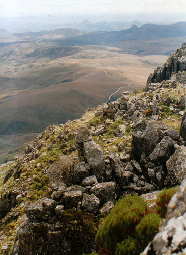
As one turns one’s eyes around further, the vast V-shaped Pungwe Gorge, with its tumbling, two-channel, waterfall, sweeps into view, followed by the entire Nyanga National Park and its environs. Beyond, that, shrouded in mystery lie, the ruin-strewed hills of Ziwa, and Nyahokwe and then, silhouetted, against the skyline, the massive granite dome of Mt Dombo. Crane your head still further and you will find yourself looking down the broad spine of the Nyanga escarpment to where both Mt Mouzi and the twin peaks of Nyangui mountain – whose beacon marked the edge of our old farm – jut out in the far distance.
View down to Nyazengu Gorge and Honde Valley.
View towards Ziwa and Nyahowe
Three main rivers have their source on Mt Nyangani – the Nyamaziwa, the Gaerezi and the Pungwe. The first two are tributaries of the Mazowe which eventually flows north into the Zambezi. The Pungwe, which grows steadily wider as it follows its eastwards course, has its mouth in the Indian Ocean, at the port city of Beira in Mozambique.
Despite the relative ease of the climb Mt Nyangani has an ominous reputation. One local newspaper even went so far as to label it, in bold type, as “A MOUNTAIN WHICH SWALLOWS PEOPLE”. Others have, in equally dramatic terms, compared it to the Bermuda Triangle and Japan’s Devil’s Triangle. To some extent, its reputation as some sort of dark, hungry, malfeasant, force is well deserved for numerous hikers have indeed disappeared on the mountain never to be seen again.
Back in colonial times the word “Nyanga” was usually interpreted as meaning “place of the witchdoctor” which added further to the reputation of the mountain for being a bit of a scary, forbidden, place although the correct translation of the word is ‘herbalist ‘which has far less sinister connotations.
Like other sacred mountains in Southern Africa, Mt Nyangani has its prohibitions and taboos, including the fairly common stricture against pointing at it. No laughter is permitted either. The mountain is, also, subject to sharp weather changes particularly mist-build-up which make it easy to get disorientated and lost in. Hence, presumably, all those missing hikers who got ‘swallowed’ by the mountain.
We got first- hand experience of how quickly this can happen. I was posing for the obligatory Hail-the-All-Conquering-Mountaineer photo when I noticed a slight drop in temperature and a sudden jab of wind against the back of my neck. Pivoting around, I saw, to our immediate north, a low bank of cloud, glistening white in the sunshine. I think something about this sort of weather breeds an anxious hyper-alertness of the senses for I realised instantly it was time to get off the mountain.
As we hastened back down the track, more thin wisps of cloud began chasing one another along the mountain top towards us. I felt tiny splashes of rain. By the time we had got back to the parking area, the whole mountain, which had previously seemed so benign, had taken on a more sinister aspect.
We retreated down the road to the Nyangwe fort, just above Mare Dam, and sat on the rock walls watching the drama unfold. In the blink of an eyelid, Mt Nyangani was engulfed under a massive cumulonimbus cloud which, just kept growing and growing in size.
The angry mountain, seen from Nyangwe Fort.
I was very glad we had got down in time to avoid being caught up in that vast, vortex of rising air. Awed by the spectacle, I found myself succumbing to all sorts of nagging, corrosive doubts. Maybe we had angered the mountain? Had I made a big mistake being so cheerful and upbeat as I posed for my vanity photographs? Was it some ill-humoured, demonic spirit that had sent that towering storm cloud?
I was not the only one with concerns about the mountain’s temperamental nature and sudden mood swings. Since we got to the summit, the park’s management has decided that you can now only climb it in the company of a guide.
And with a reputation like that who would not want to climb it?
Pungwe Gorge and river, leading up to Mt Nyangani.
*Robert Paul by Colette Wild, Brian Bradshaw, Francois Roux, Patricia Broderick and Martin Van der Spuy. Printed by Grillford Limited.
GALLERY:
Some artwork inspired by our trip:
Mt Nyangani from Nyangwe Fort. Artwork by Anthony Stidolph. Oil.
Nyangui aloes. Artwork by Sally Scott. Pastel.
The Climb. Artwork by Nicky Rosselli. Oil. The two figures in the foreground are Sally and myself…
Summit of Mt Nyangani, looking North. Artwork by Anthony Stidolph. Oil.
Summit of Mt Nyangani, looking South. Artwork by Anthony Stidolph. Oil.
Maybe it was in the name but somewhere around Kommadagga I started to get a little paranoid.
I had just turned off the N10, where it runs between Cradock and Port Elizabeth, and was bouncing along a dirt track when, ahead of me, a sudden scurry of wind lifted the dust from the surface, making a bank of pink fog. As I peered through the windscreen I was overcome by this strange notion that I had somehow transcended the highway hyper-reality of speeding taxis and long-haulage trucks and was now travelling down a ghost road, although, when I emerged from that cloud of swirling sand, the scenery appeared little changed from what had gone before -miles and miles of rough, ribbed, ungoverned country, tapering off towards infinity.
The road led on. I
followed it. A white speck suddenly appeared on the horizon, got
bigger and solidified through the heat shimmer.
Reaching an isolated
crossroads I pulled over onto the side, although with the amount of
traffic I had seen that didn’t seem strictly necessary, and consulted
my map. I was right. The spectre I had been chasing was indeed my
destination.
Enfolded in a shallow, winding valley, with a commanding view over the surrounding plains, Ann’s Villa lies on the Karoo side of the old Suurberg Pass. Built in 1864, it once served as a stopover point for ox-wagons full of romantics and day-dreamers heading upcountry, all hoping to strike it rich in the diamond fields of Kimberley.
The construction of the national highway some 20-odd kilometres to the north robbed Ann’s Villa of its reason for existence but it has somehow managed to survive its growing isolation and the march of time, preserved in its own little time capsule and not much changed from when it was originally built. As the crow flies it is not all that far from Port Elizabeth. And yet it feels remote.
Ann’s Villa, Suurberg.
As I crested the final rise I got my first proper view of it – a big, white-washed, double-storied Victorian house with a weather vane, upstairs balcony and a corrugated iron roof that glittered silver in the sunlight.
In its day it must have
been one of the most proudly posh buildings in the area, attracting a
polyglot crowd of farmers, hunters, adventurers and fortune seekers,
all gathering to slake their thirst and exchange gossip. Even now one
can still feel the pride of its owners in their creation.
The Shop and Post Office
Besides the inn itself there was a shop, post office, blacksmith, a barn that doubled as a dance hall and even a small school which has now been colonised by an army of dassies. There is also a little hilltop graveyard, fenced off with barbed wire whose individual graves lie untended.
As I carried my luggage up the front steps my arm brushed against the tangled bush in which, the Zimbabwean caretaker cheerfully informed me, the resident boomslang lived, but not to worry “he’s very friendly”. I decided not to put it to the test. Inside, the building had that unmistakeable, reassuring quality of an old, well-lived in home.
On the first floor landing there are a collection of black and white photos of the previous owners – the Websters, the Halls and the Shaws – which I stopped to peer at, hunting for clues in the shadows that would reveal what their lives must have been like. With their stiff body postures and pinned on smiles, it was hard to judge but one thing I knew for certain: it seemed like my kind of place – warm, tranquil and very laid-back.
Old photos – picture courtesy of Craig Scott.
The closet-sized rooms
smell of dust and the lawns are covered in sheep droppings. Across
the road, at the foot of the pass, there is a collection of old gum
trees from which the doves call; beyond that lies wild county, mostly
dry scrub-land and aloes, rutted and rocky. After the barbered green
of the Natal Midlands the tumbled surge of rocks, sand and shale
served as a somewhat peremptory reminder of just what an arid place
so much of South Africa is.
During the Boer War, Ann’s Villa was transformed into a hospital for wounded British troops and was allegedly raided for food by a commando led by Jan Smuts himself. Later on it was advertised as a ‘health resort”, prompting one wit at the time to quip that you would need to be pretty healthy to survive its climate.
View over the Suurberg from the Old Pass.
The Pass that was its lifeblood is nowadays little used although it takes in some classic South African scenery. At the top of it, I stopped and gazed back down over the road I had just travelled. If the purpose of any journey is to keep progressing until you find somewhere worth getting to, I was where I was supposed to be.
POSTSCRIPT: My sister, Sally Scott, a well known Eastern Cape fabric and landscape artist, was so taken with Ann’s Villa that she decided to have her 60th birthday celebrations there. In keeping with the personality of the place we felt we should dress up in period costume. This was the result:
Dressed up in regulation “mufti”. Picture courtesy of Craig Scott.
Her son, Craig Scott, a professional photographer, also took this picture of the whole birthday group.
A very serious occasion. Picture courtesy of Craig Scott.